Munro · Central Highlands
Beinn Udlamain
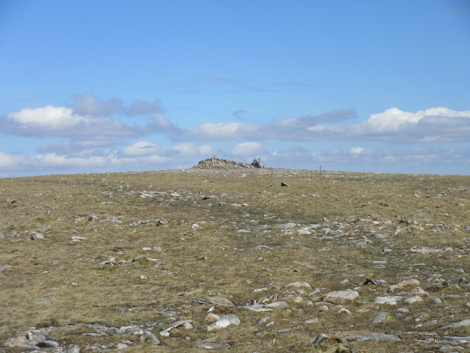
Beinn Udlamain (1010m) — "hill of the unsteady place" — is the highest of the four Drumochter Munros that flank the A9 in the great glacial trench between Glen Garry and Speyside. Together with A' Mharconaich, Geal-charn (Drumochter) and Sgàirneach Mhòr it forms a rounded plateau group that contrasts with the rocky west-coast hills. The summit is a wide flat top with a substantial stone windshelter built around the cairn — useful in the often-savage westerly weather that scours these hills.
Quick facts
- Height
- 1010.2m/ 3314ft
- Prominence
- 555 m
- Distance
- 17 km
- Ascent
- 889 m
- Time
- 5–8 hrs
- Grid ref
- NN579739
- Parking
- NN628792
- Nearest city
- Fort William· 47km
- Dogs
- Dogs on lead required near livestockDog-friendly guide ↗
Height and prominence cross-checked against the Database of British and Irish Hills (CC BY).
No GPX track yet
Walked this route? Share your track to help other walkers.
Standard route
A9 path start 20% · Open hillside 50% · Summit plateau 30%
Start from the Balsporran Cottages lay-by on the A9 at Drumochter (south of Dalwhinnie). Take the rough estate track west, cross the Allt Coire Fhar via the footbridge, then climb the broad south-east ridge of A' Mharconaich (Munro). Continue south-west across the broad bealach to Beinn Udlamain. Most parties also include Sgàirneach Mhòr to the south for a three-Munro round. The full three-Munro circuit covers around 18km with 1100m of climb.
Terrain
The Balsporran estate track is firm but rapidly becomes wet underfoot. The lower slopes of A' Mharconaich are notorious peat hag — slow and tiring after rain. Higher up the ground turns to mossy turf and gravel, easy walking. The summit plateaux are broad and featureless. The windshelter at the summit of Beinn Udlamain is a substantial stone enclosure — a welcome refuge in winds. The descent off Sgàirneach Mhòr to Coire Dhomhain is rough heathery.
In winter
A serious open-plateau winter day. The Drumochter hills are notorious for extreme wind chill — exposed continental conditions with little shelter. The summits drift heavily and the broad bealachs make whiteout navigation tricky. The A9 corridor through Drumochter is reliably gritted but the lay-by tends to ice over. SAIS Southern Cairngorms applies as the closest forecast. Phone signal is moderate at the lay-by, fading on the plateau.
This hill is in the Creag Meagaidh SAIS forecast area. Check SAIS forecasts in winter (December–April).
Best time of year
Getting there
- Glasgow2h 18m
- Edinburgh3h 34m
OS maps: OS Landranger 42
Mobile signal: Reasonable signal at the A9 Drumochter car park — the A9 valley has decent 4G coverage. Bars drop away above 900m on the plateau.
Current conditions
Daylight Today
- Sunrise
- 05:13
- Sunset
- 21:35
- Civil dawn
- 04:21
- Civil dusk
- 22:26
NOAA Solar Calculator · 30 July 2026
Pair with
Curated multi-hill combinations from Beinn Udlamain.
Around Beinn Udlamain on the SCOT network
Getting there, basing yourself, and what to do off the hill.
Getting there: Dalwhinnie station
Highest mainline station; Drumochter Munros; Ben Alder approach
13km from the hill
tripscot.co.uk
On TripSCOTBase yourself in Aberfeldy
Loch Tay base — Ben Lawers, Tarmachan ridge, Birks of Aberfeldy
37km from the hill
tripscot.co.uk
On TasteSCOTAfter the hill: Dalwhinnie
Dalwhinnie — Scotland's highest distillery on the Drumochter pass
13km from the hill
tastescot.co.uk
Beinn Udlamain — common questions
- How difficult is Beinn Udlamain?
- Beinn Udlamain carries a 4/5 (challenging) grade on the OutdoorSCOT scale. Count on about 17km, 889m of ascent and a 5-8 hour day on the standard route. Underfoot: The Balsporran estate track is firm but rapidly becomes wet underfoot.
- What is Beinn Udlamain's prominence?
- 555m of prominence. That's the vertical drop from the summit to the col that links Beinn Udlamain to the next higher ground.
- Where do I park for Beinn Udlamain?
- Most walkers start from NN628792. Verify the grid reference on an OS map before you set off — space is tight on busy summer weekends.
- When is the best time to climb Beinn Udlamain?
- May, June, July, August, September, October give the most reliable conditions on Beinn Udlamain. Beyond that window the high ground turns wintry: carry full mountain kit, be confident navigating, and check the SAIS avalanche forecast for the area.
- Is Beinn Udlamain dog-friendly?
- Yes, but dogs must be kept on a lead — there is livestock or ground-nesting bird interest on the route.
- Is there mobile signal on Beinn Udlamain?
- Reasonable signal at the A9 Drumochter car park — the A9 valley has decent 4G coverage. Bars drop away above 900m on the plateau.
- Is Beinn Udlamain safe in winter?
- A serious open-plateau winter day. The Drumochter hills are notorious for extreme wind chill — exposed continental conditions with little shelter. The summits drift heavily and the broad bealachs make whiteout navigation tricky. The A9 corridor through Drumochter is reliably gritted but the lay-by tends to ice over. SAIS Southern Cairngorms applies as the closest forecast. Phone signal is moderate at the lay-by, fading on the plateau.
Get the OutdoorSCOT weekly
One email a week — new route, hill and bothy guides, seasonal conditions and the odd hard-won lesson. No spam, unsubscribe in one click.