Graham · Central Highlands
Creag a' Mhadaidh
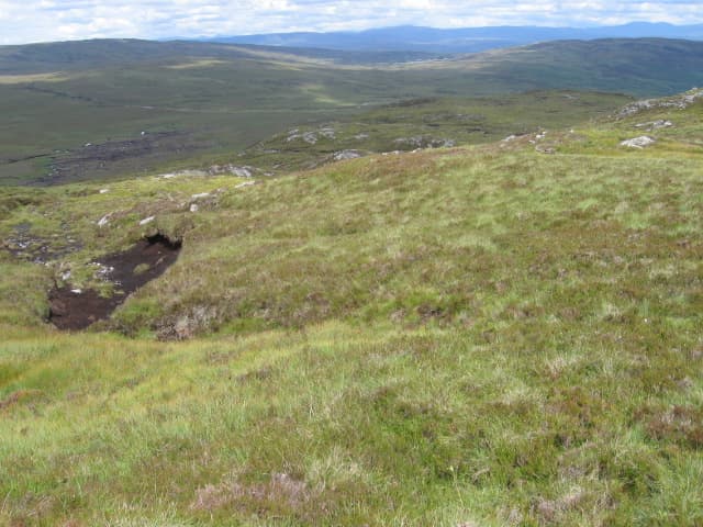
Creag a' Mhadaidh (611m), the fox's crag, rises above the north shore of Loch Rannoch in the NN66 square, on the southern edge of the great Rannoch deer forest. The summit rock perches at the top of a broken hillside that drops steeply toward the loch. From the top the view stretches across to Schiehallion and along the loch to the Black Wood of Rannoch, with the bigger Munros north toward Loch Ericht.
Quick facts
- Height
- 611.4m/ 2006ft
- Prominence
- 155 m
- Distance
- 12 km
- Ascent
- 458 m
- Time
- 3–5 hrs
- Grid ref
- NN634650
- Parking
- NN623648
- Nearest
- Fort William· Inverness 80km
- Dogs
- Dogs on lead required near livestockDog-friendly guide ↗
Height and prominence cross-checked against the Database of British and Irish Hills (CC BY).
No GPX track yet
Walked this route? Share your track to help other walkers.
Standard route
heather moorland 50% · rocky hillside 35% · bog and lochans 15%
Park at NN623648 near Bridge of Gaur on the B846 north shore road. Take the forest path north before climbing the obvious east ridge directly to the summit rock. The way is largely on heather with short rock steps near the top. Round trip about four hours; descend via the same line as the south face above the loch is awkwardly broken.
Terrain
Forest paths through stands of birch and pine give a sheltered start. Above the treeline heather and rock define the climb, with a small rock step needing one or two hands at about 500m. The summit area is rocky knolls and short grass.
In winter
Rannoch Moor catches snow showers off all directions and Creag a' Mhadaidh's rock step can ice quickly. The north shore of the loch is shaded much of midwinter, with the forest path frozen rather than thawed. The hill is short enough for a good winter day if the rock step is dry or under firm snow.
This hill is in the Creag Meagaidh SAIS forecast area. Check SAIS forecasts in winter (December–April).
Best time of year
Getting there
- Glasgow2h 7m
- Edinburgh2h 21m
OS maps: OS Landranger 42
Mobile signal: Variable. Patchy on Rannoch north shore; EE marginal on the summit.
Current conditions
Daylight Today
- Sunrise
- 04:43
- Sunset
- 22:02
- Civil dawn
- 03:43
- Civil dusk
- 23:02
NOAA Solar Calculator · 13 July 2026
Around Creag a' Mhadaidh on the SCOT network
Getting there, basing yourself, and what to do off the hill.
Getting there: Dalwhinnie station
Highest mainline station; Drumochter Munros; Ben Alder approach
21km from the hill
tripscot.co.uk
On TripSCOTBase yourself in Aberfeldy
Loch Tay base — Ben Lawers, Tarmachan ridge, Birks of Aberfeldy
27km from the hill
tripscot.co.uk
On TasteSCOTAfter the hill: Dalwhinnie
Dalwhinnie — Scotland's highest distillery on the Drumochter pass
20km from the hill
tastescot.co.uk
Creag a' Mhadaidh — common questions
- How hard is Creag a' Mhadaidh?
- We grade Creag a' Mhadaidh at 3/5, which puts it in moderately challenging territory. The usual route is around 12km with 458m of climbing; allow 3-5 hours. Terrain: Forest paths through stands of birch and pine give a sheltered start.
- How prominent is Creag a' Mhadaidh?
- Creag a' Mhadaidh has 155m of topographic prominence — the height of its summit above the highest col connecting it to higher ground.
- Where should I park to climb Creag a' Mhadaidh?
- Standard parking is at NN623648 near Fort William. Check the parking grid reference on an OS map before travel; informal laybys can fill on summer weekends.
- When should I climb Creag a' Mhadaidh?
- The standard good-weather months for Creag a' Mhadaidh are March, April, May, June, July, August, September, October, November. Outside those months, expect winter conditions on the high ground — full mountain kit, navigation skills, and a check of the SAIS avalanche forecast for the relevant region.
- Can I bring my dog up Creag a' Mhadaidh?
- On a lead only — the route crosses ground with livestock or nesting-bird interest.
- What's mobile reception like on Creag a' Mhadaidh?
- Variable. Patchy on Rannoch north shore; EE marginal on the summit.
- Is Creag a' Mhadaidh safe in winter?
- Rannoch Moor catches snow showers off all directions and Creag a' Mhadaidh's rock step can ice quickly. The north shore of the loch is shaded much of midwinter, with the forest path frozen rather than thawed. The hill is short enough for a good winter day if the rock step is dry or under firm snow.
Get the OutdoorSCOT weekly
One email a week — new route, hill and bothy guides, seasonal conditions and the odd hard-won lesson. No spam, unsubscribe in one click.