Marilyn · Ochils
West Lomond
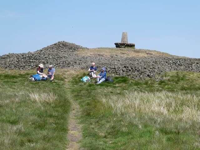
West Lomond is the higher of the two volcanic plugs that dominate the skyline of central Fife, rising in the NO 197 grid square above Loch Leven. At 522m it commands views from the Forth bridges across to the Tay, with the Pentlands and Highlands on the horizon.
Quick facts
- Height
- 522m/ 1713ft
- Prominence
- 405 m
- Grid ref
- NO 19732 06632
- Nearest city
- Perth· 19km
- Dogs
- Dogs on lead required near livestockDog-friendly guide ↗
Height and prominence cross-checked against the Database of British and Irish Hills (CC BY).
No GPX track yet
Walked this route? Share your track to help other walkers.
Standard route
volcanic basalt 45% · heather moorland 35% · grass slopes 20%
The most popular line starts from Craigmead car park between East and West Lomond and climbs west along a clear path, with a short steep pull onto the conical summit. About 8km round trip and 2-3 hours.
Terrain
A well-trodden path runs across heather and grass moorland, with the final 50m a steep zigzag on eroded basalt. The volcanic plug stands clearly apart from the surrounding plateau.
In winter
A reliable Fife winter walk with quick access from Edinburgh and the central belt. The summit cone can ice up after thaws and the descent is the trickiest part — micro-spikes are worth carrying.
Best time of year
Getting there
- Glasgow3h 39m
- Edinburgh1h 48m
OS maps: OS Landranger 58, OS Explorer 370
Mobile signal: Good across the Fife approach and on the Bishop Hill summit ridge — EE and Vodafone both hold a steady signal looking out over Loch Leven. Coverage is weaker on the eastern flank where the hill shadows the Kinross masts.
Current conditions
Daylight Today
- Sunrise
- 05:12
- Sunset
- 21:28
- Civil dawn
- 04:22
- Civil dusk
- 22:18
NOAA Solar Calculator · 30 July 2026
Pair with
Curated multi-hill combinations from West Lomond.
Around West Lomond on the SCOT network
Getting there, basing yourself, and what to do off the hill.
Getting there: Perth station
Gateway to Perthshire; Schiehallion, Beinn a Ghlo via bus
19km from the hill
tripscot.co.uk
On TripSCOTBase yourself in Dunkeld
Southern Cairngorms gateway — Hermitage, Loch of the Lowes
40km from the hill
tripscot.co.uk
On TasteSCOTAfter the hill: Tullibardine
Blackford — central Highland distillery on the A9 between Stirling and Perth
30km from the hill
tastescot.co.uk
West Lomond — common questions
- Is West Lomond a hard climb?
- West Lomond is rated 2/5 (moderate) on the OutdoorSCOT scale. Terrain: A well-trodden path runs across heather and grass moorland, with the final 50m a steep zigzag on eroded basalt.
- How prominent is West Lomond?
- West Lomond has 405m of topographic prominence — the height of its summit above the highest col connecting it to higher ground. Marilyns are defined by that measure: at least 150m of drop on all sides.
- When should I climb West Lomond?
- The standard good-weather months for West Lomond are March, April, May, June, July, August, September, October. Outside those months, expect winter conditions on the high ground — full mountain kit, navigation skills, and a check of the SAIS avalanche forecast for the relevant region.
- Can I bring my dog up West Lomond?
- On a lead only — the route crosses ground with livestock or nesting-bird interest.
- What's mobile reception like on West Lomond?
- Good across the Fife approach and on the Bishop Hill summit ridge — EE and Vodafone both hold a steady signal looking out over Loch Leven. Coverage is weaker on the eastern flank where the hill shadows the Kinross masts.
- Is West Lomond safe in winter?
- A reliable Fife winter walk with quick access from Edinburgh and the central belt. The summit cone can ice up after thaws and the descent is the trickiest part — micro-spikes are worth carrying.
Get the OutdoorSCOT weekly
One email a week — new route, hill and bothy guides, seasonal conditions and the odd hard-won lesson. No spam, unsubscribe in one click.