Marilyn · Ochils
Benarty Hill
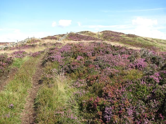
Benarty Hill rears above the south shore of Loch Leven at NT15, a dramatic basalt escarpment of 356m known locally as the Sleeping Giant for its profile. The summit looks straight down onto the Loch Leven RSPB reserve and across to the Lomonds.
Quick facts
- Height
- 356m/ 1168ft
- Prominence
- 228 m
- Grid ref
- NT 15381 97876
- Parking
- NT 156 968
- Nearest city
- Perth· 26km
- Dogs
- Dogs on lead required near livestockDog-friendly guide ↗
Height and prominence cross-checked against the Database of British and Irish Hills (CC BY).
No GPX track yet
Walked this route? Share your track to help other walkers.
Standard route
volcanic basalt 50% · grass slopes 30% · heather patches 20%
Start from Harran Hill car park in Benarty Forest and follow the forestry roads east, then cut up onto the escarpment via the steep path past the trig point. The cliff-edge walk west gives stunning Loch Leven views.
Terrain
Forestry tracks for most of the approach with a steep eroded path onto the cliff plateau. The summit walk follows a fence along basalt edges — keep well back in wind.
In winter
North-facing cliffs hold cornices after heavy snow. Conditions on the plateau are exposed; the escarpment edge becomes dangerous when iced and is best avoided in low cloud.
Best time of year
Getting there
- Glasgow2h 25m
- Edinburgh1h 43m
OS maps: OS Landranger 58, OS Explorer 367W
Mobile signal: Good. Fife/Kinross-shire; EE reliable.
Current conditions
Daylight Today
- Sunrise
- 05:12
- Sunset
- 21:27
- Civil dawn
- 04:23
- Civil dusk
- 22:17
NOAA Solar Calculator · 30 July 2026
Around Benarty Hill on the SCOT network
Getting there, basing yourself, and what to do off the hill.
Getting there: Perth station
Gateway to Perthshire; Schiehallion, Beinn a Ghlo via bus
26km from the hill
tripscot.co.uk
On TripSCOTBase yourself in Dunkeld
Southern Cairngorms gateway — Hermitage, Loch of the Lowes
47km from the hill
tripscot.co.uk
On TasteSCOTAfter the hill: Tullibardine
Blackford — central Highland distillery on the A9 between Stirling and Perth
27km from the hill
tastescot.co.uk
Benarty Hill — common questions
- How hard is Benarty Hill?
- We grade Benarty Hill at 1/5, which puts it in easy territory. Underfoot: Forestry tracks for most of the approach with a steep eroded path onto the cliff plateau.
- What is Benarty Hill's prominence?
- 228m of prominence. That's the vertical drop from the summit to the col that links Benarty Hill to the next higher ground. That drop is what qualifies it as a Marilyn — a hill with at least 150m of descent on every side.
- Where do I park for Benarty Hill?
- Most walkers start from NT 156 968. Verify the grid reference on an OS map before you set off — space is tight on busy summer weekends.
- When is the best time to climb Benarty Hill?
- March, April, May, June, July, August, September, October give the most reliable conditions on Benarty Hill. Beyond that window the high ground turns wintry: carry full mountain kit, be confident navigating, and check the SAIS avalanche forecast for the area.
- Is Benarty Hill dog-friendly?
- Yes, but dogs must be kept on a lead — there is livestock or ground-nesting bird interest on the route.
- Is there mobile signal on Benarty Hill?
- Good. Fife/Kinross-shire; EE reliable.
- Is Benarty Hill safe in winter?
- North-facing cliffs hold cornices after heavy snow. Conditions on the plateau are exposed; the escarpment edge becomes dangerous when iced and is best avoided in low cloud.
Get the OutdoorSCOT weekly
One email a week — new route, hill and bothy guides, seasonal conditions and the odd hard-won lesson. No spam, unsubscribe in one click.