Marilyn · Ochils
Dumglow
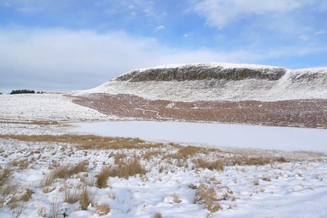
Dumglow is the highest of the Cleish Hills west of Loch Leven, a 379m basalt knoll at NT07 with the remains of an Iron Age fort on its summit. The view ranges from the Lomonds across to Ben Cleuch and back over Kinross.
Quick facts
- Height
- 379m/ 1243ft
- Prominence
- 251 m
- Grid ref
- NT 07594 96500
- Parking
- NT 088 974
- Nearest city
- Perth· 27km
- Dogs
- Dogs on lead required near livestockDog-friendly guide ↗
Height and prominence cross-checked against the Database of British and Irish Hills (CC BY).
No GPX track yet
Walked this route? Share your track to help other walkers.
Standard route
grass slopes 60% · heather moorland 30% · boggy ground 10%
Start from the forestry parking near Maryburgh or the Nivingston farm road and pick up the path through the trees onto open moor. Cross the boggy col below the fort then climb the short steep cone to the summit.
Terrain
Forestry track gives way to peaty moor with intermittent paths. Last 80m is a steep grass and earth pull onto the fort knoll.
In winter
Cleish Hills sit below the snow line most years but the forestry rides hold ice well into spring. Useful as a sheltered low-level outing when the Ochil tops are claggy.
Best time of year
Getting there
- Glasgow2h 6m
- Edinburgh1h 56m
OS maps: OS Landranger 58, OS Explorer 367W
Mobile signal: Good. Kinross-shire; EE reliable on summit and approach.
Current conditions
Daylight Today
- Sunrise
- 06:43
- Sunset
- 19:37
- Civil dawn
- 06:05
- Civil dusk
- 20:14
NOAA Solar Calculator · 14 September 2026
Around Dumglow on the SCOT network
Getting there, basing yourself, and what to do off the hill.
Getting there: Gleneagles station
Glen Devon; Ochil ridges; Auchterarder; PGA Centenary course access
22km from the hill
tripscot.co.uk
On TripSCOTBase yourself in Callander
Trossachs gateway — Ben Ledi, Stuc a Chroin, Rob Roy Way
46km from the hill
tripscot.co.uk
On TasteSCOTAfter the hill: Tullibardine
Blackford — central Highland distillery on the A9 between Stirling and Perth
21km from the hill
tastescot.co.uk
Dumglow — common questions
- Is Dumglow a hard climb?
- Dumglow is rated 1/5 (easy) on the OutdoorSCOT scale. Underfoot: Forestry track gives way to peaty moor with intermittent paths.
- What is Dumglow's prominence?
- 251m of prominence. That's the vertical drop from the summit to the col that links Dumglow to the next higher ground. That drop is what qualifies it as a Marilyn — a hill with at least 150m of descent on every side.
- Where do I park for Dumglow?
- Most walkers start from NT 088 974. Verify the grid reference on an OS map before you set off — space is tight on busy summer weekends.
- When is the best time to climb Dumglow?
- March, April, May, June, July, August, September, October give the most reliable conditions on Dumglow. Beyond that window the high ground turns wintry: carry full mountain kit, be confident navigating, and check the SAIS avalanche forecast for the area.
- Is Dumglow dog-friendly?
- Yes, but dogs must be kept on a lead — there is livestock or ground-nesting bird interest on the route.
- Is there mobile signal on Dumglow?
- Good. Kinross-shire; EE reliable on summit and approach.
- Is Dumglow safe in winter?
- Cleish Hills sit below the snow line most years but the forestry rides hold ice well into spring. Useful as a sheltered low-level outing when the Ochil tops are claggy.
Get the OutdoorSCOT weekly
One email a week — new route, hill and bothy guides, seasonal conditions and the odd hard-won lesson. No spam, unsubscribe in one click.