Marilyn · Ochils
Bishop Hill
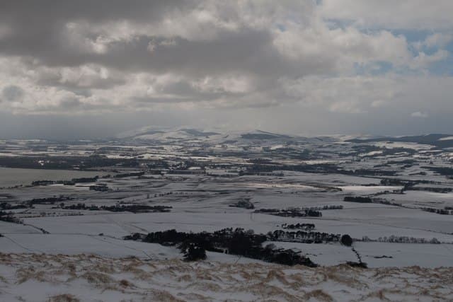
Bishop Hill is the southern outlier of the Lomond Hills, rising in the NO 185 grid square directly above Loch Leven. Its 461m summit ends in a steep volcanic scarp on the western edge that makes the hill look more dramatic from below than its height suggests.
Quick facts
- Height
- 461m/ 1512ft
- Prominence
- 179 m
- Grid ref
- NO 18546 04370
- Nearest city
- Perth· 20km
- Dogs
- Dogs on lead required near livestockDog-friendly guide ↗
Height and prominence cross-checked against the Database of British and Irish Hills (CC BY).
No GPX track yet
Walked this route? Share your track to help other walkers.
Standard route
volcanic basalt 50% · heather moorland 30% · grass slopes 20%
A popular route starts from Kinnesswood and climbs the steep western face onto the scarp before an easy ridge walk south to the summit. Around 7km and 2-3 hours, with the option of extending north to West Lomond.
Terrain
Eroded paths on the steep scarp face firm up to short turf on the plateau. The cliff edge along the western side is unfenced and demands attention, especially with families.
In winter
A favourite winter quick-fix for Fife and Edinburgh walkers, with hard frost firming up the scarp paths. Cornices can build over the western edge after easterly snowfalls and warrant a careful line.
Best time of year
Getting there
- Glasgow3h 35m
- Edinburgh1h 46m
OS maps: OS Landranger 58, OS Explorer 370
Mobile signal: Reliable EE and O2 coverage on Largo Law from the car park to the summit — the Forth coast gives an unobstructed line to the Fife and East Lothian masts. Brief drop-outs are possible in the wooded lower slopes.
Current conditions
Daylight Today
- Sunrise
- 05:12
- Sunset
- 21:28
- Civil dawn
- 04:22
- Civil dusk
- 22:18
NOAA Solar Calculator · 30 July 2026
Pair with
Curated multi-hill combinations from Bishop Hill.
Around Bishop Hill on the SCOT network
Getting there, basing yourself, and what to do off the hill.
Getting there: Perth station
Gateway to Perthshire; Schiehallion, Beinn a Ghlo via bus
20km from the hill
tripscot.co.uk
On TripSCOTBase yourself in Dunkeld
Southern Cairngorms gateway — Hermitage, Loch of the Lowes
41km from the hill
tripscot.co.uk
On TasteSCOTAfter the hill: Tullibardine
Blackford — central Highland distillery on the A9 between Stirling and Perth
29km from the hill
tastescot.co.uk
Bishop Hill — common questions
- How hard is Bishop Hill?
- We grade Bishop Hill at 1/5, which puts it in easy territory. Underfoot: Eroded paths on the steep scarp face firm up to short turf on the plateau.
- What is Bishop Hill's prominence?
- 179m of prominence. That's the vertical drop from the summit to the col that links Bishop Hill to the next higher ground. That drop is what qualifies it as a Marilyn — a hill with at least 150m of descent on every side.
- When is the best time to climb Bishop Hill?
- March, April, May, June, July, August, September, October give the most reliable conditions on Bishop Hill. Beyond that window the high ground turns wintry: carry full mountain kit, be confident navigating, and check the SAIS avalanche forecast for the area.
- Is Bishop Hill dog-friendly?
- Yes, but dogs must be kept on a lead — there is livestock or ground-nesting bird interest on the route.
- Is there mobile signal on Bishop Hill?
- Reliable EE and O2 coverage on Largo Law from the car park to the summit — the Forth coast gives an unobstructed line to the Fife and East Lothian masts. Brief drop-outs are possible in the wooded lower slopes.
- Is Bishop Hill safe in winter?
- A favourite winter quick-fix for Fife and Edinburgh walkers, with hard frost firming up the scarp paths. Cornices can build over the western edge after easterly snowfalls and warrant a careful line.
Get the OutdoorSCOT weekly
One email a week — new route, hill and bothy guides, seasonal conditions and the odd hard-won lesson. No spam, unsubscribe in one click.