Marilyn · Ochils
Cairnie Hill
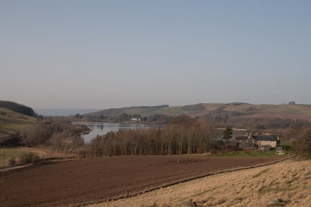
Cairnie Hill is a modest 228m wooded ridge in north-east Fife between Cupar and Newburgh at NO27. Forestry plantation cloaks the lower flanks while the summit clearing offers views over the Howe of Fife and toward the Tay.
Quick facts
- Height
- 228.9m/ 751ft
- Prominence
- 150 m
- Grid ref
- NO 27933 15486
- Parking
- NO 282 152
- Nearest city
- Perth· 18km
- Dogs
- Dogs on lead required near livestockDog-friendly guide ↗
Height and prominence cross-checked against the Database of British and Irish Hills (CC BY).
No GPX track yet
Walked this route? Share your track to help other walkers.
Standard route
grass slopes 65% · heather patches 25% · boggy ground 10%
Start from the forestry parking on the minor road north of Letham and follow the gravel track up through Cairnie Wood. A short detour off the main track reaches the summit trig hidden among the trees.
Terrain
Forestry roads throughout, with a narrow path through spruce to the summit clearing. Easy underfoot but limited views except at gaps in the canopy.
In winter
Sheltered woodland walk that works well as a foul-weather option. Forestry tracks can be icy after thaw and refreeze; otherwise undemanding year-round.
Best time of year
Getting there
- Glasgow3h 3m
- Edinburgh1h 58m
OS maps: OS Landranger 59, OS Explorer 370
Mobile signal: Good. Perthshire/Fife border; EE reliable.
Current conditions
Daylight Today
- Sunrise
- 05:11
- Sunset
- 21:28
- Civil dawn
- 04:21
- Civil dusk
- 22:18
NOAA Solar Calculator · 30 July 2026
Around Cairnie Hill on the SCOT network
Getting there, basing yourself, and what to do off the hill.
Cairnie Hill — common questions
- Is Cairnie Hill a hard climb?
- Cairnie Hill is rated 1/5 (easy) on the OutdoorSCOT scale. Underfoot: Forestry roads throughout, with a narrow path through spruce to the summit clearing.
- What is Cairnie Hill's prominence?
- 150m of prominence. That's the vertical drop from the summit to the col that links Cairnie Hill to the next higher ground. That drop is what qualifies it as a Marilyn — a hill with at least 150m of descent on every side.
- Where do I park for Cairnie Hill?
- Most walkers start from NO 282 152. Verify the grid reference on an OS map before you set off — space is tight on busy summer weekends.
- When is the best time to climb Cairnie Hill?
- March, April, May, June, July, August, September, October give the most reliable conditions on Cairnie Hill. Beyond that window the high ground turns wintry: carry full mountain kit, be confident navigating, and check the SAIS avalanche forecast for the area.
- Is Cairnie Hill dog-friendly?
- Yes, but dogs must be kept on a lead — there is livestock or ground-nesting bird interest on the route.
- Is there mobile signal on Cairnie Hill?
- Good. Perthshire/Fife border; EE reliable.
- Is Cairnie Hill safe in winter?
- Sheltered woodland walk that works well as a foul-weather option. Forestry tracks can be icy after thaw and refreeze; otherwise undemanding year-round.
Get the OutdoorSCOT weekly
One email a week — new route, hill and bothy guides, seasonal conditions and the odd hard-won lesson. No spam, unsubscribe in one click.