Marilyn · Ochils
Mount Hill
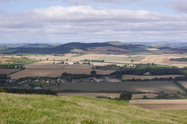
Mount Hill rises above the village of Hopetoun and Cupar in north Fife at NO33, capped by a tall stone obelisk built in 1826 to the Earl of Hopetoun. The 222m summit is one of the most prominent landmarks visible from the M90.
Quick facts
- Height
- 222.1m/ 729ft
- Prominence
- 163 m
- Grid ref
- NO 33093 16479
- Parking
- NO 339 167
- Nearest city
- Dundee· 16km
- Dogs
- Dogs on lead required near livestockDog-friendly guide ↗
Height and prominence cross-checked against the Database of British and Irish Hills (CC BY).
No GPX track yet
Walked this route? Share your track to help other walkers.
Standard route
grass slopes 65% · heather patches 25% · rocky outcrops 10%
Park at the entrance to the Hopetoun Monument track and walk up through farmland and beech woodland on the estate access road. A short final pull leads onto the open knoll and the foot of the monument.
Terrain
Estate track and stone steps the whole way to the obelisk. Easy underfoot with mature beech woodland providing shelter most of the climb.
In winter
Sheltered approach makes this a popular winter outing. The monument viewpoint is exposed to easterlies; otherwise straightforward in any weather.
Best time of year
Getting there
- Glasgow3h 15m
- Edinburgh1h 2m
OS maps: OS Landranger 59, OS Explorer 370, OS Explorer 371N
Mobile signal: Good. Fife/Perthshire; EE reliable.
Current conditions
Daylight Today
- Sunrise
- 05:10
- Sunset
- 21:27
- Civil dawn
- 04:20
- Civil dusk
- 22:17
NOAA Solar Calculator · 30 July 2026
Around Mount Hill on the SCOT network
Getting there, basing yourself, and what to do off the hill.
Mount Hill — common questions
- Is Mount Hill a hard climb?
- Mount Hill is rated 1/5 (easy) on the OutdoorSCOT scale. Ground conditions: Estate track and stone steps the whole way to the obelisk.
- How much drop does Mount Hill have?
- The drop is 163m: measured from the summit of Mount Hill down to the saddle joining it to higher terrain. Passing the 150m-drop threshold on all sides is exactly what makes it a Marilyn.
- Where's the parking for Mount Hill?
- Park at NO 339 167. Double-check the grid reference on an OS map first; informal laybys here fill early in high season.
- What's the best month to climb Mount Hill?
- Aim for March, April, May, June, July, August, September, October on Mount Hill. In the remaining months treat it as a winter hill — full kit, solid navigation, and a look at the relevant SAIS avalanche forecast before you go.
- Can dogs go up Mount Hill?
- Dogs are fine on a lead. The route passes livestock or ground-nesting bird habitat, so keep them close throughout.
- Will I get phone signal on Mount Hill?
- Good. Fife/Perthshire; EE reliable.
- Is Mount Hill safe in winter?
- Sheltered approach makes this a popular winter outing. The monument viewpoint is exposed to easterlies; otherwise straightforward in any weather.
Get the OutdoorSCOT weekly
One email a week — new route, hill and bothy guides, seasonal conditions and the odd hard-won lesson. No spam, unsubscribe in one click.