Marilyn · Arran
Tighvein
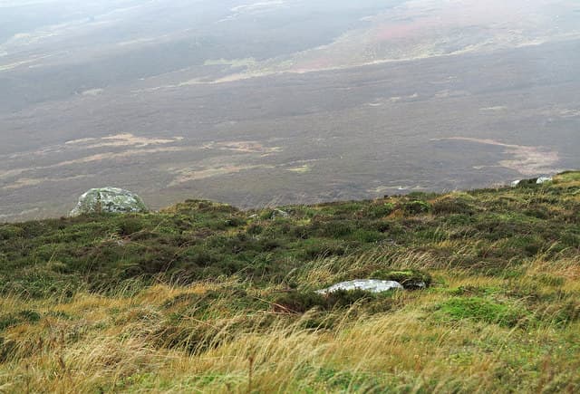
The highest point of southern Arran at 458m, presiding over an empty expanse of bog, lochans and tussock that few visitors ever see. From the summit cairn the whole of the Firth of Clyde unfolds — Ailsa Craig, Holy Island, Bute, and the Galloway hills beyond.
Quick facts
- Height
- 458.2m/ 1503ft
- Prominence
- 183 m
- Grid ref
- NR 99784 27410
- Nearest city
- Glasgow· 70km
- Dogs
- Dogs on lead required near livestockDog-friendly guide ↗
Height and prominence cross-checked against the Database of British and Irish Hills (CC BY).
No GPX track yet
Walked this route? Share your track to help other walkers.
Standard route
heather moorland 60% · grass slopes 25% · rocky summit 15%
Best from Kilmory on the south coast, following forestry roads inland for several kilometres before the long wet pull onto the boggy summit dome. A serious 14km return outing with rough ground throughout — five hours minimum.
Terrain
The notorious peat hags of the Tighvein plateau make this one of the wettest Marilyns in Scotland. Even after dry spells the ground holds water; choose your line carefully or be prepared to wade.
In winter
Snow rarely lies but the peat hags freeze unpredictably and a thin crust over deep bog is a particular hazard. Visibility on the featureless plateau drops to nothing in cloud.
Best time of year
Getting there
- Glasgow3h 33m
- Edinburgh5h 15m
Ferry access
Ardrossan → Brodick
- Crossing time55 min
- Summer sailingsUp to 6 sailings daily (Apr–Oct)
- Winter sailings3–4 sailings daily (Nov–Mar)
- Book ahead7 days
- Last ferry backCheck CalMac timetable — last departure varies seasonally
Foot passengers welcome without booking. Book vehicle space well in advance in summer. A seasonal alternative runs Claonaig → Lochranza (30 min) in summer.
Book on CalMac ↗OS maps: OS Landranger 69, OS Explorer 361S
Mobile signal: Mixed. EE patchy up high; improves toward Brodick.
Current conditions
Daylight Today
- Sunrise
- 05:23
- Sunset
- 21:31
- Civil dawn
- 04:35
- Civil dusk
- 22:19
NOAA Solar Calculator · 30 July 2026
Around Tighvein on the SCOT network
Getting there, basing yourself, and what to do off the hill.
Getting there: Ardrossan Harbour station
Ferry to Brodick (Arran) — Goat Fell, Arran ridge
27km from the hill
tripscot.co.uk
On TripSCOTBase yourself in Brodick
Arran base — Goat Fell, Glen Rosa, the Arran ridge
9km from the hill
tripscot.co.uk
On TasteSCOTAfter the hill: Arran
Lochranza — northern Arran; revived in 1995; rich sherried releases
25km from the hill
tastescot.co.uk
Tighvein — common questions
- What difficulty is Tighvein?
- On the OutdoorSCOT scale, Tighvein comes in at 1/5 — easy. Terrain: The notorious peat hags of the Tighvein plateau make this one of the wettest Marilyns in Scotland.
- How prominent is Tighvein?
- Tighvein has 183m of topographic prominence — the height of its summit above the highest col connecting it to higher ground. Marilyns are defined by that measure: at least 150m of drop on all sides.
- When should I climb Tighvein?
- The standard good-weather months for Tighvein are March, April, May, June, July, August, September, October. Outside those months, expect winter conditions on the high ground — full mountain kit, navigation skills, and a check of the SAIS avalanche forecast for the relevant region.
- Can I bring my dog up Tighvein?
- On a lead only — the route crosses ground with livestock or nesting-bird interest.
- What's mobile reception like on Tighvein?
- Mixed. EE patchy up high; improves toward Brodick.
- How do I get the ferry to Tighvein?
- Ardrossan → Brodick. Up to 6 sailings daily (Apr–Oct) in summer; 3–4 sailings daily (Nov–Mar) in winter. Book at least 7 days ahead. Foot passengers welcome without booking. Book vehicle space well in advance in summer. A seasonal alternative runs Claonaig → Lochranza (30 min) in summer.
- Is Tighvein safe in winter?
- Snow rarely lies but the peat hags freeze unpredictably and a thin crust over deep bog is a particular hazard. Visibility on the featureless plateau drops to nothing in cloud.
Get the OutdoorSCOT weekly
One email a week — new route, hill and bothy guides, seasonal conditions and the odd hard-won lesson. No spam, unsubscribe in one click.