Marilyn · Arran
Beinn Bhreac
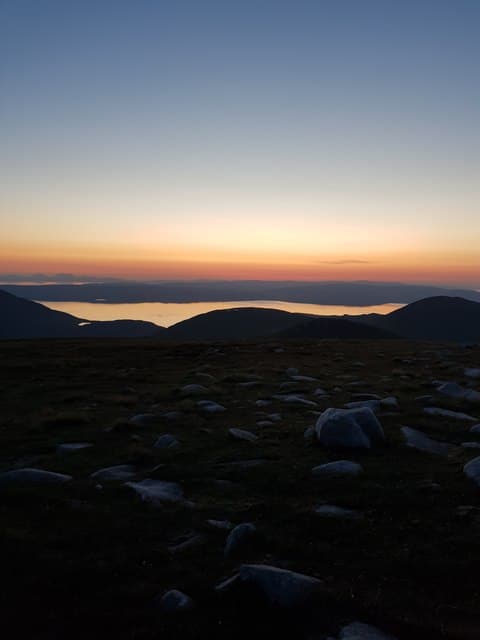
Speckled Hill, a broad heather-and-granite dome north of Glen Rosa on Arran. From the summit ridge the famous A'Chir aretes and Cir Mhor rise dramatically to the west, offering a fine first taste of the wilder northern Arran skyline without committing to scrambling ground.
Quick facts
- Height
- 574.1m/ 1883ft
- Grid ref
- NR 94326 45547
- Nearest city
- Glasgow· 68km
- Dogs
- Dogs on lead required near livestockDog-friendly guide ↗
No GPX track yet
Walked this route? Share your track to help other walkers.
Standard route
heather moorland 50% · rough grassland 30% · granite/schist 20%
The usual line is from Glen Rosa, taking the path up Glen Rosa and then breaking right onto the south-east ridge of the hill. Around 13km return with 700m of ascent; allow five hours and savour the seats with a view of the Saddle.
Terrain
Stalkers' path in lower Glen Rosa, then a pathless rough heather and granite ridge. The summit cap is a tumble of granite boulders — care needed if wet or snow-covered.
In winter
Snow accumulates on the upper ridge from December onwards and can be wind-slabbed. Treat as a serious hill day in winter despite the modest altitude — full kit and an early start.
Best time of year
Getting there
- Glasgow3h 41m
- Edinburgh5h 26m
Ferry access
Ardrossan → Brodick
- Crossing time55 min
- Summer sailingsUp to 6 sailings daily (Apr–Oct)
- Winter sailings3–4 sailings daily (Nov–Mar)
- Book ahead7 days
- Last ferry backCheck CalMac timetable — last departure varies seasonally
Foot passengers welcome without booking. Book vehicle space well in advance in summer. A seasonal alternative runs Claonaig → Lochranza (30 min) in summer.
Book on CalMac ↗OS maps: OS Landranger 62, OS Landranger 69, OS Explorer 361N
Mobile signal: Moderate. EE works in lower Glen Rosa; the upper ridge is intermittent and the summit can drop out.
Current conditions
Daylight Today
- Sunrise
- 04:39
- Sunset
- 22:09
- Civil dawn
- 03:38
- Civil dusk
- 23:10
NOAA Solar Calculator · 27 June 2026
Around Beinn Bhreac on the SCOT network
Getting there, basing yourself, and what to do off the hill.
Getting there: Ardrossan Harbour station
Ferry to Brodick (Arran) — Goat Fell, Arran ridge
28km from the hill
tripscot.co.uk
On TripSCOTBase yourself in Brodick
Arran base — Goat Fell, Glen Rosa, the Arran ridge
12km from the hill
tripscot.co.uk
On TasteSCOTAfter the hill: Arran
Lochranza — northern Arran; revived in 1995; rich sherried releases
6km from the hill
tastescot.co.uk
Beinn Bhreac — common questions
- How hard is Beinn Bhreac?
- Beinn Bhreac is rated 2/5 (moderate) on the OutdoorSCOT scale. Terrain: Stalkers' path in lower Glen Rosa, then a pathless rough heather and granite ridge.
- When is the best time to climb Beinn Bhreac?
- The standard good-weather months for Beinn Bhreac are March, April, May, June, July, August, September, October. Outside those months, expect winter conditions on the high ground — full mountain kit, navigation skills, and a check of the SAIS avalanche forecast for the relevant region.
- Can I bring my dog up Beinn Bhreac?
- Yes, but dogs must be kept on a lead — there is livestock or ground-nesting bird interest on the route.
- Is there mobile signal on Beinn Bhreac?
- Moderate. EE works in lower Glen Rosa; the upper ridge is intermittent and the summit can drop out.
- How do I get the ferry to Beinn Bhreac?
- Ardrossan → Brodick. Up to 6 sailings daily (Apr–Oct) in summer; 3–4 sailings daily (Nov–Mar) in winter. Book at least 7 days ahead. Foot passengers welcome without booking. Book vehicle space well in advance in summer. A seasonal alternative runs Claonaig → Lochranza (30 min) in summer.
- Is Beinn Bhreac safe in winter?
- Snow accumulates on the upper ridge from December onwards and can be wind-slabbed. Treat as a serious hill day in winter despite the modest altitude — full kit and an early start.
Get the OutdoorSCOT weekly
One email a week — new route, hill and bothy guides, seasonal conditions and the odd hard-won lesson. No spam, unsubscribe in one click.