Marilyn · Arran
Mullach Mor
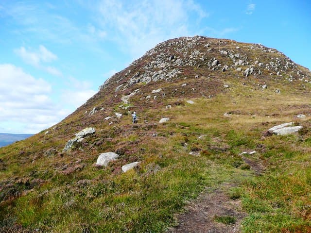
The Big Top, high point of Holy Island in Lamlash Bay off the east coast of Arran. The island is owned by a Buddhist community and the climb passes painted Buddha rock-carvings on its way to a magnificent 314m viewpoint over the Firth of Clyde.
Gaelic: “summit, big” · Pronunciation: mull-ach more
Quick facts
- Height
- 314m/ 1030ft
- Grid ref
- NS 06317 29741
- Nearest city
- Glasgow· 64km
- Dogs
- Dogs on lead required near livestockDog-friendly guide ↗
No GPX track yet
Walked this route? Share your track to help other walkers.
Standard route
rough grassland 50% · heather moorland 30% · schist outcrops 20%
A foot ferry from Lamlash lands at the north end of Holy Island; from there the path climbs steeply south-east up the spine of the island to the summit. Roughly 5km and 350m of ascent; two and a half hours plus ferry time.
Terrain
A clear stony path the whole way, but steep and rough underfoot in places. Holy Island has feral goats and Eriskay ponies — keep dogs strictly on the lead.
In winter
Snow rarely settles on Holy Island but the ferry is weather-dependent and may not run in winter. Check sailings in advance and accept that a south-westerly gale will keep you on the mainland.
Best time of year
Getting there
- Glasgow2h 17m
- Edinburgh5h 59m
OS maps: OS Landranger 69, OS Explorer 361S
Mobile signal: Good signal across most of the island; EE reliable thanks to the Lamlash mast across the bay.
Current conditions
Daylight Today
- Sunrise
- 04:39
- Sunset
- 22:07
- Civil dawn
- 03:39
- Civil dusk
- 23:07
NOAA Solar Calculator · 27 June 2026
Around Mullach Mor on the SCOT network
Getting there, basing yourself, and what to do off the hill.
Getting there: Ardrossan Harbour station
Ferry to Brodick (Arran) — Goat Fell, Arran ridge
20km from the hill
tripscot.co.uk
On TripSCOTBase yourself in Brodick
Arran base — Goat Fell, Glen Rosa, the Arran ridge
8km from the hill
tripscot.co.uk
On TasteSCOTAfter the hill: Arran
Lochranza — northern Arran; revived in 1995; rich sherried releases
25km from the hill
tastescot.co.uk
Mullach Mor — common questions
- How hard is Mullach Mor?
- Mullach Mor is rated 1/5 (easy) on the OutdoorSCOT scale. Terrain: A clear stony path the whole way, but steep and rough underfoot in places.
- When is the best time to climb Mullach Mor?
- The standard good-weather months for Mullach Mor are March, April, May, June, July, August, September, October. Outside those months, expect winter conditions on the high ground — full mountain kit, navigation skills, and a check of the SAIS avalanche forecast for the relevant region.
- Can I bring my dog up Mullach Mor?
- Yes, but dogs must be kept on a lead — there is livestock or ground-nesting bird interest on the route.
- Is there mobile signal on Mullach Mor?
- Good signal across most of the island; EE reliable thanks to the Lamlash mast across the bay.
- Is Mullach Mor safe in winter?
- Snow rarely settles on Holy Island but the ferry is weather-dependent and may not run in winter. Check sailings in advance and accept that a south-westerly gale will keep you on the mainland.
Get the OutdoorSCOT weekly
One email a week — new route, hill and bothy guides, seasonal conditions and the odd hard-won lesson. No spam, unsubscribe in one click.