Marilyn · Cairngorms
Tap o' Noth
The Top of Noth, the unmistakable conical hill above Rhynie in west Aberdeenshire, crowned by Scotland's second-highest Iron Age vitrified fort. Recent excavations suggest this was the centre of a Pictish power complex of regional significance — walking the rampart on the summit is to walk in two thousand years of history.
Quick facts
- Height
- 564.3m/ 1851ft
- Prominence
- 248 m
- Grid ref
- NJ 48408 29321
- Nearest city
- Aberdeen· 51km
- Dogs
- Dogs on lead required near livestockDog-friendly guide ↗
Height and prominence cross-checked against the Database of British and Irish Hills (CC BY).
No GPX track yet
Walked this route? Share your track to help other walkers.
Standard route
heather moorland 60% · grass slopes 30% · rocky summit 10%
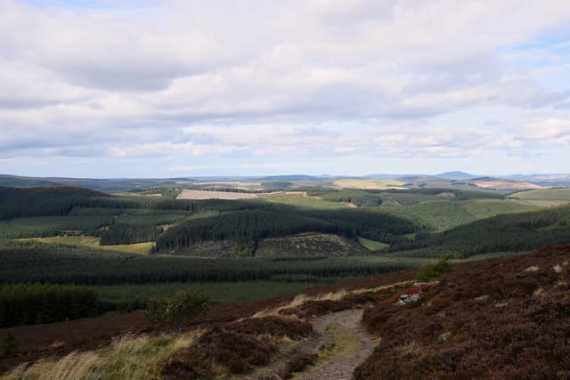
From the Brae of Scurdargue car park north of Rhynie a clear path climbs steadily for around 3km to the summit fort. A 6km return outing of two to three hours, gaining 250m — one of the easiest Marilyns in Scotland.
Terrain
A well-graded gravel and grass path the whole way, gentle enough for most fitness levels. The summit itself is the stone-strewn floor of the ancient fort.
In winter
The path can be icy or snow-covered from December to March but the gradient is forgiving. A great winter introduction to the area's archaeology with the bonus of long views in clear, cold air.
This hill is in the Northern Cairngorms SAIS forecast area. Check SAIS forecasts in winter (December–April).
Best time of year
Getting there
- Glasgow5h 16m
- Edinburgh4h 43m
OS maps: OS Landranger 37, OS Explorer 062E, OS Explorer 420E
Mobile signal: Coverage is solid; EE and Vodafone hold. Iron Age vitrified fort on summit.
Current conditions
Daylight Today
- Sunrise
- 05:04
- Sunset
- 21:32
- Civil dawn
- 04:11
- Civil dusk
- 22:25
NOAA Solar Calculator · 30 July 2026
Around Tap o' Noth on the SCOT network
Getting there, basing yourself, and what to do off the hill.
Getting there: Stonehaven station
Dunnottar Castle; Aberdeenshire coast; Mearns walking country
58km from the hill
tripscot.co.uk
On TripSCOTBase yourself in Dufftown
Speyside whisky town in the eastern Cairngorms
19km from the hill
tripscot.co.uk
On TasteSCOTAfter the hill: Glenfiddich
Dufftown — the world's best-selling single malt; visitor centre on the Speyside Way
20km from the hill
tastescot.co.uk
Tap o' Noth — common questions
- Is Tap o' Noth a hard climb?
- Tap o' Noth is rated 2/5 (moderate) on the OutdoorSCOT scale. Ground conditions: A well-graded gravel and grass path the whole way, gentle enough for most fitness levels.
- How much drop does Tap o' Noth have?
- The drop is 248m: measured from the summit of Tap o' Noth down to the saddle joining it to higher terrain. Passing the 150m-drop threshold on all sides is exactly what makes it a Marilyn.
- What's the best month to climb Tap o' Noth?
- Aim for March, April, May, June, July, August, September, October on Tap o' Noth. In the remaining months treat it as a winter hill — full kit, solid navigation, and a look at the relevant SAIS avalanche forecast before you go.
- Can dogs go up Tap o' Noth?
- Dogs are fine on a lead. The route passes livestock or ground-nesting bird habitat, so keep them close throughout.
- Will I get phone signal on Tap o' Noth?
- Coverage is solid; EE and Vodafone hold. Iron Age vitrified fort on summit.
- Is Tap o' Noth safe in winter?
- The path can be icy or snow-covered from December to March but the gradient is forgiving. A great winter introduction to the area's archaeology with the bonus of long views in clear, cold air.
Get the OutdoorSCOT weekly
One email a week — new route, hill and bothy guides, seasonal conditions and the odd hard-won lesson. No spam, unsubscribe in one click.