Marilyn · Cairngorms
Coiliochbhar Hill
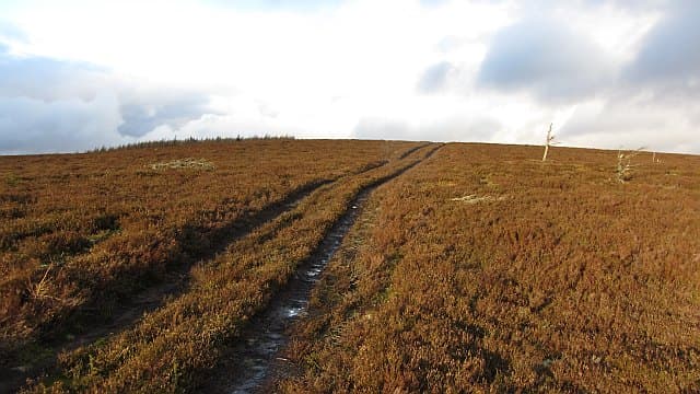
Coiliochbhar Hill rises to 533m above the upper Don valley, a quiet rolling whaleback flanked by working forestry plantation and heather moor. Reasonable prominence and a remote feel make it a more interesting outing than its modest stature suggests.
Quick facts
- Height
- 533m/ 1749ft
- Prominence
- 211 m
- Grid ref
- NJ 50357 16331
- Nearest city
- Aberdeen· 45km
- Dogs
- Dogs on lead required near livestockDog-friendly guide ↗
Height and prominence cross-checked against the Database of British and Irish Hills (CC BY).
No GPX track yet
Walked this route? Share your track to help other walkers.
Standard route
heather moorland 70% · grass slopes 20% · summit area 10%
Most parties start from forest tracks off the A97 south of Bridge of Bogendreip, weaving up through plantation rides before emerging on the open hill. The upper slopes are pathless heather to a small cairn. Allow 2.5-3.5 hours round trip.
Terrain
Forestry rides give way to deep heather and tussock on the upper hill — boots and gaiters help. Boggy patches between plantation blocks. No path on the summit dome.
In winter
Snow is rarely deep but driving wind off the Cairngorms can make the open plateau unpleasant. Compass work needed if the cloud comes down — the summit lacks distinguishing features.
This hill is in the Northern Cairngorms SAIS forecast area. Check SAIS forecasts in winter (December–April).
Best time of year
Getting there
- Glasgow5h 7m
- Edinburgh3h 27m
OS maps: OS Landranger 37, OS Explorer 059E, OS Explorer 062E, OS Explorer 405E, OS Explorer 420E
Mobile signal: Patchy. EE fitful up top; stronger toward Aberchirder.
Current conditions
Daylight Today
- Sunrise
- 05:04
- Sunset
- 21:31
- Civil dawn
- 04:12
- Civil dusk
- 22:24
NOAA Solar Calculator · 30 July 2026
Around Coiliochbhar Hill on the SCOT network
Getting there, basing yourself, and what to do off the hill.
Getting there: Stonehaven station
Dunnottar Castle; Aberdeenshire coast; Mearns walking country
48km from the hill
tripscot.co.uk
On TripSCOTBase yourself in Ballater
Eastern Cairngorms / Royal Deeside
24km from the hill
tripscot.co.uk
On TasteSCOTAfter the hill: The Glenlivet
Ballindalloch — the first legal distillery under the 1823 Excise Act
26km from the hill
tastescot.co.uk
Coiliochbhar Hill — common questions
- How hard is Coiliochbhar Hill?
- We grade Coiliochbhar Hill at 2/5, which puts it in moderate territory. Terrain: Forestry rides give way to deep heather and tussock on the upper hill — boots and gaiters help.
- How prominent is Coiliochbhar Hill?
- Coiliochbhar Hill has 211m of topographic prominence — the height of its summit above the highest col connecting it to higher ground. Marilyns are defined by that measure: at least 150m of drop on all sides.
- When should I climb Coiliochbhar Hill?
- The standard good-weather months for Coiliochbhar Hill are March, April, May, June, July, August, September, October. Outside those months, expect winter conditions on the high ground — full mountain kit, navigation skills, and a check of the SAIS avalanche forecast for the relevant region.
- Can I bring my dog up Coiliochbhar Hill?
- On a lead only — the route crosses ground with livestock or nesting-bird interest.
- What's mobile reception like on Coiliochbhar Hill?
- Patchy. EE fitful up top; stronger toward Aberchirder.
- Is Coiliochbhar Hill safe in winter?
- Snow is rarely deep but driving wind off the Cairngorms can make the open plateau unpleasant. Compass work needed if the cloud comes down — the summit lacks distinguishing features.
Get the OutdoorSCOT weekly
One email a week — new route, hill and bothy guides, seasonal conditions and the odd hard-won lesson. No spam, unsubscribe in one click.