Marilyn · Cairngorms
Ben Newe
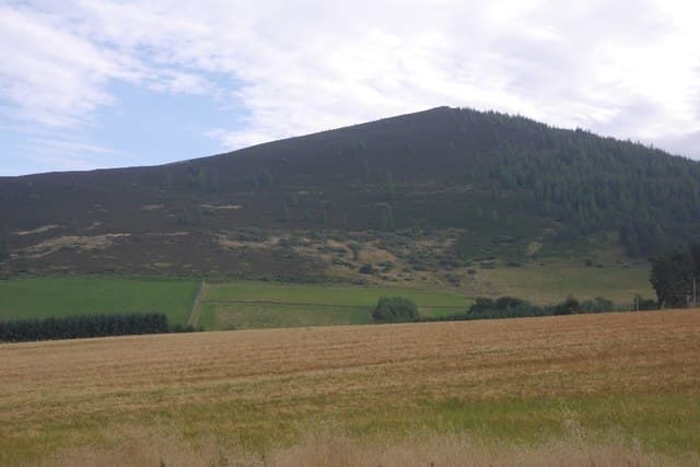
Beautiful Hill, the genteel viewpoint above Strathdon village in upper Donside. A waymarked path through old Caledonian pine and birch leads to a cairn with one of the best panoramas in the eastern Cairngorms — Lochnagar, the Buck and Ben Avon all line up beyond the valley.
Quick facts
- Height
- 566m/ 1857ft
- Prominence
- 181 m
- Grid ref
- NJ 38175 14302
- Nearest city
- Aberdeen· 57km
- Dogs
- Dogs on lead required near livestockDog-friendly guide ↗
Height and prominence cross-checked against the Database of British and Irish Hills (CC BY).
No GPX track yet
Walked this route? Share your track to help other walkers.
Standard route
heather moorland 65% · grass slopes 25% · rocky summit 10%
From the Bellabeg car park in Strathdon, follow the well-signed Ben Newe path through plantation and onto the open hillside. About 7km return with 400m of ascent — three hours at a steady pace and ideal as a family outing.
Terrain
A graded forest path the whole way to within a kilometre of the summit, then open heather slopes to the cairn. Boggy in places after rain but well-drained elsewhere.
In winter
Often climbable in winter when the higher Cairngorms are off-limits. Ice on the lower forest tracks is the main risk; the upper slopes can drift but rarely lock up.
This hill is in the Northern Cairngorms SAIS forecast area. Check SAIS forecasts in winter (December–April).
Best time of year
Getting there
- Glasgow5h 43m
- Edinburgh3h 18m
OS maps: OS Landranger 37, OS Explorer 059W, OS Explorer 062W, OS Explorer 405W, OS Explorer 420W
Mobile signal: Good signal throughout; EE and Vodafone dependable. Fine Strathdon viewpoint.
Current conditions
Daylight Today
- Sunrise
- 05:05
- Sunset
- 21:32
- Civil dawn
- 04:13
- Civil dusk
- 22:24
NOAA Solar Calculator · 30 July 2026
Around Ben Newe on the SCOT network
Getting there, basing yourself, and what to do off the hill.
Getting there: Aviemore station
Cairngorm plateau; Lairig Ghru; Speyside Way; Glenmore
48km from the hill
tripscot.co.uk
On TripSCOTBase yourself in Ballater
Eastern Cairngorms / Royal Deeside
18km from the hill
tripscot.co.uk
On TasteSCOTAfter the hill: The Glenlivet
Ballindalloch — the first legal distillery under the 1823 Excise Act
18km from the hill
tastescot.co.uk
Ben Newe — common questions
- How hard is Ben Newe?
- We grade Ben Newe at 2/5, which puts it in moderate territory. Terrain: A graded forest path the whole way to within a kilometre of the summit, then open heather slopes to the cairn.
- How prominent is Ben Newe?
- Ben Newe has 181m of topographic prominence — the height of its summit above the highest col connecting it to higher ground. Marilyns are defined by that measure: at least 150m of drop on all sides.
- When should I climb Ben Newe?
- The standard good-weather months for Ben Newe are March, April, May, June, July, August, September, October. Outside those months, expect winter conditions on the high ground — full mountain kit, navigation skills, and a check of the SAIS avalanche forecast for the relevant region.
- Can I bring my dog up Ben Newe?
- On a lead only — the route crosses ground with livestock or nesting-bird interest.
- What's mobile reception like on Ben Newe?
- Good signal throughout; EE and Vodafone dependable. Fine Strathdon viewpoint.
- Is Ben Newe safe in winter?
- Often climbable in winter when the higher Cairngorms are off-limits. Ice on the lower forest tracks is the main risk; the upper slopes can drift but rarely lock up.
Get the OutdoorSCOT weekly
One email a week — new route, hill and bothy guides, seasonal conditions and the odd hard-won lesson. No spam, unsubscribe in one click.