Marilyn · Cairngorms
Lord Arthur's Hill
Lord Arthur's Hill stands at 518m above the upper Don, an unassuming Aberdeenshire summit named after a long-dead local landowner. A grouse-shooting hill of heather and bilberry with a wide-open feel and a fine outlook to Bennachie.
Quick facts
- Height
- 518m/ 1699ft
- Prominence
- 265 m
- Grid ref
- NJ 51340 19791
- Nearest city
- Aberdeen· 45km
- Dogs
- Dogs on lead required near livestockDog-friendly guide ↗
Height and prominence cross-checked against the Database of British and Irish Hills (CC BY).
No GPX track yet
Walked this route? Share your track to help other walkers.
Standard route
heather moorland 70% · grass slopes 20% · rocky summit 10%
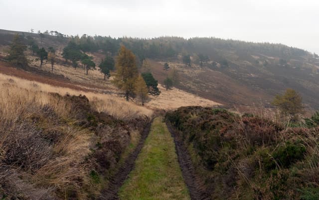
A track from the minor road south of Towie climbs steadily through managed heather moor onto the rounded summit plateau. Around 7-8km return on mostly good underfoot, taking 2.5-3 hours. The cairn is set back from the rim.
Terrain
Land Rover tracks form the bulk of the ascent — good walking. Short pathless heather across the summit. Drainage is reasonable but boggy after prolonged rain.
In winter
Open and exposed, but with the estate track providing a clear line of ascent in snow. Wind chill is the dominant winter hazard rather than depth of cover.
This hill is in the Northern Cairngorms SAIS forecast area. Check SAIS forecasts in winter (December–April).
Best time of year
Getting there
- Glasgow5h 12m
- Edinburgh4h 32m
OS maps: OS Landranger 37, OS Explorer 062E, OS Explorer 420E
Mobile signal: Patchy. EE flickers up top; better toward Inverurie.
Current conditions
Daylight Today
- Sunrise
- 05:04
- Sunset
- 21:31
- Civil dawn
- 04:12
- Civil dusk
- 22:24
NOAA Solar Calculator · 30 July 2026
Around Lord Arthur's Hill on the SCOT network
Getting there, basing yourself, and what to do off the hill.
Getting there: Stonehaven station
Dunnottar Castle; Aberdeenshire coast; Mearns walking country
49km from the hill
tripscot.co.uk
On TripSCOTBase yourself in Dufftown
Speyside whisky town in the eastern Cairngorms
28km from the hill
tripscot.co.uk
On TasteSCOTAfter the hill: The Glenlivet
Ballindalloch — the first legal distillery under the 1823 Excise Act
26km from the hill
tastescot.co.uk
Lord Arthur's Hill — common questions
- What difficulty is Lord Arthur's Hill?
- On the OutdoorSCOT scale, Lord Arthur's Hill comes in at 2/5 — moderate. Ground conditions: Land Rover tracks form the bulk of the ascent — good walking.
- How much drop does Lord Arthur's Hill have?
- The drop is 265m: measured from the summit of Lord Arthur's Hill down to the saddle joining it to higher terrain. Passing the 150m-drop threshold on all sides is exactly what makes it a Marilyn.
- What's the best month to climb Lord Arthur's Hill?
- Aim for March, April, May, June, July, August, September, October on Lord Arthur's Hill. In the remaining months treat it as a winter hill — full kit, solid navigation, and a look at the relevant SAIS avalanche forecast before you go.
- Can dogs go up Lord Arthur's Hill?
- Dogs are fine on a lead. The route passes livestock or ground-nesting bird habitat, so keep them close throughout.
- Will I get phone signal on Lord Arthur's Hill?
- Patchy. EE flickers up top; better toward Inverurie.
- Is Lord Arthur's Hill safe in winter?
- Open and exposed, but with the estate track providing a clear line of ascent in snow. Wind chill is the dominant winter hazard rather than depth of cover.
Get the OutdoorSCOT weekly
One email a week — new route, hill and bothy guides, seasonal conditions and the odd hard-won lesson. No spam, unsubscribe in one click.