Marilyn · Cairngorms
Benaquhallie
Benaquhallie reaches 494m on a quiet stretch of moorland between the Don and Dee, a rounded heathery dome offering big skies and views to Lochnagar. One of the lesser-walked Aberdeenshire Marilyns, with a real sense of solitude.
Quick facts
- Height
- 494m/ 1621ft
- Prominence
- 211 m
- Grid ref
- NJ 60641 08691
- Nearest city
- Aberdeen· 34km
- Dogs
- Dogs on lead required near livestockDog-friendly guide ↗
Height and prominence cross-checked against the Database of British and Irish Hills (CC BY).
No GPX track yet
Walked this route? Share your track to help other walkers.
Standard route
heather moorland 70% · grass slopes 20% · rocky summit 10%
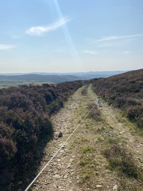
Estate tracks from the road near Tornaveen provide the standard line up the broad east flank. Expect 6-7km return with about 250m of ascent — a comfortable half-day at 2.5-3 hours. A modest cairn picks out the high point on the broad heathery dome.
Terrain
Good Land Rover tracks for most of the climb. Shorter heather and grass on the final pull to the cairn. Generally well-drained for an Aberdeenshire moorland hill.
In winter
A reasonable winter walk when the higher Cairngorms are inhospitable. Frozen tracks aid progress, though new snowfall can drift across the exposed plateau.
This hill is in the Northern Cairngorms SAIS forecast area. Check SAIS forecasts in winter (December–April).
Best time of year
Getting there
- Glasgow5h 20m
- Edinburgh3h 26m
OS maps: OS Landranger 37, OS Explorer 059E, OS Explorer 405E
Mobile signal: Variable. EE intermittent up top; better toward Banchory.
Current conditions
Daylight Today
- Sunrise
- 05:04
- Sunset
- 21:30
- Civil dawn
- 04:12
- Civil dusk
- 22:22
NOAA Solar Calculator · 30 July 2026
Around Benaquhallie on the SCOT network
Getting there, basing yourself, and what to do off the hill.
Benaquhallie — common questions
- Is Benaquhallie a hard climb?
- Benaquhallie is rated 1/5 (easy) on the OutdoorSCOT scale. Ground conditions: Good Land Rover tracks for most of the climb.
- How much drop does Benaquhallie have?
- The drop is 211m: measured from the summit of Benaquhallie down to the saddle joining it to higher terrain. Passing the 150m-drop threshold on all sides is exactly what makes it a Marilyn.
- What's the best month to climb Benaquhallie?
- Aim for March, April, May, June, July, August, September, October on Benaquhallie. In the remaining months treat it as a winter hill — full kit, solid navigation, and a look at the relevant SAIS avalanche forecast before you go.
- Can dogs go up Benaquhallie?
- Dogs are fine on a lead. The route passes livestock or ground-nesting bird habitat, so keep them close throughout.
- Will I get phone signal on Benaquhallie?
- Variable. EE intermittent up top; better toward Banchory.
- Is Benaquhallie safe in winter?
- A reasonable winter walk when the higher Cairngorms are inhospitable. Frozen tracks aid progress, though new snowfall can drift across the exposed plateau.
Get the OutdoorSCOT weekly
One email a week — new route, hill and bothy guides, seasonal conditions and the odd hard-won lesson. No spam, unsubscribe in one click.