Marilyn · Cairngorms
Cairn William
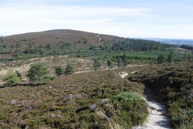
Cairn William rises to 448m within the Forestry & Land Scotland-managed Pitfichie Forest, the western outlier of the Bennachie group. Its mountain biking trails are well-known to riders, but walkers find a fine summit cairn with views across to Mither Tap.
Quick facts
- Height
- 448m/ 1470ft
- Prominence
- 258 m
- Grid ref
- NJ 65618 16809
- Nearest city
- Aberdeen· 31km
- Dogs
- Dogs on lead required near livestockDog-friendly guide ↗
Height and prominence cross-checked against the Database of British and Irish Hills (CC BY).
No GPX track yet
Walked this route? Share your track to help other walkers.
Standard route
heather moorland 70% · grass slopes 20% · rocky summit 10%
From the Pitfichie Forest car park near Monymusk, signposted forest trails and mountain biking routes lead up through plantation onto the summit ridge. About 7km return with 280m of climb in 2.5-3 hours. The summit is open and gently rocky.
Terrain
Forest tracks and well-graded MTB trails make for fast walking. The final section to the cairn crosses heather and short grass. Watch for cyclists on shared sections.
In winter
Tree cover shelters most of the route from wind, making this a reliable winter walk. The summit ridge can be icy in cold spells but never seriously committing.
This hill is in the Northern Cairngorms SAIS forecast area. Check SAIS forecasts in winter (December–April).
Best time of year
Getting there
- Glasgow6h 37m
- Edinburgh4h 42m
OS maps: OS Landranger 38, OS Explorer 059E, OS Explorer 062E, OS Explorer 405E, OS Explorer 420E
Mobile signal: Good. EE signal reliable on this Aberdeenshire hill. Vodafone also works.
Current conditions
Daylight Today
- Sunrise
- 05:03
- Sunset
- 21:30
- Civil dawn
- 04:11
- Civil dusk
- 22:23
NOAA Solar Calculator · 30 July 2026
Around Cairn William on the SCOT network
Getting there, basing yourself, and what to do off the hill.
Cairn William — common questions
- Is Cairn William a hard climb?
- Cairn William is rated 1/5 (easy) on the OutdoorSCOT scale. Ground conditions: Forest tracks and well-graded MTB trails make for fast walking.
- How much drop does Cairn William have?
- The drop is 258m: measured from the summit of Cairn William down to the saddle joining it to higher terrain. Passing the 150m-drop threshold on all sides is exactly what makes it a Marilyn.
- What's the best month to climb Cairn William?
- Aim for March, April, May, June, July, August, September, October on Cairn William. In the remaining months treat it as a winter hill — full kit, solid navigation, and a look at the relevant SAIS avalanche forecast before you go.
- Can dogs go up Cairn William?
- Dogs are fine on a lead. The route passes livestock or ground-nesting bird habitat, so keep them close throughout.
- Will I get phone signal on Cairn William?
- Good. EE signal reliable on this Aberdeenshire hill. Vodafone also works.
- Is Cairn William safe in winter?
- Tree cover shelters most of the route from wind, making this a reliable winter walk. The summit ridge can be icy in cold spells but never seriously committing.
Get the OutdoorSCOT weekly
One email a week — new route, hill and bothy guides, seasonal conditions and the odd hard-won lesson. No spam, unsubscribe in one click.