Marilyn · Cairngorms
Bennachie - Oxen Craig
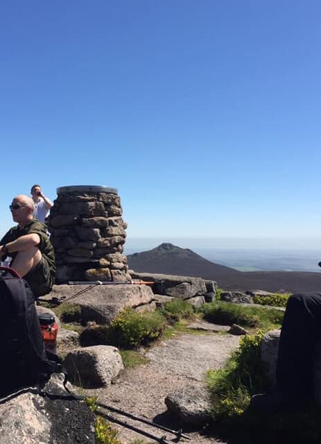
Oxen Craig is the highest point of Bennachie, the granite ridge whose distinctive silhouette dominates the central Aberdeenshire landscape. While Mither Tap to the east is the famous tor-crowned summit, this 529m top is the true high point of one of Scotland's most-loved local hills.
Quick facts
- Height
- 529m/ 1736ft
- Prominence
- 314 m
- Grid ref
- NJ 66281 22591
- Nearest city
- Aberdeen· 32km
- Dogs
- Dogs on lead required near livestockDog-friendly guide ↗
Height and prominence cross-checked against the Database of British and Irish Hills (CC BY).
No GPX track yet
Walked this route? Share your track to help other walkers.
Standard route
heather moorland 50% · granite tors 30% · woodland paths 20%
Excellent waymarked paths radiate from the Bennachie Centre and several other Forestry car parks. Most walkers take the Heather Brig path up through pine plantation onto the ridge, then continue west over open moor to the cairn at Oxen Craig. A 3-4 hour outing combining well with Mither Tap.
Terrain
Outstanding paths throughout — granite gravel on the open ridge, well-drained forest tracks below. Some loose stone underfoot near the summit. Erosion-prone in places due to popularity.
In winter
Snow and ice can linger on the exposed ridge. The paths are usable in most conditions but careful footing is needed if frozen. A genuine winter destination in heavy snow.
This hill is in the Northern Cairngorms SAIS forecast area. Check SAIS forecasts in winter (December–April).
Best time of year
Getting there
- Glasgow6h 44m
- Edinburgh4h 50m
OS maps: OS Landranger 38, OS Explorer 062E, OS Explorer 420E, OS Explorer 421W
Mobile signal: Excellent signal on summit; strong EE, Vodafone and O2. Telecom mast on the hill.
Current conditions
Daylight Today
- Sunrise
- 05:03
- Sunset
- 21:30
- Civil dawn
- 04:10
- Civil dusk
- 22:23
NOAA Solar Calculator · 30 July 2026
Around Bennachie - Oxen Craig on the SCOT network
Getting there, basing yourself, and what to do off the hill.
Bennachie - Oxen Craig — common questions
- How hard is Bennachie - Oxen Craig?
- We grade Bennachie - Oxen Craig at 2/5, which puts it in moderate territory. Underfoot: Outstanding paths throughout — granite gravel on the open ridge, well-drained forest tracks below.
- What is Bennachie - Oxen Craig's prominence?
- 314m of prominence. That's the vertical drop from the summit to the col that links Bennachie - Oxen Craig to the next higher ground. That drop is what qualifies it as a Marilyn — a hill with at least 150m of descent on every side.
- When is the best time to climb Bennachie - Oxen Craig?
- March, April, May, June, July, August, September, October give the most reliable conditions on Bennachie - Oxen Craig. Beyond that window the high ground turns wintry: carry full mountain kit, be confident navigating, and check the SAIS avalanche forecast for the area.
- Is Bennachie - Oxen Craig dog-friendly?
- Yes, but dogs must be kept on a lead — there is livestock or ground-nesting bird interest on the route.
- Is there mobile signal on Bennachie - Oxen Craig?
- Excellent signal on summit; strong EE, Vodafone and O2. Telecom mast on the hill.
- Is Bennachie - Oxen Craig safe in winter?
- Snow and ice can linger on the exposed ridge. The paths are usable in most conditions but careful footing is needed if frozen. A genuine winter destination in heavy snow.
Get the OutdoorSCOT weekly
One email a week — new route, hill and bothy guides, seasonal conditions and the odd hard-won lesson. No spam, unsubscribe in one click.