Marilyn · Cairngorms
Hill of Foudland
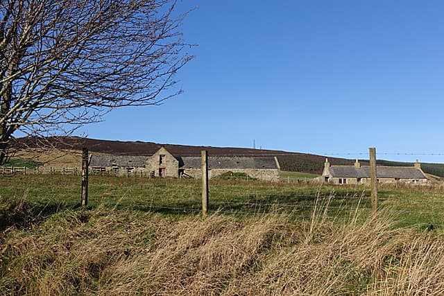
Hill of Foudland is a prominent 467m summit between Huntly and Inverurie, instantly recognisable from the A96 by its skyline of telecommunications masts. The hill has a long industrial heritage — slate was quarried on its flanks for centuries.
Quick facts
- Height
- 467m/ 1532ft
- Prominence
- 286 m
- Grid ref
- NJ 60317 33224
- Nearest city
- Aberdeen· 43km
- Dogs
- Dogs on lead required near livestockDog-friendly guide ↗
Height and prominence cross-checked against the Database of British and Irish Hills (CC BY).
No GPX track yet
Walked this route? Share your track to help other walkers.
Standard route
heather moorland 65% · grass slopes 25% · rocky summit 10%
The service road for the masts climbs directly from a layby on the A96 near Lewes Farm — a steady ramp of about 4km return that takes most parties 1.5-2 hours. The summit lies just south of the masts, with old quarry workings to explore on the descent.
Terrain
Tarmac service road for most of the ascent — easy walking. Heather and grass around the summit cairn. Slate spoil heaps add interest on the lower hill.
In winter
Easy access in most winter conditions thanks to the service road, which is generally kept open for engineers. Exposure at the masts is fierce in any wind.
Best time of year
Getting there
- Glasgow6h 42m
- Edinburgh4h 58m
OS maps: OS Landranger 29, OS Explorer 425S
Mobile signal: Decent up top; EE and Vodafone hold. Prominent north Aberdeenshire viewpoint.
Current conditions
Daylight Today
- Sunrise
- 06:38
- Sunset
- 19:34
- Civil dawn
- 05:59
- Civil dusk
- 20:14
NOAA Solar Calculator · 14 September 2026
Around Hill of Foudland on the SCOT network
Getting there, basing yourself, and what to do off the hill.
Getting there: Stonehaven station
Dunnottar Castle; Aberdeenshire coast; Mearns walking country
54km from the hill
tripscot.co.uk
On TripSCOTBase yourself in Dufftown
Speyside whisky town in the eastern Cairngorms
29km from the hill
tripscot.co.uk
On TasteSCOTAfter the hill: Strathisla
Keith — postcard-pretty Speysider and the heart of Chivas Regal
25km from the hill
tastescot.co.uk
Hill of Foudland — common questions
- How hard is Hill of Foudland?
- We grade Hill of Foudland at 1/5, which puts it in easy territory. Underfoot: Tarmac service road for most of the ascent — easy walking.
- What is Hill of Foudland's prominence?
- 286m of prominence. That's the vertical drop from the summit to the col that links Hill of Foudland to the next higher ground. That drop is what qualifies it as a Marilyn — a hill with at least 150m of descent on every side.
- When is the best time to climb Hill of Foudland?
- March, April, May, June, July, August, September, October give the most reliable conditions on Hill of Foudland. Beyond that window the high ground turns wintry: carry full mountain kit, be confident navigating, and check the SAIS avalanche forecast for the area.
- Is Hill of Foudland dog-friendly?
- Yes, but dogs must be kept on a lead — there is livestock or ground-nesting bird interest on the route.
- Is there mobile signal on Hill of Foudland?
- Decent up top; EE and Vodafone hold. Prominent north Aberdeenshire viewpoint.
- Is Hill of Foudland safe in winter?
- Easy access in most winter conditions thanks to the service road, which is generally kept open for engineers. Exposure at the masts is fierce in any wind.
Get the OutdoorSCOT weekly
One email a week — new route, hill and bothy guides, seasonal conditions and the odd hard-won lesson. No spam, unsubscribe in one click.