Marilyn · Cairngorms
Hill of Tillymorgan
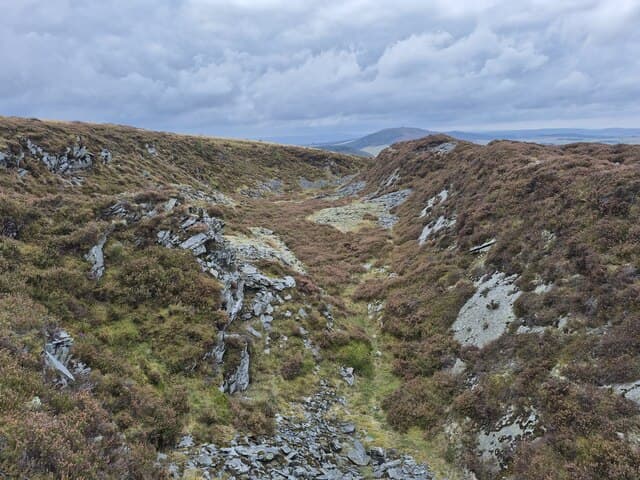
Hill of Tillymorgan sits at 380m on the rolling moorland north of Insch, a low but distinctive heather summit visible across much of central Aberdeenshire. Old slate quarries on its flanks once supplied roofing across the northeast.
Quick facts
- Height
- 380.8m/ 1249ft
- Prominence
- 153 m
- Grid ref
- NJ 65236 34804
- Nearest city
- Aberdeen· 41km
- Dogs
- Dogs on lead required near livestockDog-friendly guide ↗
Height and prominence cross-checked against the Database of British and Irish Hills (CC BY).
No GPX track yet
Walked this route? Share your track to help other walkers.
Standard route
heather moorland 70% · grass slopes 20% · summit area 10%
A track from the minor road near Largue climbs gently through heather to the trig point at the summit. Around 4-5km return and rarely more than 90 minutes — an easy half-day walk with disproportionately wide views.
Terrain
Estate track for most of the climb, short heather and grass close to the summit. The hill is well-drained underfoot.
In winter
Snow is generally light and short-lived. The exposed summit catches wind sweeping in from the Moray Firth — wrap up well even on bright days.
Best time of year
Getting there
- Glasgow6h 53m
- Edinburgh4h 4m
OS maps: OS Landranger 29, OS Explorer 425S
Mobile signal: Signal is good; EE behaves well. Fine north Aberdeenshire views.
Current conditions
Daylight Today
- Sunrise
- 06:38
- Sunset
- 19:34
- Civil dawn
- 05:59
- Civil dusk
- 20:13
NOAA Solar Calculator · 14 September 2026
Around Hill of Tillymorgan on the SCOT network
Getting there, basing yourself, and what to do off the hill.
Getting there: Stonehaven station
Dunnottar Castle; Aberdeenshire coast; Mearns walking country
54km from the hill
tripscot.co.uk
On TripSCOTBase yourself in Dufftown
Speyside whisky town in the eastern Cairngorms
33km from the hill
tripscot.co.uk
On TasteSCOTAfter the hill: Strathisla
Keith — postcard-pretty Speysider and the heart of Chivas Regal
27km from the hill
tastescot.co.uk
Hill of Tillymorgan — common questions
- What difficulty is Hill of Tillymorgan?
- On the OutdoorSCOT scale, Hill of Tillymorgan comes in at 1/5 — easy. Underfoot: Estate track for most of the climb, short heather and grass close to the summit.
- What is Hill of Tillymorgan's prominence?
- 153m of prominence. That's the vertical drop from the summit to the col that links Hill of Tillymorgan to the next higher ground. That drop is what qualifies it as a Marilyn — a hill with at least 150m of descent on every side.
- When is the best time to climb Hill of Tillymorgan?
- March, April, May, June, July, August, September, October give the most reliable conditions on Hill of Tillymorgan. Beyond that window the high ground turns wintry: carry full mountain kit, be confident navigating, and check the SAIS avalanche forecast for the area.
- Is Hill of Tillymorgan dog-friendly?
- Yes, but dogs must be kept on a lead — there is livestock or ground-nesting bird interest on the route.
- Is there mobile signal on Hill of Tillymorgan?
- Signal is good; EE behaves well. Fine north Aberdeenshire views.
- Is Hill of Tillymorgan safe in winter?
- Snow is generally light and short-lived. The exposed summit catches wind sweeping in from the Moray Firth — wrap up well even on bright days.
Get the OutdoorSCOT weekly
One email a week — new route, hill and bothy guides, seasonal conditions and the odd hard-won lesson. No spam, unsubscribe in one click.