Marilyn · Cairngorms
Craiglich
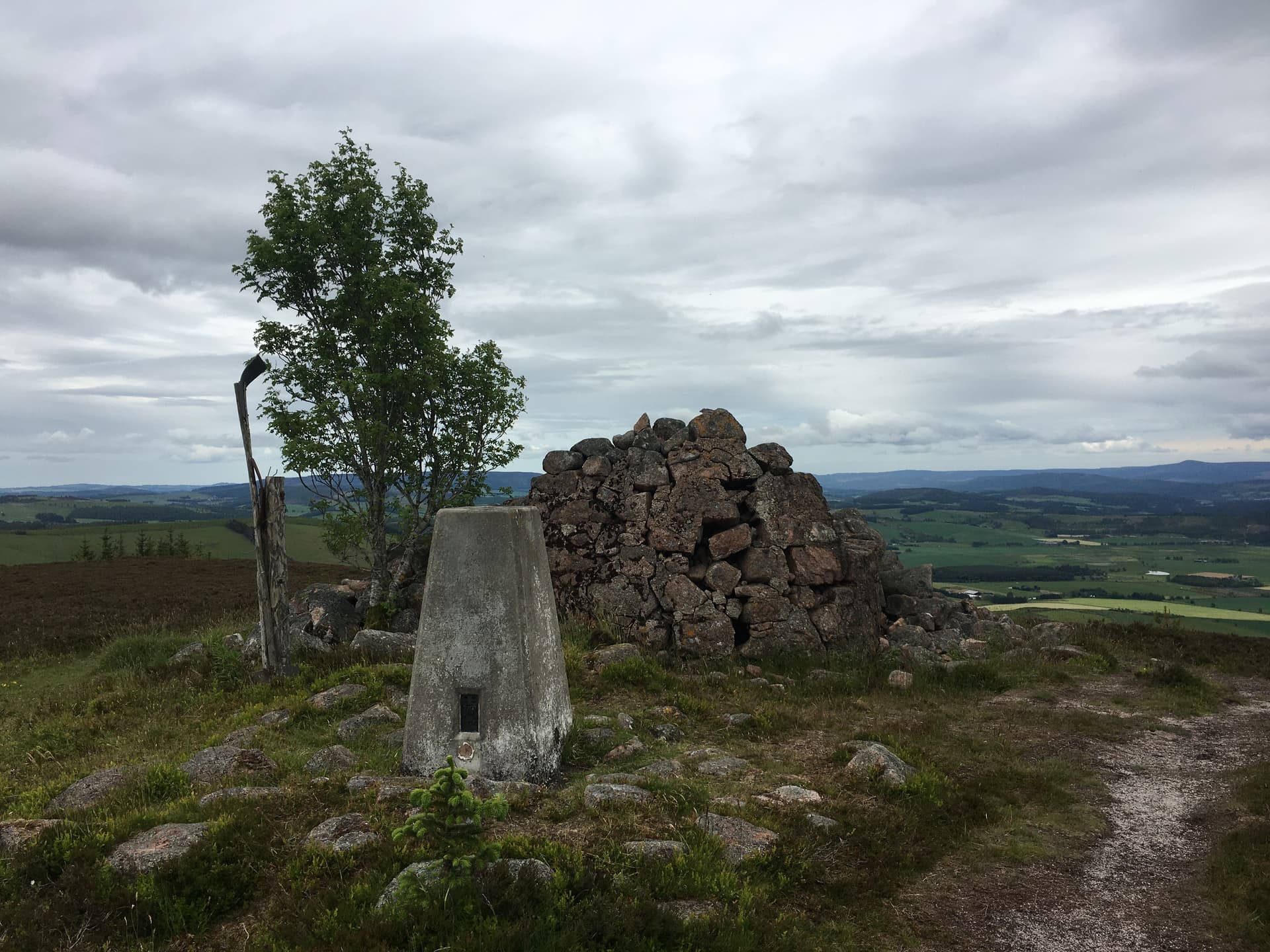
Craiglich is a 476m heather hill just north of Aboyne, easily-reached but surprisingly little-walked. Forest plantation cloaks the lower slopes while the upper hill is open moor with a broad outlook across Deeside to the eastern Cairngorms.
Quick facts
- Height
- 476m/ 1562ft
- Prominence
- 167 m
- Grid ref
- NJ 53307 05421
- Nearest city
- Aberdeen· 41km
- Dogs
- Dogs on lead required near livestockDog-friendly guide ↗
Height and prominence cross-checked against the Database of British and Irish Hills (CC BY).
No GPX track yet
Walked this route? Share your track to help other walkers.
Standard route
heather moorland 70% · grass slopes 20% · rocky summit 10%
A forestry track from the B9094 near Tarland offers the easiest approach, winding up through plantation onto the open south flank. Around 6km return with 200m of ascent — under three hours at a relaxed pace.
Terrain
Good forest tracks on the lower hill. Heather and short grass above with the occasional rocky outcrop near the summit. Few wet sections.
In winter
Sheltered approach through plantation makes this a useful low-level winter option. Snow on the upper slopes is rarely deep but the trig point sits on an exposed crown.
This hill is in the Northern Cairngorms SAIS forecast area. Check SAIS forecasts in winter (December–April).
Best time of year
Getting there
- Glasgow5h 3m
- Edinburgh3h 15m
OS maps: OS Landranger 37, OS Explorer 059E, OS Explorer 405E
Mobile signal: Good. Aberdeenshire; EE reliable on summit. Good connectivity throughout.
Current conditions
Daylight Today
- Sunrise
- 05:05
- Sunset
- 21:30
- Civil dawn
- 04:12
- Civil dusk
- 22:23
NOAA Solar Calculator · 30 July 2026
Around Craiglich on the SCOT network
Getting there, basing yourself, and what to do off the hill.
Getting there: Stonehaven station
Dunnottar Castle; Aberdeenshire coast; Mearns walking country
39km from the hill
tripscot.co.uk
On TripSCOTBase yourself in Ballater
Eastern Cairngorms / Royal Deeside
19km from the hill
tripscot.co.uk
On TasteSCOTAfter the hill: Royal Lochnagar
Balmoral — Queen Victoria's favourite; eastern Cairngorms setting
30km from the hill
tastescot.co.uk
Craiglich — common questions
- What difficulty is Craiglich?
- On the OutdoorSCOT scale, Craiglich comes in at 1/5 — easy. Ground conditions: Good forest tracks on the lower hill.
- How much drop does Craiglich have?
- The drop is 167m: measured from the summit of Craiglich down to the saddle joining it to higher terrain. Passing the 150m-drop threshold on all sides is exactly what makes it a Marilyn.
- What's the best month to climb Craiglich?
- Aim for March, April, May, June, July, August, September, October on Craiglich. In the remaining months treat it as a winter hill — full kit, solid navigation, and a look at the relevant SAIS avalanche forecast before you go.
- Can dogs go up Craiglich?
- Dogs are fine on a lead. The route passes livestock or ground-nesting bird habitat, so keep them close throughout.
- Will I get phone signal on Craiglich?
- Good. Aberdeenshire; EE reliable on summit. Good connectivity throughout.
- Is Craiglich safe in winter?
- Sheltered approach through plantation makes this a useful low-level winter option. Snow on the upper slopes is rarely deep but the trig point sits on an exposed crown.
Get the OutdoorSCOT weekly
One email a week — new route, hill and bothy guides, seasonal conditions and the odd hard-won lesson. No spam, unsubscribe in one click.