Marilyn · Glen Coe & Lochaber
Sgurr Bhuidhe
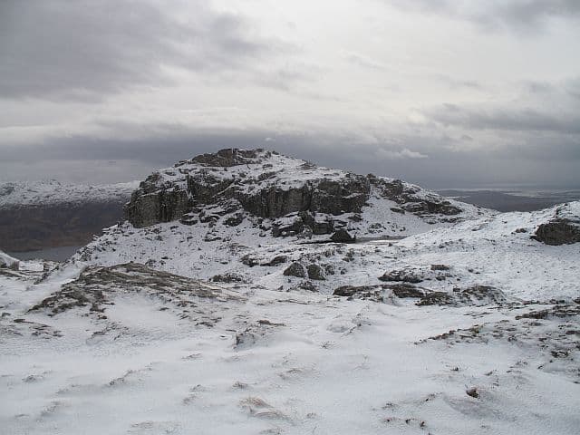
Sgurr Bhuidhe, the yellow peak, is a 440m gneiss knoll in the rough country between Arisaig and Loch Morar. The name refers to the lichens that coat the slabs gold on a sunny day; the summit looks out over the Small Isles.
Quick facts
- Height
- 440m/ 1444ft
- Prominence
- 178 m
- Grid ref
- NM 72274 94571
- Nearest city
- Fort William· 43km
- Dogs
- Dogs on lead required near livestockDog-friendly guide ↗
Height and prominence cross-checked against the Database of British and Irish Hills (CC BY).
No GPX track yet
Walked this route? Share your track to help other walkers.
Standard route
heather moorland 50% · rocky slopes 35% · grass slopes 15%
From the A830 near Loch nan Eala, walk in along the lochside path and climb open hillside to the south. The going alternates between heather hollows and clean gneiss slabs. Three hours and a fine seaward view.
Terrain
Lewisian gneiss country: lichen-yellow slabs, deep heather pockets and wet hollows. The slabs are clean but slow because of the constant route-finding around heather and water.
In winter
A small coastal Marilyn at 440m that almost never holds proper winter conditions. The slabs ice readily after rain-followed-by-frost; the saving grace is short days are usually enough to complete the round comfortably.
This hill is in the Glen Coe SAIS forecast area. Check SAIS forecasts in winter (December–April).
Best time of year
Getting there
- Glasgow5h 51m
- Edinburgh7h 9m
Ferry access
Mallaig → Inverie (Knoydart)
- Crossing time45 min
- Summer sailingsMon–Sat, 2–3 sailings daily (Apr–Oct, Western Isles Cruises)
- Winter sailingsMon/Wed/Fri only (Nov–Mar)
- Book ahead3 days
- Last ferry backLast ferry from Inverie ~17:30 (check Western Isles Cruises timetable)
Knoydart is a roadless peninsula — not an island, but accessible only by ferry or a very long walk (18+ km over difficult terrain). Day trips to Sgùrr Coire Choinnichean are achievable in summer. For Ladhar Bheinn, base yourself overnight at Inverie.
Book on ferry operator ↗OS maps: OS Landranger 33, OS Landranger 40, OS Explorer 398W
Mobile signal: Reasonable. Coastal masts at Arisaig give signal at the road end and intermittently on the summit.
Current conditions
Daylight Today
- Sunrise
- 05:17
- Sunset
- 21:41
- Civil dawn
- 04:26
- Civil dusk
- 22:33
NOAA Solar Calculator · 30 July 2026
Around Sgurr Bhuidhe on the SCOT network
Getting there, basing yourself, and what to do off the hill.
Sgurr Bhuidhe — common questions
- How hard is Sgurr Bhuidhe?
- We grade Sgurr Bhuidhe at 1/5, which puts it in easy territory. Terrain: Lewisian gneiss country: lichen-yellow slabs, deep heather pockets and wet hollows.
- How prominent is Sgurr Bhuidhe?
- Sgurr Bhuidhe has 178m of topographic prominence — the height of its summit above the highest col connecting it to higher ground. Marilyns are defined by that measure: at least 150m of drop on all sides.
- When should I climb Sgurr Bhuidhe?
- The standard good-weather months for Sgurr Bhuidhe are March, April, May, June, July, August, September, October. Outside those months, expect winter conditions on the high ground — full mountain kit, navigation skills, and a check of the SAIS avalanche forecast for the relevant region.
- Can I bring my dog up Sgurr Bhuidhe?
- On a lead only — the route crosses ground with livestock or nesting-bird interest.
- What's mobile reception like on Sgurr Bhuidhe?
- Reasonable. Coastal masts at Arisaig give signal at the road end and intermittently on the summit.
- How do I get the ferry to Sgurr Bhuidhe?
- Mallaig → Inverie (Knoydart). Mon–Sat, 2–3 sailings daily (Apr–Oct, Western Isles Cruises) in summer; Mon/Wed/Fri only (Nov–Mar) in winter. Book at least 3 days ahead. Knoydart is a roadless peninsula — not an island, but accessible only by ferry or a very long walk (18+ km over difficult terrain). Day trips to Sgùrr Coire Choinnichean are achievable in summer. For Ladhar Bheinn, base yourself overnight at Inverie.
- Is Sgurr Bhuidhe safe in winter?
- A small coastal Marilyn at 440m that almost never holds proper winter conditions. The slabs ice readily after rain-followed-by-frost; the saving grace is short days are usually enough to complete the round comfortably.
Get the OutdoorSCOT weekly
One email a week — new route, hill and bothy guides, seasonal conditions and the odd hard-won lesson. No spam, unsubscribe in one click.