Sub-Marilyn · North-West Highlands
Sgorr Tuath
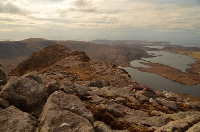
Sgorr Tuath is the northern sentinel of the Beinn an Eoin ridge in Coigach, rising in striking sandstone pinnacles above Loch Lurgainn. The NC 11 07 grid sits within the core of the Inverpolly nature reserve, with Stac Pollaidh just to the south and Suilven's arête away to the north.
Quick facts
- Height
- 587.5m/ 1927ft
- Prominence
- 149 m
- Grid ref
- NC 11037 07479
- Nearest city
- Inverness· 83km
- Dogs
- Dogs on lead required near livestockDog-friendly guide ↗
Sub-Marilyn: 149m of drop — misses the 150m Marilyn cut by 1m. We keep it on the list as a near-miss.
Height and prominence cross-checked against the Database of British and Irish Hills (CC BY).
No GPX track yet
Walked this route? Share your track to help other walkers.
Standard route
heather moorland 55% · rocky slopes 30% · grass slopes 15%
Park at the lay-by by Loch Lurgainn (NC 12 06) and pick up the boggy stalker's path that climbs north between Sgorr Tuath and Beinn an Eoin. Break off east onto the south-west ridge for a steep pull onto the sandstone summit blocks. About 8 km return with 540m of climb.
Terrain
Torridonian sandstone tiers form the upper hill, requiring a short hands-on scramble at one point. Lower down the going is wet heather and peat with the typical Coigach lochan obstacles.
In winter
In a hard winter the sandstone steps glaze with verglas and the scramble becomes a serious proposition needing crampons. Snow rarely accumulates on the pinnacles themselves but cornices form on the north flank.
This hill is in the Torridon SAIS forecast area. Check SAIS forecasts in winter (December–April).
Best time of year
Getting there
- Glasgow6h 6m
- Edinburgh7h 28m
OS maps: OS Landranger 15, OS Explorer 439E
Mobile signal: Poor. Remote north Sutherland; limited coverage.
Current conditions
Daylight Today
- Sunrise
- 05:09
- Sunset
- 21:45
- Civil dawn
- 04:14
- Civil dusk
- 22:40
NOAA Solar Calculator · 30 July 2026
Around Sgorr Tuath on the SCOT network
Getting there, basing yourself, and what to do off the hill.
Sgorr Tuath — common questions
- What difficulty is Sgorr Tuath?
- On the OutdoorSCOT scale, Sgorr Tuath comes in at 2/5 — moderate. Ground conditions: Torridonian sandstone tiers form the upper hill, requiring a short hands-on scramble at one point.
- How much drop does Sgorr Tuath have?
- The drop is 149m: measured from the summit of Sgorr Tuath down to the saddle joining it to higher terrain. That leaves it 1m short of the 150m drop a Marilyn needs — DoBIH classes it a sub-Marilyn, a near-miss rather than a full Marilyn.
- What's the best month to climb Sgorr Tuath?
- Aim for March, April, May, June, July, August, September, October on Sgorr Tuath. In the remaining months treat it as a winter hill — full kit, solid navigation, and a look at the relevant SAIS avalanche forecast before you go.
- Can dogs go up Sgorr Tuath?
- Dogs are fine on a lead. The route passes livestock or ground-nesting bird habitat, so keep them close throughout.
- Will I get phone signal on Sgorr Tuath?
- Poor. Remote north Sutherland; limited coverage.
- Is Sgorr Tuath safe in winter?
- In a hard winter the sandstone steps glaze with verglas and the scramble becomes a serious proposition needing crampons. Snow rarely accumulates on the pinnacles themselves but cornices form on the north flank.
Get the OutdoorSCOT weekly
One email a week — new route, hill and bothy guides, seasonal conditions and the odd hard-won lesson. No spam, unsubscribe in one click.