Marilyn · North-West Highlands
Cnoc a' Bhaid-rallaich
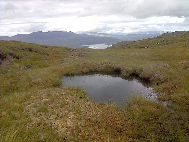
Cnoc a' Bhaid-rallaich — knoll of the turbulent clump — is a 281m bump at NC 968 652 in the Flow Country of east Caithness, between Loch More and the Forsinard reserves. The contour rings barely register on the map, yet the prominence is enough to qualify it as a Marilyn in some of the flattest hill country in mainland Britain.
Quick facts
- Height
- 543.3m/ 1782ft
- Prominence
- 165 m
- Grid ref
- NH 06604 93030
- Nearest city
- Inverness· 76km
- Dogs
- Dogs on lead required near livestockDog-friendly guide ↗
Height and prominence cross-checked against the Database of British and Irish Hills (CC BY).
No GPX track yet
Walked this route? Share your track to help other walkers.
Standard route
heather and bog 65% · grass slopes 25% · rocky summit 10%
Approached from the minor road by Loch More or the B871 near Kinbrace, the line is a pathless wade across heather and lochan ground for roughly 4-5km each way. There are no fixed paths and route choice is dictated by the wettest pools. Allow 4-5 hours and treat the return bearing as the priority.
Terrain
Classic Flow Country going — sphagnum lawns, deep peat hags and slot pools that swallow a boot. Drier ridgelets of heather give the only firm walking; the summit knoll itself is grassier and easier than the approach.
In winter
Below 300m so rarely holds lasting snow, but the bog freezes hard in cold snaps which actually makes the crossing faster. In thaw or rain this place becomes nearly impassable; wait for frost or a dry late-summer spell.
This hill is in the Torridon SAIS forecast area. Check SAIS forecasts in winter (December–April).
Best time of year
Getting there
- Glasgow6h 51m
- Edinburgh7h 20m
OS maps: OS Landranger 19, OS Explorer 435N
Mobile signal: Poor. No coverage; Duncansby / Caithness border area has poor inland signal.
Current conditions
Daylight Today
- Sunrise
- 05:10
- Sunset
- 21:45
- Civil dawn
- 04:16
- Civil dusk
- 22:39
NOAA Solar Calculator · 30 July 2026
Around Cnoc a' Bhaid-rallaich on the SCOT network
Getting there, basing yourself, and what to do off the hill.
Cnoc a' Bhaid-rallaich — common questions
- How hard is Cnoc a' Bhaid-rallaich?
- We grade Cnoc a' Bhaid-rallaich at 2/5, which puts it in moderate territory. Underfoot: Classic Flow Country going — sphagnum lawns, deep peat hags and slot pools that swallow a boot.
- What is Cnoc a' Bhaid-rallaich's prominence?
- 165m of prominence. That's the vertical drop from the summit to the col that links Cnoc a' Bhaid-rallaich to the next higher ground. That drop is what qualifies it as a Marilyn — a hill with at least 150m of descent on every side.
- When is the best time to climb Cnoc a' Bhaid-rallaich?
- March, April, May, June, July, August, September, October give the most reliable conditions on Cnoc a' Bhaid-rallaich. Beyond that window the high ground turns wintry: carry full mountain kit, be confident navigating, and check the SAIS avalanche forecast for the area.
- Is Cnoc a' Bhaid-rallaich dog-friendly?
- Yes, but dogs must be kept on a lead — there is livestock or ground-nesting bird interest on the route.
- Is there mobile signal on Cnoc a' Bhaid-rallaich?
- Poor. No coverage; Duncansby / Caithness border area has poor inland signal.
- Is Cnoc a' Bhaid-rallaich safe in winter?
- Below 300m so rarely holds lasting snow, but the bog freezes hard in cold snaps which actually makes the crossing faster. In thaw or rain this place becomes nearly impassable; wait for frost or a dry late-summer spell.
Get the OutdoorSCOT weekly
One email a week — new route, hill and bothy guides, seasonal conditions and the odd hard-won lesson. No spam, unsubscribe in one click.