Marilyn · North-West Highlands
Beinn Eilideach
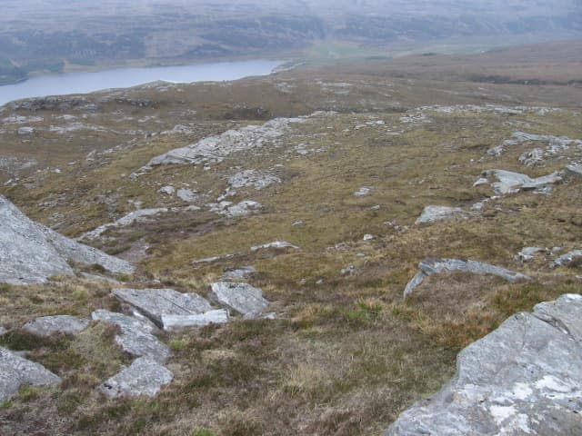
Beinn Eilideach — hill of the hind — is a 559m hill at NH 170 926 on the rising ground east of Ullapool, between Loch Achall and the Rhidorroch deer forest. The name reflects its long-standing role as hind ground; the hill is part of an active stalking estate.
Quick facts
- Height
- 559m/ 1834ft
- Prominence
- 187 m
- Grid ref
- NH 17066 92665
- Nearest city
- Inverness· 68km
- Dogs
- Dogs on lead required near livestockDog-friendly guide ↗
Height and prominence cross-checked against the Database of British and Irish Hills (CC BY).
No GPX track yet
Walked this route? Share your track to help other walkers.
Standard route
heather and bog 65% · grass slopes 25% · rocky summit 10%
Easiest from the Loch Achall track east of Ullapool, walking 4km in before climbing the south ridge. The track is open to walkers but closed to vehicles. Allow 4-5 hours including the road walk in.
Terrain
Lewisian gneiss outcrops with peat and heather between. The south ridge is a clear line of crag and grass leading to a small rocky summit. Lower slopes hold significant blanket bog after rain.
In winter
Within sight of Loch Broom and only 559m, the hill rarely accumulates serious snow but freezing fog and verglas on the gneiss can make the south ridge tricky. The view to An Teallach in winter light is the day's highlight.
This hill is in the Torridon SAIS forecast area. Check SAIS forecasts in winter (December–April).
Best time of year
Getting there
- Glasgow6h 40m
- Edinburgh7h 1m
OS maps: OS Landranger 20, OS Explorer 436N
Mobile signal: Poor. EE, Vodafone, Three and O2 all absent on this Sutherland summit.
Current conditions
Daylight Today
- Sunrise
- 05:10
- Sunset
- 21:44
- Civil dawn
- 04:15
- Civil dusk
- 22:38
NOAA Solar Calculator · 30 July 2026
Around Beinn Eilideach on the SCOT network
Getting there, basing yourself, and what to do off the hill.
Beinn Eilideach — common questions
- How hard is Beinn Eilideach?
- We grade Beinn Eilideach at 2/5, which puts it in moderate territory. Underfoot: Lewisian gneiss outcrops with peat and heather between.
- What is Beinn Eilideach's prominence?
- 187m of prominence. That's the vertical drop from the summit to the col that links Beinn Eilideach to the next higher ground. That drop is what qualifies it as a Marilyn — a hill with at least 150m of descent on every side.
- When is the best time to climb Beinn Eilideach?
- March, April, May, June, July, August, September, October give the most reliable conditions on Beinn Eilideach. Beyond that window the high ground turns wintry: carry full mountain kit, be confident navigating, and check the SAIS avalanche forecast for the area.
- Is Beinn Eilideach dog-friendly?
- Yes, but dogs must be kept on a lead — there is livestock or ground-nesting bird interest on the route.
- Is there mobile signal on Beinn Eilideach?
- Poor. EE, Vodafone, Three and O2 all absent on this Sutherland summit.
- Is Beinn Eilideach safe in winter?
- Within sight of Loch Broom and only 559m, the hill rarely accumulates serious snow but freezing fog and verglas on the gneiss can make the south ridge tricky. The view to An Teallach in winter light is the day's highlight.
Get the OutdoorSCOT weekly
One email a week — new route, hill and bothy guides, seasonal conditions and the odd hard-won lesson. No spam, unsubscribe in one click.