Sub-Marilyn · Perthshire
Meall Odhar a' Chire
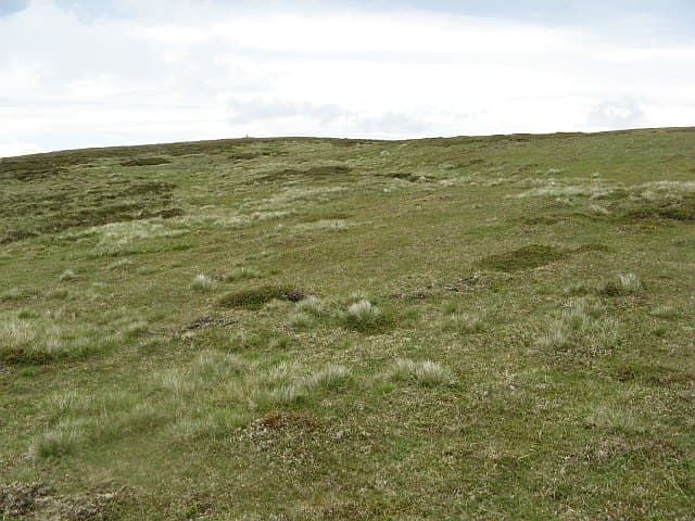
Meall Odhar a' Chire — the dun-coloured lump of the corrie — is an 835m Marilyn in NN-square Atholl, sitting on the west side of the Gaick pass between Loch an Duin and Loch Bhrodainn. The summit watches the Sronphadruig stalking road threading the deep cleft below.
Quick facts
- Height
- 835m/ 2740ft
- Prominence
- 144 m
- Grid ref
- NN 79673 78588
- Nearest city
- Inverness· 68km
- Dogs
- Dogs on lead required near livestockDog-friendly guide ↗
Sub-Marilyn: 144m of drop — misses the 150m Marilyn cut by 6m. We keep it on the list as a near-miss.
Height and prominence cross-checked against the Database of British and Irish Hills (CC BY).
No GPX track yet
Walked this route? Share your track to help other walkers.
Standard route
heather moorland 65% · grass slopes 25% · rocky summit 10%
Best reached from the Gaick estate road south of Tromie Bridge, with bicycle helpful for the long in-walk. From beside Loch an Duin a steep slope of heather and broken ground climbs west to the summit; alternative descent down the south ridge gives variation.
Terrain
Approach is on stalking road and then trackless tundra above the loch shore. The flanks above Loch an Duin are steep cropped grass with occasional band of broken schist; the summit dome is short bilberry and lichen.
In winter
The narrow Gaick pass funnels wind and loads the east-facing slopes with windslab. Drifts can mask the loch edge below; keep well back from the cornice line above the steep east face. The estate road is sometimes ice-glazed beneath an inch of fresh snow.
Best time of year
Getting there
- Glasgow3h 44m
- Edinburgh3h 9m
OS maps: OS Landranger 42, OS Explorer 051W, OS Explorer 394W
Mobile signal: Minimal. reception fades on approach; remote Breadalbane glen gives zero coverage.
Current conditions
Daylight Today
- Sunrise
- 05:11
- Sunset
- 21:34
- Civil dawn
- 04:19
- Civil dusk
- 22:25
NOAA Solar Calculator · 30 July 2026
Around Meall Odhar a' Chire on the SCOT network
Getting there, basing yourself, and what to do off the hill.
Getting there: Blair Atholl station
Beinn a Ghlo; Glen Tilt corridor north to the Cairngorms
15km from the hill
tripscot.co.uk
On TripSCOTBase yourself in Pitlochry
Perthshire base — Schiehallion, Beinn a Ghlo, Ben Vrackie
25km from the hill
tripscot.co.uk
On TasteSCOTAfter the hill: Dalwhinnie
Dalwhinnie — Scotland's highest distillery on the Drumochter pass
18km from the hill
tastescot.co.uk
Meall Odhar a' Chire — common questions
- What difficulty is Meall Odhar a' Chire?
- On the OutdoorSCOT scale, Meall Odhar a' Chire comes in at 3/5 — moderately challenging. Terrain: Approach is on stalking road and then trackless tundra above the loch shore.
- How prominent is Meall Odhar a' Chire?
- Meall Odhar a' Chire has 144m of topographic prominence — the height of its summit above the highest col connecting it to higher ground. That leaves it 6m short of the 150m drop a Marilyn needs — DoBIH classes it a sub-Marilyn, a near-miss rather than a full Marilyn.
- When should I climb Meall Odhar a' Chire?
- The standard good-weather months for Meall Odhar a' Chire are April, May, June, September. Outside those months, expect winter conditions on the high ground — full mountain kit, navigation skills, and a check of the SAIS avalanche forecast for the relevant region.
- Can I bring my dog up Meall Odhar a' Chire?
- On a lead only — the route crosses ground with livestock or nesting-bird interest.
- What's mobile reception like on Meall Odhar a' Chire?
- Minimal. reception fades on approach; remote Breadalbane glen gives zero coverage.
- Is Meall Odhar a' Chire safe in winter?
- The narrow Gaick pass funnels wind and loads the east-facing slopes with windslab. Drifts can mask the loch edge below; keep well back from the cornice line above the steep east face. The estate road is sometimes ice-glazed beneath an inch of fresh snow.
Get the OutdoorSCOT weekly
One email a week — new route, hill and bothy guides, seasonal conditions and the odd hard-won lesson. No spam, unsubscribe in one click.