Marilyn · Central Highlands
Creag na Doire Duibhe
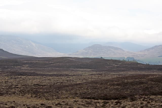
Creag na Doire Duibhe — the crag of the dark grove — is a 571m Marilyn in NN-square Badenoch, lying west of Dalwhinnie on the rolling ground east of Loch Pattack. The summit looks across to the gateway of the Bealach Dubh and the eastern Munros of the Ben Alder massif.
Gaelic: “crag, of the, black” · Pronunciation: krayg na doire doo-ya
Quick facts
- Height
- 571m/ 1873ft
- Prominence
- 166 m
- Grid ref
- NN 61508 90576
- Nearest city
- Inverness· 55km
- Dogs
- Dogs on lead required near livestockDog-friendly guide ↗
Height and prominence cross-checked against the Database of British and Irish Hills (CC BY).
No GPX track yet
Walked this route? Share your track to help other walkers.
Standard route
heather moorland 65% · rocky slopes 20% · bog and grass 15%
Use the locked estate road from Dalwhinnie along the north shore of Loch Ericht as far as Ben Alder Lodge (bicycle helps for the in-walk), then cross the river and climb west up the broad heather flank. The summit is a rocky knot above a small dark cluster of self-seeded pine.
Terrain
Long heather approach with peat hags below 400m, giving way to mossy grass and shattered schist on the crest. The doire of the name is a remnant of natural pine still hanging on below the south face.
In winter
Dry Badenoch snow lies well on the cold north-east facing slopes. The featureless approach moor becomes a hard piece of navigation under snow; landmarks fade and the watercourses fill with drift.
This hill is in the Creag Meagaidh SAIS forecast area. Check SAIS forecasts in winter (December–April).
Best time of year
Getting there
- Glasgow3h 54m
- Edinburgh4h 53m
OS maps: OS Landranger 35, OS Explorer 056, OS Explorer 402
Mobile signal: Poor. Remote central Highlands; limited coverage.
Current conditions
Daylight Today
- Sunrise
- 05:12
- Sunset
- 21:36
- Civil dawn
- 04:20
- Civil dusk
- 22:27
NOAA Solar Calculator · 30 July 2026
Around Creag na Doire Duibhe on the SCOT network
Getting there, basing yourself, and what to do off the hill.
Creag na Doire Duibhe — common questions
- How difficult is Creag na Doire Duibhe?
- Creag na Doire Duibhe carries a 2/5 (moderate) grade on the OutdoorSCOT scale. Terrain: Long heather approach with peat hags below 400m, giving way to mossy grass and shattered schist on the crest.
- How prominent is Creag na Doire Duibhe?
- Creag na Doire Duibhe has 166m of topographic prominence — the height of its summit above the highest col connecting it to higher ground. Marilyns are defined by that measure: at least 150m of drop on all sides.
- When should I climb Creag na Doire Duibhe?
- The standard good-weather months for Creag na Doire Duibhe are March, April, May, June, July, August, September, October. Outside those months, expect winter conditions on the high ground — full mountain kit, navigation skills, and a check of the SAIS avalanche forecast for the relevant region.
- Can I bring my dog up Creag na Doire Duibhe?
- On a lead only — the route crosses ground with livestock or nesting-bird interest.
- What's mobile reception like on Creag na Doire Duibhe?
- Poor. Remote central Highlands; limited coverage.
- Is Creag na Doire Duibhe safe in winter?
- Dry Badenoch snow lies well on the cold north-east facing slopes. The featureless approach moor becomes a hard piece of navigation under snow; landmarks fade and the watercourses fill with drift.
Get the OutdoorSCOT weekly
One email a week — new route, hill and bothy guides, seasonal conditions and the odd hard-won lesson. No spam, unsubscribe in one click.