Marilyn · Glen Coe & Lochaber
Meall nan Con
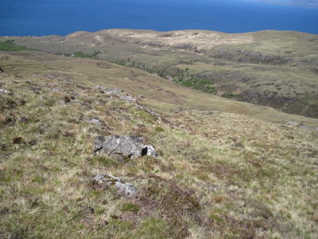
Meall nan Con sits at the heart of the Ardnamurchan ring complex, a 437m summit ringed by some of the strangest geology in Britain — a circular pattern of intrusive rocks left by a vanished Tertiary volcano. The hill itself is a modest grassy dome, but the views and the geology are remarkable, with the Small Isles strung out across the Sea of the Hebrides.
Gaelic: “rounded hill, of the, dog” · Pronunciation: myowl nan kon
Quick facts
- Height
- 437m/ 1434ft
- Prominence
- 290 m
- Grid ref
- NM 50392 68128
- Dogs
- Dogs on lead required near livestockDog-friendly guide ↗
Height and prominence cross-checked against the Database of British and Irish Hills (CC BY).
No GPX track yet
Walked this route? Share your track to help other walkers.
Standard route
heather and bog 60% · grass slopes 25% · rocky summit 15%
Start from the visitor centre at Glenmore on the B8007 and follow the burn northwest onto open hillside. There are faint stalkers' tracks lower down; higher up the going is grassy and pathless. Around two and a half hours up and down.
Terrain
Short turf and heather across the slopes, broken by occasional outcrops of dolerite. Drier ground than most Ardnamurchan hills thanks to the slightly more porous volcanic rocks.
In winter
Snow rarely settles deeply but the open summit gathers spindrift from any sustained wind. The exposed position above the Atlantic means wind chill is the dominant winter hazard rather than ice.
This hill is in the Glen Coe SAIS forecast area. Check SAIS forecasts in winter (December–April).
Best time of year
Getting there
- Glasgow5h 15m
- Edinburgh8h 45m
OS maps: OS Landranger 47, OS Explorer 390W
Mobile signal: Poor. Remote Ardnamurchan/Moidart; limited coverage.
Current conditions
Daylight Today
- Sunrise
- 05:20
- Sunset
- 21:41
- Civil dawn
- 04:29
- Civil dusk
- 22:33
NOAA Solar Calculator · 30 July 2026
Around Meall nan Con on the SCOT network
Getting there, basing yourself, and what to do off the hill.
Getting there: Morar station
Silver Sands, Knoydart approach, Loch Morar
29km from the hill
tripscot.co.uk
On TripSCOTBase yourself in Tobermory
Mull base — Ben More, Treshnish, ferry to Iona
13km from the hill
tripscot.co.uk
On TasteSCOTAfter the hill: Tobermory
Mull — colourful harbour-front distillery making both unpeated and peated (Ledaig) whisky
13km from the hill
tastescot.co.uk
Meall nan Con — common questions
- How difficult is Meall nan Con?
- Meall nan Con carries a 1/5 (easy) grade on the OutdoorSCOT scale. Underfoot: Short turf and heather across the slopes, broken by occasional outcrops of dolerite.
- What is Meall nan Con's prominence?
- 290m of prominence. That's the vertical drop from the summit to the col that links Meall nan Con to the next higher ground. That drop is what qualifies it as a Marilyn — a hill with at least 150m of descent on every side.
- When is the best time to climb Meall nan Con?
- March, April, May, June, July, August, September, October give the most reliable conditions on Meall nan Con. Beyond that window the high ground turns wintry: carry full mountain kit, be confident navigating, and check the SAIS avalanche forecast for the area.
- Is Meall nan Con dog-friendly?
- Yes, but dogs must be kept on a lead — there is livestock or ground-nesting bird interest on the route.
- Is there mobile signal on Meall nan Con?
- Poor. Remote Ardnamurchan/Moidart; limited coverage.
- Is Meall nan Con safe in winter?
- Snow rarely settles deeply but the open summit gathers spindrift from any sustained wind. The exposed position above the Atlantic means wind chill is the dominant winter hazard rather than ice.
Get the OutdoorSCOT weekly
One email a week — new route, hill and bothy guides, seasonal conditions and the odd hard-won lesson. No spam, unsubscribe in one click.