Marilyn · Glen Coe & Lochaber
Meall nan Each
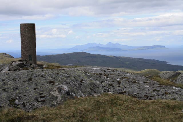
Meall nan Each — the Hill of the Horses — is a broad heathery whaleback at the head of Glen Hurich, north of Loch Sunart. The 490m summit gives a wide outlook over the wild interior of Ardgour and west to Mull. Few walkers come this way; it is one of the quieter corners of an already quiet peninsula.
Quick facts
- Height
- 490m/ 1608ft
- Prominence
- 214 m
- Grid ref
- NM 63215 64296
- Nearest city
- Oban· 41km
- Dogs
- Dogs on lead required near livestockDog-friendly guide ↗
Height and prominence cross-checked against the Database of British and Irish Hills (CC BY).
No GPX track yet
Walked this route? Share your track to help other walkers.
Standard route
heather and bog 60% · grass slopes 25% · rocky summit 15%
Approach from the forestry road in Glen Hurich, leaving the track at the burn that drains the eastern corrie and climbing open hillside to the broad east ridge. The summit cairn lies on flat heathery ground a short walk from where the ridge eases. Allow five hours return.
Terrain
Almost all heather and bog — long stretches of waist-deep heather make for slow going. Few rocks or paths, but no real difficulty beyond the wet conditions underfoot.
In winter
A reasonable winter outing when frosts firm up the bog. Snow cover is usually patchy and the rounded summit means no technical difficulty, but visibility can collapse quickly on the featureless plateau.
This hill is in the Glen Coe SAIS forecast area. Check SAIS forecasts in winter (December–April).
Best time of year
Getting there
- Glasgow5h 44m
- Edinburgh7h 12m
OS maps: OS Landranger 40, OS Explorer 390E
Mobile signal: Poor. Remote Ardnamurchan/Sunart; limited coverage.
Current conditions
Daylight Today
- Sunrise
- 05:19
- Sunset
- 21:40
- Civil dawn
- 04:28
- Civil dusk
- 22:32
NOAA Solar Calculator · 30 July 2026
Around Meall nan Each on the SCOT network
Getting there, basing yourself, and what to do off the hill.
Getting there: Morar station
Silver Sands, Knoydart approach, Loch Morar
28km from the hill
tripscot.co.uk
On TripSCOTBase yourself in Tobermory
Mull base — Ben More, Treshnish, ferry to Iona
15km from the hill
tripscot.co.uk
On TasteSCOTAfter the hill: Tobermory
Mull — colourful harbour-front distillery making both unpeated and peated (Ledaig) whisky
15km from the hill
tastescot.co.uk
Meall nan Each — common questions
- Is Meall nan Each a hard climb?
- Meall nan Each is rated 1/5 (easy) on the OutdoorSCOT scale. Terrain: Almost all heather and bog — long stretches of waist-deep heather make for slow going.
- How prominent is Meall nan Each?
- Meall nan Each has 214m of topographic prominence — the height of its summit above the highest col connecting it to higher ground. Marilyns are defined by that measure: at least 150m of drop on all sides.
- When should I climb Meall nan Each?
- The standard good-weather months for Meall nan Each are March, April, May, June, July, August, September, October. Outside those months, expect winter conditions on the high ground — full mountain kit, navigation skills, and a check of the SAIS avalanche forecast for the relevant region.
- Can I bring my dog up Meall nan Each?
- On a lead only — the route crosses ground with livestock or nesting-bird interest.
- What's mobile reception like on Meall nan Each?
- Poor. Remote Ardnamurchan/Sunart; limited coverage.
- Is Meall nan Each safe in winter?
- A reasonable winter outing when frosts firm up the bog. Snow cover is usually patchy and the rounded summit means no technical difficulty, but visibility can collapse quickly on the featureless plateau.
Get the OutdoorSCOT weekly
One email a week — new route, hill and bothy guides, seasonal conditions and the odd hard-won lesson. No spam, unsubscribe in one click.