Marilyn · Glen Coe & Lochaber
Beinn Bhreac
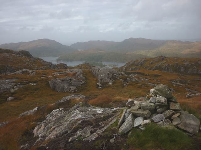
Beinn Bhreac — the Speckled Hill — is a small, characterful summit at the head of Loch Doilet in Sunart, rising to just 240m yet making a tidy half-day out. The name reflects the lichen-streaked outcrops that pattern the upper slopes. Views span the Sunart oakwoods and pick out Garbh Bheinn's craggy profile to the east.
Quick facts
- Height
- 240m/ 787ft
- Grid ref
- NM 68152 71515
- Nearest city
- Fort William· 42km
- Dogs
- Dogs on lead required near livestockDog-friendly guide ↗
No GPX track yet
Walked this route? Share your track to help other walkers.
Standard route
rough grassland 40% · basalt/gabbro 35% · heather moorland 25%
Start from the lane near Strontian or Polloch and follow forestry tracks to the foot of the hill, then climb steep grass and heather direct to the summit. The walking is short and intuitive but pathless above the trees. Two to three hours return.
Terrain
Mossy oakwood floor and forestry edge on the approach, then mixed heather and granite outcrops higher up. The mottled rock that gives the hill its name is grippy when dry, less so in rain.
In winter
A useful short-day option when the bigger Ardgour hills are buried. Snow accumulates only briefly here, but the steep grass sections become slick and need care if frozen.
This hill is in the Glen Coe SAIS forecast area. Check SAIS forecasts in winter (December–April).
Best time of year
Getting there
- Glasgow5h 39m
- Edinburgh7h 4m
OS maps: OS Landranger 40, OS Explorer 390E
Mobile signal: Poor. Ardnamurchan/Morvern; limited coverage.
Current conditions
Daylight Today
- Sunrise
- 04:33
- Sunset
- 22:20
- Civil dawn
- 03:26
- Civil dusk
- 23:26
NOAA Solar Calculator · 27 June 2026
Around Beinn Bhreac on the SCOT network
Getting there, basing yourself, and what to do off the hill.
Getting there: Morar station
Silver Sands, Knoydart approach, Loch Morar
21km from the hill
tripscot.co.uk
On TripSCOTBase yourself in Tobermory
Mull base — Ben More, Treshnish, ferry to Iona
24km from the hill
tripscot.co.uk
On TasteSCOTAfter the hill: Tobermory
Mull — colourful harbour-front distillery making both unpeated and peated (Ledaig) whisky
24km from the hill
tastescot.co.uk
Beinn Bhreac — common questions
- How hard is Beinn Bhreac?
- Beinn Bhreac is rated 1/5 (easy) on the OutdoorSCOT scale. Terrain: Mossy oakwood floor and forestry edge on the approach, then mixed heather and granite outcrops higher up.
- When is the best time to climb Beinn Bhreac?
- The standard good-weather months for Beinn Bhreac are March, April, May, June, July, August, September, October. Outside those months, expect winter conditions on the high ground — full mountain kit, navigation skills, and a check of the SAIS avalanche forecast for the relevant region.
- Can I bring my dog up Beinn Bhreac?
- Yes, but dogs must be kept on a lead — there is livestock or ground-nesting bird interest on the route.
- Is there mobile signal on Beinn Bhreac?
- Poor. Ardnamurchan/Morvern; limited coverage.
- Is Beinn Bhreac safe in winter?
- A useful short-day option when the bigger Ardgour hills are buried. Snow accumulates only briefly here, but the steep grass sections become slick and need care if frozen.
Get the OutdoorSCOT weekly
One email a week — new route, hill and bothy guides, seasonal conditions and the odd hard-won lesson. No spam, unsubscribe in one click.