Marilyn · Glen Coe & Lochaber
Beinn a' Bhaillidh
Beinn a' Bhaillidh — the Bailiff's Hill — is a low, wooded hill rising above the south shore of Loch Shiel in Moidart. Only 266m, but it claims its Marilyn status thanks to the steep drops on every side, and its summit clearing gives a beautiful view down the long line of the loch towards Glenfinnan.
Quick facts
- Height
- 266m/ 873ft
- Prominence
- 265 m
- Grid ref
- NM 64909 74153
- Nearest city
- Fort William· 46km
- Dogs
- Dogs on lead required near livestockDog-friendly guide ↗
Height and prominence cross-checked against the Database of British and Irish Hills (CC BY).
No GPX track yet
Walked this route? Share your track to help other walkers.
Standard route
heather and bog 65% · grass slopes 25% · rocky summit 10%
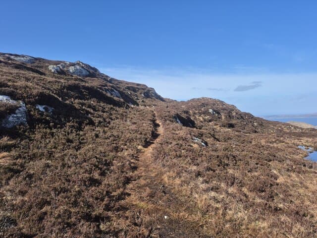
Park near Dalilea on the B8007 and follow the forest track east, breaking off uphill on faint paths through old birchwood. The summit is a small open knoll above the trees. A short outing of around two hours.
Terrain
Mossy ancient birch and oak woodland on the lower slopes giving way to bracken and short heather around the summit. Roots and fallen branches make winter navigation surprisingly fiddly.
In winter
Sheltered by trees on most aspects, this is a useful low-level option in poor mountain weather. Heavy autumn leaf-fall under fresh snow can hide pitfalls, so descend with care.
This hill is in the Glen Coe SAIS forecast area. Check SAIS forecasts in winter (December–April).
Best time of year
Getting there
- Glasgow5h 48m
- Edinburgh7h 14m
OS maps: OS Landranger 40, OS Explorer 390E
Mobile signal: Poor. Remote Moidart; limited coverage.
Current conditions
Daylight Today
- Sunrise
- 05:19
- Sunset
- 21:41
- Civil dawn
- 04:28
- Civil dusk
- 22:32
NOAA Solar Calculator · 30 July 2026
Around Beinn a' Bhaillidh on the SCOT network
Getting there, basing yourself, and what to do off the hill.
Getting there: Morar station
Silver Sands, Knoydart approach, Loch Morar
18km from the hill
tripscot.co.uk
On TripSCOTBase yourself in Mallaig
Ferry port for Skye and the Small Isles; CWT finish supply
23km from the hill
tripscot.co.uk
On TasteSCOTAfter the hill: Tobermory
Mull — colourful harbour-front distillery making both unpeated and peated (Ledaig) whisky
24km from the hill
tastescot.co.uk
Beinn a' Bhaillidh — common questions
- How difficult is Beinn a' Bhaillidh?
- Beinn a' Bhaillidh carries a 1/5 (easy) grade on the OutdoorSCOT scale. Ground conditions: Mossy ancient birch and oak woodland on the lower slopes giving way to bracken and short heather around the summit.
- How much drop does Beinn a' Bhaillidh have?
- Beinn a' Bhaillidh's prominence is its full height — 265m — because it is the highest point of its landmass, with no higher ground connected to it. Passing the 150m-drop threshold on all sides is exactly what makes it a Marilyn.
- What's the best month to climb Beinn a' Bhaillidh?
- Aim for March, April, May, June, July, August, September, October on Beinn a' Bhaillidh. In the remaining months treat it as a winter hill — full kit, solid navigation, and a look at the relevant SAIS avalanche forecast before you go.
- Can dogs go up Beinn a' Bhaillidh?
- Dogs are fine on a lead. The route passes livestock or ground-nesting bird habitat, so keep them close throughout.
- Will I get phone signal on Beinn a' Bhaillidh?
- Poor. Remote Moidart; limited coverage.
- Is Beinn a' Bhaillidh safe in winter?
- Sheltered by trees on most aspects, this is a useful low-level option in poor mountain weather. Heavy autumn leaf-fall under fresh snow can hide pitfalls, so descend with care.
Get the OutdoorSCOT weekly
One email a week — new route, hill and bothy guides, seasonal conditions and the odd hard-won lesson. No spam, unsubscribe in one click.