Sub-Marilyn · Glen Coe & Lochaber
Sgurr Dhomhuill Mor
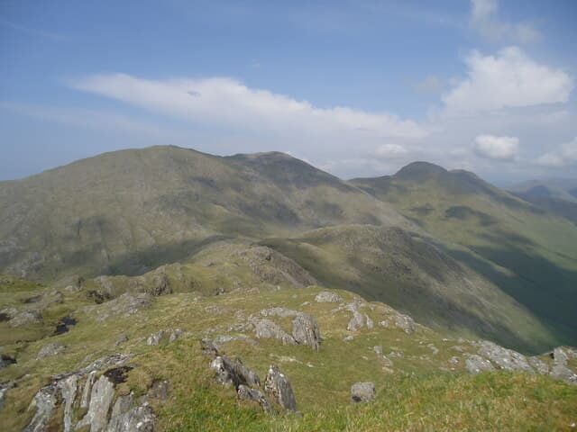
Sgurr Dhomhuill Mor — Donald's Big Peak — is the highest summit of the Ardgour group north of Loch Shiel, rising to 713m in a tangle of rough, little-visited ridges. Its prominence and isolation make it one of the wildest Marilyns in the region. From the top the eye runs across Moidart's lochs and forests to the Rough Bounds of Knoydart, with Beinn Resipol prominent to the south.
Gaelic: “sharp peak, big” · Pronunciation: skoor dhomhuill more
Quick facts
- Height
- 713.7m/ 2342ft
- Prominence
- 145 m
- Grid ref
- NM 74042 75913
- Nearest city
- Fort William· 36km
- Dogs
- Dogs on lead required near livestockDog-friendly guide ↗
Sub-Marilyn: 145m of drop — misses the 150m Marilyn cut by 5m. We keep it on the list as a near-miss.
Height and prominence cross-checked against the Database of British and Irish Hills (CC BY).
No GPX track yet
Walked this route? Share your track to help other walkers.
Standard route
heather and bog 55% · igneous rock 30% · grass slopes 15%
Best approached from the south end of Loch Doilet or from Polloch on Loch Shiel, climbing rough open hillside north then west to gain the south ridge. The final summit slope is steep grass and broken crag. Allow seven to eight hours for the full round.
Terrain
Lower slopes are deep heather, peat and felled forestry on the Polloch side; higher up the ground firms into knobbly schist and short turf. Plenty of small crags to weave around on the summit ridge.
In winter
In good cold conditions the upper slopes hold useful snow and the summit gives a fine winter day, but the long approach and lack of paths mean a full kit including axe and crampons. White-out navigation on the broad summit demands care.
This hill is in the Glen Coe SAIS forecast area. Check SAIS forecasts in winter (December–April).
Best time of year
Getting there
- Glasgow5h 30m
- Edinburgh7h 53m
OS maps: OS Landranger 40, OS Explorer 390E
Mobile signal: Poor. Remote Ardnamurchan; limited coverage.
Current conditions
Daylight Today
- Sunrise
- 05:18
- Sunset
- 21:40
- Civil dawn
- 04:27
- Civil dusk
- 22:32
NOAA Solar Calculator · 30 July 2026
Around Sgurr Dhomhuill Mor on the SCOT network
Getting there, basing yourself, and what to do off the hill.
Sgurr Dhomhuill Mor — common questions
- How hard is Sgurr Dhomhuill Mor?
- We grade Sgurr Dhomhuill Mor at 2/5, which puts it in moderate territory. Underfoot: Lower slopes are deep heather, peat and felled forestry on the Polloch side; higher up the ground firms into knobbly schist and short turf.
- What is Sgurr Dhomhuill Mor's prominence?
- 145m of prominence. That's the vertical drop from the summit to the col that links Sgurr Dhomhuill Mor to the next higher ground. That leaves it 5m short of the 150m drop a Marilyn needs — DoBIH classes it a sub-Marilyn, a near-miss rather than a full Marilyn.
- When is the best time to climb Sgurr Dhomhuill Mor?
- April, May, June, September give the most reliable conditions on Sgurr Dhomhuill Mor. Beyond that window the high ground turns wintry: carry full mountain kit, be confident navigating, and check the SAIS avalanche forecast for the area.
- Is Sgurr Dhomhuill Mor dog-friendly?
- Yes, but dogs must be kept on a lead — there is livestock or ground-nesting bird interest on the route.
- Is there mobile signal on Sgurr Dhomhuill Mor?
- Poor. Remote Ardnamurchan; limited coverage.
- Is Sgurr Dhomhuill Mor safe in winter?
- In good cold conditions the upper slopes hold useful snow and the summit gives a fine winter day, but the long approach and lack of paths mean a full kit including axe and crampons. White-out navigation on the broad summit demands care.
Get the OutdoorSCOT weekly
One email a week — new route, hill and bothy guides, seasonal conditions and the odd hard-won lesson. No spam, unsubscribe in one click.