Marilyn · Glen Coe & Lochaber
Creag Bhan
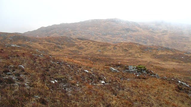
Creag Bhan, the pale crag, is a 510m gneiss knoll in central Moidart between Loch Moidart and Glenuig. The exposed Lewisian gneiss faces give the hill its name, weathering to a pale grey-white in dry weather.
Gaelic: “crag, fair” · Pronunciation: krayg vahn
Quick facts
- Height
- 510m/ 1673ft
- Prominence
- 224 m
- Grid ref
- NM 78243 84662
- Nearest city
- Fort William· 34km
- Dogs
- Dogs on lead required near livestockDog-friendly guide ↗
Height and prominence cross-checked against the Database of British and Irish Hills (CC BY).
No GPX track yet
Walked this route? Share your track to help other walkers.
Standard route
heather moorland 50% · quartzite rock 35% · grass slopes 15%
From the A861 west of Kinlochmoidart, climb up through woodland and onto the open rocky hillside. There is no path but the line is obvious — work up the broad south ridge over a sequence of slab steps to the cairn. Allow 3 to 4 hours.
Terrain
Classic Moidart underfoot — pale Lewisian gneiss slabs separated by heather hollows and small lochans. The slabs grip well dry; they are slick once damp. Bracken is dense up to about 200m in summer.
In winter
A low coastal Marilyn at 510m. Snow rarely settles for long but the slabs glaze readily and feel a grade harder under verglas. Spikes recommended; the lower bracken sections benefit from frost rather than suffer from snow.
This hill is in the Glen Coe SAIS forecast area. Check SAIS forecasts in winter (December–April).
Best time of year
Getting there
- Glasgow5h 30m
- Edinburgh7h 48m
OS maps: OS Landranger 40, OS Explorer 398W
Mobile signal: Patchy. The A861 has signal in places; the upper slabs are mostly dead ground.
Current conditions
Daylight Today
- Sunrise
- 05:18
- Sunset
- 21:41
- Civil dawn
- 04:26
- Civil dusk
- 22:32
NOAA Solar Calculator · 30 July 2026
Around Creag Bhan on the SCOT network
Getting there, basing yourself, and what to do off the hill.
Creag Bhan — common questions
- How difficult is Creag Bhan?
- Creag Bhan carries a 2/5 (moderate) grade on the OutdoorSCOT scale. Underfoot: Classic Moidart underfoot — pale Lewisian gneiss slabs separated by heather hollows and small lochans.
- What is Creag Bhan's prominence?
- 224m of prominence. That's the vertical drop from the summit to the col that links Creag Bhan to the next higher ground. That drop is what qualifies it as a Marilyn — a hill with at least 150m of descent on every side.
- When is the best time to climb Creag Bhan?
- March, April, May, June, July, August, September, October give the most reliable conditions on Creag Bhan. Beyond that window the high ground turns wintry: carry full mountain kit, be confident navigating, and check the SAIS avalanche forecast for the area.
- Is Creag Bhan dog-friendly?
- Yes, but dogs must be kept on a lead — there is livestock or ground-nesting bird interest on the route.
- Is there mobile signal on Creag Bhan?
- Patchy. The A861 has signal in places; the upper slabs are mostly dead ground.
- Is Creag Bhan safe in winter?
- A low coastal Marilyn at 510m. Snow rarely settles for long but the slabs glaze readily and feel a grade harder under verglas. Spikes recommended; the lower bracken sections benefit from frost rather than suffer from snow.
Get the OutdoorSCOT weekly
One email a week — new route, hill and bothy guides, seasonal conditions and the odd hard-won lesson. No spam, unsubscribe in one click.