Marilyn · Glen Coe & Lochaber
Cruachan Charna
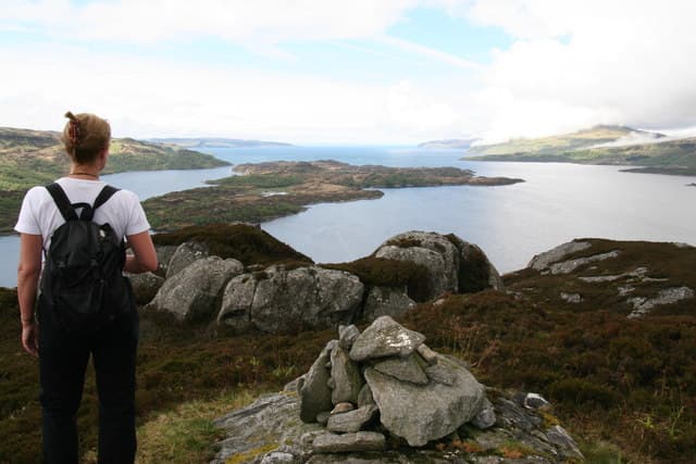
Cruachan Charna is the high point of Carna, a small uninhabited island lying in Loch Sunart. At just 170m it ranks among Scotland's most logistically interesting Marilyns — you need a boat to reach it.
Quick facts
- Height
- 170m/ 558ft
- Prominence
- 170 m
- Grid ref
- NM 61832 58973
- Nearest city
- Oban· 37km
- Dogs
- Dogs on lead required near livestockDog-friendly guide ↗
Height and prominence cross-checked against the Database of British and Irish Hills (CC BY).
No GPX track yet
Walked this route? Share your track to help other walkers.
Standard route
heather and bog 60% · rocky slopes 25% · coastal grass 15%
Reach Carna by private charter or kayak from Glenborrodale or the Morvern shore, landing on the south-east beach. From there it is a short heathery climb of about an hour return, but plan the tides and weather window before committing.
Terrain
Open island moor of heather, bracken and exposed rock with no path. Coastal grass on the landing ground. The ascent itself is short but the sea crossing dominates the day.
In winter
Winter rarely brings snow at this height but Atlantic storms can strand visitors on the island. Choose a settled forecast and confirm pickup before crossing.
This hill is in the Glen Coe SAIS forecast area. Check SAIS forecasts in winter (December–April).
Best time of year
Getting there
- Glasgow5h 43m
- Edinburgh7h 13m
OS maps: OS Landranger 49, OS Explorer 383W
Mobile signal: Poor. Remote Morvern/Ardnamurchan coast; limited coverage.
Current conditions
Daylight Today
- Sunrise
- 05:20
- Sunset
- 21:40
- Civil dawn
- 04:29
- Civil dusk
- 22:31
NOAA Solar Calculator · 30 July 2026
Around Cruachan Charna on the SCOT network
Getting there, basing yourself, and what to do off the hill.
Getting there: Morar station
Silver Sands, Knoydart approach, Loch Morar
33km from the hill
tripscot.co.uk
On TripSCOTBase yourself in Tobermory
Mull base — Ben More, Treshnish, ferry to Iona
12km from the hill
tripscot.co.uk
On TasteSCOTAfter the hill: Tobermory
Mull — colourful harbour-front distillery making both unpeated and peated (Ledaig) whisky
12km from the hill
tastescot.co.uk
Cruachan Charna — common questions
- How hard is Cruachan Charna?
- We grade Cruachan Charna at 1/5, which puts it in easy territory. Terrain: Open island moor of heather, bracken and exposed rock with no path.
- How prominent is Cruachan Charna?
- Cruachan Charna's prominence is its full height — 170m — because it is the highest point of its landmass, with no higher ground connected to it. Marilyns are defined by that measure: at least 150m of drop on all sides.
- When should I climb Cruachan Charna?
- The standard good-weather months for Cruachan Charna are March, April, May, June, July, August, September, October. Outside those months, expect winter conditions on the high ground — full mountain kit, navigation skills, and a check of the SAIS avalanche forecast for the relevant region.
- Can I bring my dog up Cruachan Charna?
- On a lead only — the route crosses ground with livestock or nesting-bird interest.
- What's mobile reception like on Cruachan Charna?
- Poor. Remote Morvern/Ardnamurchan coast; limited coverage.
- Is Cruachan Charna safe in winter?
- Winter rarely brings snow at this height but Atlantic storms can strand visitors on the island. Choose a settled forecast and confirm pickup before crossing.
Get the OutdoorSCOT weekly
One email a week — new route, hill and bothy guides, seasonal conditions and the odd hard-won lesson. No spam, unsubscribe in one click.