Marilyn · Cairngorms
Meall Mor
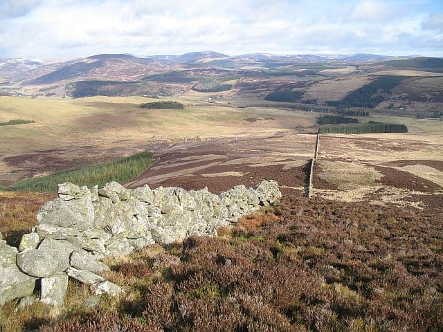
A rolling 551m moorland summit between Glen Shee and Glen Isla, with the unusual feature of a half-buried medieval shieling site on its southern flank. Despite its proximity to the busy A93, walkers rarely venture this side of the road.
Gaelic: “rounded hill, big” · Pronunciation: myowl more
Quick facts
- Height
- 551m/ 1808ft
- Grid ref
- NO 17332 60238
- Nearest city
- Perth· 37km
- Dogs
- Dogs on lead required near livestockDog-friendly guide ↗
No GPX track yet
Walked this route? Share your track to help other walkers.
Standard route
heather moorland 60% · grass slopes 30% · rocky summit 10%
Approach from the Cray junction on the A93, taking the track east before climbing pathless heather to the broad whaleback summit. About 8km return in 3 hours; route-finding is the main challenge.
Terrain
Long heather underfoot with regular peat hags requiring small detours. The summit dome is grassy and easier going. No fences or walls to guide you in mist.
In winter
Cornices can build on the eastern lip after south-westerly snowstorms — keep well back from the rim. The featureless plateau demands bearing-and-distance navigation in cloud.
This hill is in the Northern Cairngorms SAIS forecast area. Check SAIS forecasts in winter (December–April).
Best time of year
Getting there
- Glasgow3h 13m
- Edinburgh2h 3m
OS maps: OS Landranger 43, OS Explorer 052S, OS Explorer 381, OS Explorer 387S
Mobile signal: Poor. Remote Angus Glens/south Cairngorms area; limited coverage.
Current conditions
Daylight Today
- Sunrise
- 04:23
- Sunset
- 22:10
- Civil dawn
- 03:17
- Civil dusk
- 23:16
NOAA Solar Calculator · 27 June 2026
Around Meall Mor on the SCOT network
Getting there, basing yourself, and what to do off the hill.
Getting there: Dunkeld & Birnam station
Birnam Hill, Hermitage walks, southern Perthshire gateway
23km from the hill
tripscot.co.uk
On TripSCOTBase yourself in Dunkeld
Southern Cairngorms gateway — Hermitage, Loch of the Lowes
23km from the hill
tripscot.co.uk
On TasteSCOTAfter the hill: Edradour
Pitlochry — until recently Scotland's smallest distillery; charming Perthshire setting
21km from the hill
tastescot.co.uk
Meall Mor — common questions
- How hard is Meall Mor?
- Meall Mor is rated 2/5 (moderate) on the OutdoorSCOT scale. Terrain: Long heather underfoot with regular peat hags requiring small detours.
- When is the best time to climb Meall Mor?
- The standard good-weather months for Meall Mor are March, April, May, June, July, August, September, October. Outside those months, expect winter conditions on the high ground — full mountain kit, navigation skills, and a check of the SAIS avalanche forecast for the relevant region.
- Can I bring my dog up Meall Mor?
- Yes, but dogs must be kept on a lead — there is livestock or ground-nesting bird interest on the route.
- Is there mobile signal on Meall Mor?
- Poor. Remote Angus Glens/south Cairngorms area; limited coverage.
- Is Meall Mor safe in winter?
- Cornices can build on the eastern lip after south-westerly snowstorms — keep well back from the rim. The featureless plateau demands bearing-and-distance navigation in cloud.
Get the OutdoorSCOT weekly
One email a week — new route, hill and bothy guides, seasonal conditions and the odd hard-won lesson. No spam, unsubscribe in one click.