Marilyn · Cairngorms
Crock
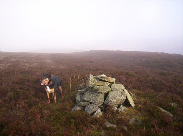
A neglected 554m moorland top above Glen Shee, set behind the better-known Cairnwell pass hills. Crock takes its name from the Gaelic for an earthenware pot, possibly a reference to the deep hollow on its eastern flank. Quiet even on summer weekends.
Quick facts
- Height
- 554m/ 1818ft
- Prominence
- 154 m
- Grid ref
- NO 22622 63246
- Nearest city
- Dundee· 37km
- Dogs
- Dogs on lead required near livestockDog-friendly guide ↗
Height and prominence cross-checked against the Database of British and Irish Hills (CC BY).
No GPX track yet
Walked this route? Share your track to help other walkers.
Standard route
heather moorland 70% · grass slopes 20% · rocky summit 10%
Park at the Spittal of Glenshee and follow the right-of-way south, leaving it after about a kilometre to climb open hillside towards the cairn. Roughly 7km return in 2.5 to 3 hours — entirely off-path beyond the road.
Terrain
Long sections of knee-high heather, with peat groughs braiding the upper slopes. Boots with reasonable ankle support help; gaiters keep ticks off in summer.
In winter
Snow lies for long periods on the broad summit and tends to drift into the eastern hollow. The benign-looking ground hides hidden holes under snow — keep a steady pace and probe with the axe spike if drifts are deep.
This hill is in the Northern Cairngorms SAIS forecast area. Check SAIS forecasts in winter (December–April).
Best time of year
Getting there
- Glasgow3h 26m
- Edinburgh2h 5m
OS maps: OS Landranger 44, OS Explorer 053S, OS Explorer 388S
Mobile signal: Mixed. EE only occasional here; better toward Huntly.
Current conditions
Daylight Today
- Sunrise
- 05:09
- Sunset
- 21:30
- Civil dawn
- 04:18
- Civil dusk
- 22:22
NOAA Solar Calculator · 30 July 2026
Around Crock on the SCOT network
Getting there, basing yourself, and what to do off the hill.
Getting there: Dunkeld & Birnam station
Birnam Hill, Hermitage walks, southern Perthshire gateway
29km from the hill
tripscot.co.uk
On TripSCOTBase yourself in Dunkeld
Southern Cairngorms gateway — Hermitage, Loch of the Lowes
29km from the hill
tripscot.co.uk
On TasteSCOTAfter the hill: Edradour
Pitlochry — until recently Scotland's smallest distillery; charming Perthshire setting
26km from the hill
tastescot.co.uk
Crock — common questions
- How difficult is Crock?
- Crock carries a 2/5 (moderate) grade on the OutdoorSCOT scale. Underfoot: Long sections of knee-high heather, with peat groughs braiding the upper slopes.
- What is Crock's prominence?
- 154m of prominence. That's the vertical drop from the summit to the col that links Crock to the next higher ground. That drop is what qualifies it as a Marilyn — a hill with at least 150m of descent on every side.
- When is the best time to climb Crock?
- March, April, May, June, July, August, September, October give the most reliable conditions on Crock. Beyond that window the high ground turns wintry: carry full mountain kit, be confident navigating, and check the SAIS avalanche forecast for the area.
- Is Crock dog-friendly?
- Yes, but dogs must be kept on a lead — there is livestock or ground-nesting bird interest on the route.
- Is there mobile signal on Crock?
- Mixed. EE only occasional here; better toward Huntly.
- Is Crock safe in winter?
- Snow lies for long periods on the broad summit and tends to drift into the eastern hollow. The benign-looking ground hides hidden holes under snow — keep a steady pace and probe with the axe spike if drifts are deep.
Get the OutdoorSCOT weekly
One email a week — new route, hill and bothy guides, seasonal conditions and the odd hard-won lesson. No spam, unsubscribe in one click.