Marilyn · Central Highlands
Meall an Tarsaid
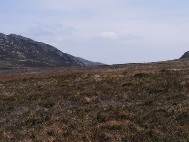
Meall an Tarsaid, the hill of the transverse, is a 492m heather knoll in the high country south-west of Loch Tarff, the small jewel-like loch on the B862 between Fort Augustus and Whitebridge. The summit looks across the Monadhliath to the Loch Ness shore.
Quick facts
- Height
- 492.3m/ 1615ft
- Prominence
- 155 m
- Grid ref
- NH 49161 13057
- Nearest city
- Inverness· 37km
- Dogs
- Dogs on lead required near livestockDog-friendly guide ↗
Height and prominence cross-checked against the Database of British and Irish Hills (CC BY).
No GPX track yet
Walked this route? Share your track to help other walkers.
Standard route
heather moorland 60% · rocky slopes 25% · grass slopes 15%
Easiest from the lay-by on the B862 at Loch Tarff: cross the bog south of the loch, pick up estate stalkers paths heading west, then a short open pull to the top. Two and a half to three hours including the boggy preliminaries.
Terrain
The approach from Loch Tarff is notoriously wet — a peaty hollow that catches drainage from the higher ground. Once on the hill it dries to short heather and turf with a granite-gravel summit.
In winter
A short walk at 492m, but the Loch Tarff approach freezes into a treacherous mosaic of frozen tussocks and unfrozen puddles in cold spells. Crisp clear mornings give wonderful long views over Loch Ness; thaw days are best avoided.
This hill is in the Creag Meagaidh SAIS forecast area. Check SAIS forecasts in winter (December–April).
Best time of year
Getting there
- Glasgow3h 29m
- Edinburgh5h 39m
OS maps: OS Landranger 34, OS Explorer 416S
Mobile signal: Patchy. The B862 corridor has reasonable signal; the western approach loses it within a kilometre.
Current conditions
Daylight Today
- Sunrise
- 05:11
- Sunset
- 21:38
- Civil dawn
- 04:19
- Civil dusk
- 22:30
NOAA Solar Calculator · 30 July 2026
Around Meall an Tarsaid on the SCOT network
Getting there, basing yourself, and what to do off the hill.
Meall an Tarsaid — common questions
- What difficulty is Meall an Tarsaid?
- On the OutdoorSCOT scale, Meall an Tarsaid comes in at 1/5 — easy. Underfoot: The approach from Loch Tarff is notoriously wet — a peaty hollow that catches drainage from the higher ground.
- What is Meall an Tarsaid's prominence?
- 155m of prominence. That's the vertical drop from the summit to the col that links Meall an Tarsaid to the next higher ground. That drop is what qualifies it as a Marilyn — a hill with at least 150m of descent on every side.
- When is the best time to climb Meall an Tarsaid?
- March, April, May, June, July, August, September, October give the most reliable conditions on Meall an Tarsaid. Beyond that window the high ground turns wintry: carry full mountain kit, be confident navigating, and check the SAIS avalanche forecast for the area.
- Is Meall an Tarsaid dog-friendly?
- Yes, but dogs must be kept on a lead — there is livestock or ground-nesting bird interest on the route.
- Is there mobile signal on Meall an Tarsaid?
- Patchy. The B862 corridor has reasonable signal; the western approach loses it within a kilometre.
- Is Meall an Tarsaid safe in winter?
- A short walk at 492m, but the Loch Tarff approach freezes into a treacherous mosaic of frozen tussocks and unfrozen puddles in cold spells. Crisp clear mornings give wonderful long views over Loch Ness; thaw days are best avoided.
Get the OutdoorSCOT weekly
One email a week — new route, hill and bothy guides, seasonal conditions and the odd hard-won lesson. No spam, unsubscribe in one click.