Sub-Marilyn · Central Highlands
Carn Easgann Bana
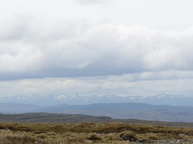
Carn Easgann Bana — cairn of the white eels — is a 779m Monadhliath top east of the Corrieyairack road, in genuinely lonely country between Strathspey and Stratherrick. The improbable name may refer to a freshwater spring on the eastern shoulder where pale eels were once seen.
Quick facts
- Height
- 779.9m/ 2559ft
- Prominence
- 143 m
- Grid ref
- NH 48523 06316
- Nearest city
- Inverness· 43km
- Dogs
- Dogs on lead required near livestockDog-friendly guide ↗
Sub-Marilyn: 143m of drop — misses the 150m Marilyn cut by 7m. We keep it on the list as a near-miss.
Height and prominence cross-checked against the Database of British and Irish Hills (CC BY).
No GPX track yet
Walked this route? Share your track to help other walkers.
Standard route
heather moorland 65% · grass slopes 25% · rocky summit 10%
A long pull from the Allt Coire Iain Oig track east of Garva Bridge, following stalker paths into the high corrie before a final pathless rise to the cairn. About 16km return in 5 to 6 hours.
Terrain
Long sections of grassy peat hag interspersed with quartzite blocks near the top. The high corrie holds a small lochan worth a brief detour on the way back down.
In winter
Winter ascents demand commitment given the long approach. The corrie holds substantial snow well into spring, with cornices forming on the lochans north side; cross only on the obvious flatter ground.
This hill is in the Creag Meagaidh SAIS forecast area. Check SAIS forecasts in winter (December–April).
Best time of year
Getting there
- Glasgow3h 20m
- Edinburgh5h 33m
OS maps: OS Landranger 34, OS Explorer 055, OS Explorer 401
Mobile signal: Poor. Remote Badenoch or Strathspey hill; EE fails. Kingussie is nearest coverage.
Current conditions
Daylight Today
- Sunrise
- 05:12
- Sunset
- 21:37
- Civil dawn
- 04:20
- Civil dusk
- 22:29
NOAA Solar Calculator · 30 July 2026
Around Carn Easgann Bana on the SCOT network
Getting there, basing yourself, and what to do off the hill.
Getting there: Dalwhinnie station
Highest mainline station; Drumochter Munros; Ben Alder approach
25km from the hill
tripscot.co.uk
On TripSCOTBase yourself in Aviemore
Cairngorms base — Strathspey valley, ski centre, train
42km from the hill
tripscot.co.uk
On TasteSCOTAfter the hill: Dalwhinnie
Dalwhinnie — Scotland's highest distillery on the Drumochter pass
26km from the hill
tastescot.co.uk
Carn Easgann Bana — common questions
- Is Carn Easgann Bana a hard climb?
- Carn Easgann Bana is rated 2/5 (moderate) on the OutdoorSCOT scale. Underfoot: Long sections of grassy peat hag interspersed with quartzite blocks near the top.
- What is Carn Easgann Bana's prominence?
- 143m of prominence. That's the vertical drop from the summit to the col that links Carn Easgann Bana to the next higher ground. That leaves it 7m short of the 150m drop a Marilyn needs — DoBIH classes it a sub-Marilyn, a near-miss rather than a full Marilyn.
- When is the best time to climb Carn Easgann Bana?
- April, May, June, September give the most reliable conditions on Carn Easgann Bana. Beyond that window the high ground turns wintry: carry full mountain kit, be confident navigating, and check the SAIS avalanche forecast for the area.
- Is Carn Easgann Bana dog-friendly?
- Yes, but dogs must be kept on a lead — there is livestock or ground-nesting bird interest on the route.
- Is there mobile signal on Carn Easgann Bana?
- Poor. Remote Badenoch or Strathspey hill; EE fails. Kingussie is nearest coverage.
- Is Carn Easgann Bana safe in winter?
- Winter ascents demand commitment given the long approach. The corrie holds substantial snow well into spring, with cornices forming on the lochans north side; cross only on the obvious flatter ground.
Get the OutdoorSCOT weekly
One email a week — new route, hill and bothy guides, seasonal conditions and the odd hard-won lesson. No spam, unsubscribe in one click.