Marilyn · Central Highlands
Beinn a' Bhacaidh
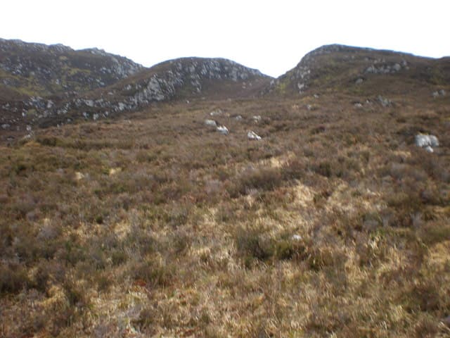
Beinn a Bhacaidh, the hill of the hindrance, rises directly above the south shore of Loch Ness between Foyers and Invermoriston. At 555m it is not a giant, but the steep face dropping straight to the loch gives the climb a Lake District feel rarely matched on the Great Glen.
Quick facts
- Height
- 555m/ 1821ft
- Prominence
- 254 m
- Grid ref
- NH 43152 11915
- Nearest city
- Inverness· 41km
- Dogs
- Dogs on lead required near livestockDog-friendly guide ↗
Height and prominence cross-checked against the Database of British and Irish Hills (CC BY).
No GPX track yet
Walked this route? Share your track to help other walkers.
Standard route
heather moorland 65% · grass slopes 25% · rocky summit 10%
Start from the small car park on the B852 at Inverfarigaig and follow the forest tracks up through the spectacular pass before breaking out onto the heather shoulder. The summit is reached by a steep open pull above the trees, with views down 200m of broken ground to Loch Ness directly below. About 3 to 4 hours circular.
Terrain
Mixed forestry tracks low down (some steep cobbled inclines from the old military engineering at Inverfarigaig), then waist-high heather and crowberry on the open hill. The rock is Moine schist with occasional small crags on the loch-facing flank.
In winter
The Loch Ness microclimate keeps the lower forest mild but the exposed shoulder above the trees can be glazed by freezing rain blowing in from the loch. At 555m snow is intermittent through January and February; usually walkable in stout boots with spikes for the icy forestry tracks.
This hill is in the Creag Meagaidh SAIS forecast area. Check SAIS forecasts in winter (December–April).
Best time of year
Getting there
- Glasgow4h 30m
- Edinburgh5h 49m
OS maps: OS Landranger 34, OS Explorer 416S
Mobile signal: Patchy. Reception comes and goes on the upper slopes; loch-side road has good Vodafone and EE coverage.
Current conditions
Daylight Today
- Sunrise
- 05:12
- Sunset
- 21:38
- Civil dawn
- 04:19
- Civil dusk
- 22:30
NOAA Solar Calculator · 30 July 2026
Around Beinn a' Bhacaidh on the SCOT network
Getting there, basing yourself, and what to do off the hill.
Beinn a' Bhacaidh — common questions
- Is Beinn a' Bhacaidh a hard climb?
- Beinn a' Bhacaidh is rated 2/5 (moderate) on the OutdoorSCOT scale. Ground conditions: Mixed forestry tracks low down (some steep cobbled inclines from the old military engineering at Inverfarigaig), then waist-high heather and crowberry on the open hill.
- How much drop does Beinn a' Bhacaidh have?
- The drop is 254m: measured from the summit of Beinn a' Bhacaidh down to the saddle joining it to higher terrain. Passing the 150m-drop threshold on all sides is exactly what makes it a Marilyn.
- What's the best month to climb Beinn a' Bhacaidh?
- Aim for March, April, May, June, July, August, September, October on Beinn a' Bhacaidh. In the remaining months treat it as a winter hill — full kit, solid navigation, and a look at the relevant SAIS avalanche forecast before you go.
- Can dogs go up Beinn a' Bhacaidh?
- Dogs are fine on a lead. The route passes livestock or ground-nesting bird habitat, so keep them close throughout.
- Will I get phone signal on Beinn a' Bhacaidh?
- Patchy. Reception comes and goes on the upper slopes; loch-side road has good Vodafone and EE coverage.
- Is Beinn a' Bhacaidh safe in winter?
- The Loch Ness microclimate keeps the lower forest mild but the exposed shoulder above the trees can be glazed by freezing rain blowing in from the loch. At 555m snow is intermittent through January and February; usually walkable in stout boots with spikes for the icy forestry tracks.
Get the OutdoorSCOT weekly
One email a week — new route, hill and bothy guides, seasonal conditions and the odd hard-won lesson. No spam, unsubscribe in one click.