Marilyn · Central Highlands
Beinn Mheadhoin
This Beinn Mheadhoin — middle hill in Gaelic, one of several so named — is the 555m summit east of Loch Mhor and north of Whitebridge, in the rolling country south of Loch Ness. Disambiguated by its grid reference NH 60 21, it is not the Cairngorm tor of the same name but a quieter heather lump in the Stratherrick uplands.
Quick facts
- Height
- 555.2m/ 1822ft
- Prominence
- 153 m
- Grid ref
- NH 60420 21460
- Nearest city
- Inverness· 25km
- Dogs
- Dogs on lead required near livestockDog-friendly guide ↗
Height and prominence cross-checked against the Database of British and Irish Hills (CC BY).
No GPX track yet
Walked this route? Share your track to help other walkers.
Standard route
heather moorland 65% · grass slopes 25% · rocky summit 10%
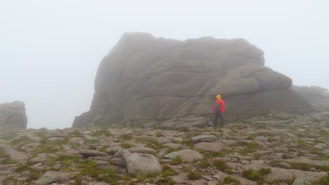
The usual line is from the B862 near Errogie, following the lochside road to Loch Mhor and taking estate tracks east toward Garrogie before striking up through young plantation onto open hillside. The summit is a broad heather dome with a small cairn looking west to the Loch Ness trench. Around 4 to 5 hours for the round.
Terrain
Estate forestry roads ease the lower approach, then heather and rough pasture grazed by sheep. The Stratherrick plateau is drier than the western glens but still has wet hollows; some new tracks shown on older maps are now overgrown.
In winter
Sub-600m and east of the watershed, so snow is patchy and rarely deep. Frozen heather and verglassed estate tracks are the real winter risk; carry microspikes for icy mornings rather than full mountaineering kit.
This hill is in the Creag Meagaidh SAIS forecast area. Check SAIS forecasts in winter (December–April).
Best time of year
Getting there
- Glasgow4h 38m
- Edinburgh4h 28m
OS maps: OS Landranger 26, OS Landranger 35, OS Explorer 417
Mobile signal: Poor. Remote Ross-shire/Strathconon area; limited coverage.
Current conditions
Daylight Today
- Sunrise
- 05:10
- Sunset
- 21:37
- Civil dawn
- 04:18
- Civil dusk
- 22:30
NOAA Solar Calculator · 30 July 2026
Around Beinn Mheadhoin on the SCOT network
Getting there, basing yourself, and what to do off the hill.
Getting there: Inverness station
Highland capital — Cairngorms east side, Affric, Far North via bus/car
25km from the hill
tripscot.co.uk
On TripSCOTBase yourself in Inverness
Highland capital — gateway to Cairngorms, Affric, Far North
24km from the hill
tripscot.co.uk
On TasteSCOTAfter the hill: Tomatin
Tomatin — large Highland distillery just off the A9, south of Inverness
20km from the hill
tastescot.co.uk
Beinn Mheadhoin — common questions
- What difficulty is Beinn Mheadhoin?
- On the OutdoorSCOT scale, Beinn Mheadhoin comes in at 2/5 — moderate. Underfoot: Estate forestry roads ease the lower approach, then heather and rough pasture grazed by sheep.
- What is Beinn Mheadhoin's prominence?
- 153m of prominence. That's the vertical drop from the summit to the col that links Beinn Mheadhoin to the next higher ground. That drop is what qualifies it as a Marilyn — a hill with at least 150m of descent on every side.
- When is the best time to climb Beinn Mheadhoin?
- March, April, May, June, July, August, September, October give the most reliable conditions on Beinn Mheadhoin. Beyond that window the high ground turns wintry: carry full mountain kit, be confident navigating, and check the SAIS avalanche forecast for the area.
- Is Beinn Mheadhoin dog-friendly?
- Yes, but dogs must be kept on a lead — there is livestock or ground-nesting bird interest on the route.
- Is there mobile signal on Beinn Mheadhoin?
- Poor. Remote Ross-shire/Strathconon area; limited coverage.
- Is Beinn Mheadhoin safe in winter?
- Sub-600m and east of the watershed, so snow is patchy and rarely deep. Frozen heather and verglassed estate tracks are the real winter risk; carry microspikes for icy mornings rather than full mountaineering kit.
Get the OutdoorSCOT weekly
One email a week — new route, hill and bothy guides, seasonal conditions and the odd hard-won lesson. No spam, unsubscribe in one click.