Marilyn · Central Highlands
Stac Gorm
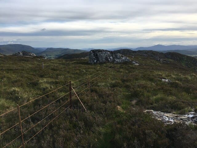
Stac Gorm, the blue or green stack, is the southerly twin of Stac na Cathaig and sits directly above Loch Ruthven in Strathnairn. At 430m it is a short outing with a disproportionately good view of the loch and the moor stretching south to the Monadhliath.
Quick facts
- Height
- 430m/ 1411ft
- Prominence
- 183 m
- Grid ref
- NH 63044 27313
- Nearest city
- Inverness· 18km
- Dogs
- Dogs on lead required near livestockDog-friendly guide ↗
Height and prominence cross-checked against the Database of British and Irish Hills (CC BY).
No GPX track yet
Walked this route? Share your track to help other walkers.
Standard route
heather moorland 55% · rocky slopes 30% · grass slopes 15%
Start from the RSPB car park at Loch Ruthven, follow the reserve path along the loch and then strike up to the heathery summit on a vague stalkers path. An easy 2 hours allows time at the cairn.
Terrain
Lochside reedbeds give way to short heather and a small rocky brow at the top. The drainage off the hill keeps the ground near Loch Ruthven boggy, but the upper slope is dry walking on schist gravel.
In winter
Only 430m, with the Cairngorms taking the worst of the eastern weather. Snow rarely lasts more than a few days; the hazards in cold weather are icy boardwalks on the RSPB section and frozen tussocks above.
This hill is in the Creag Meagaidh SAIS forecast area. Check SAIS forecasts in winter (December–April).
Best time of year
Getting there
- Glasgow4h 46m
- Edinburgh5h 31m
OS maps: OS Landranger 26, OS Landranger 35, OS Explorer 417
Mobile signal: Patchy on summit; good back at the loch shore thanks to Inverness coverage.
Current conditions
Daylight Today
- Sunrise
- 05:10
- Sunset
- 21:37
- Civil dawn
- 04:17
- Civil dusk
- 22:30
NOAA Solar Calculator · 30 July 2026
Around Stac Gorm on the SCOT network
Getting there, basing yourself, and what to do off the hill.
Getting there: Inverness station
Highland capital — Cairngorms east side, Affric, Far North via bus/car
19km from the hill
tripscot.co.uk
On TripSCOTBase yourself in Inverness
Highland capital — gateway to Cairngorms, Affric, Far North
18km from the hill
tripscot.co.uk
On TasteSCOTAfter the hill: Tomatin
Tomatin — large Highland distillery just off the A9, south of Inverness
16km from the hill
tastescot.co.uk
Stac Gorm — common questions
- Is Stac Gorm a hard climb?
- Stac Gorm is rated 1/5 (easy) on the OutdoorSCOT scale. Terrain: Lochside reedbeds give way to short heather and a small rocky brow at the top.
- How prominent is Stac Gorm?
- Stac Gorm has 183m of topographic prominence — the height of its summit above the highest col connecting it to higher ground. Marilyns are defined by that measure: at least 150m of drop on all sides.
- When should I climb Stac Gorm?
- The standard good-weather months for Stac Gorm are March, April, May, June, July, August, September, October. Outside those months, expect winter conditions on the high ground — full mountain kit, navigation skills, and a check of the SAIS avalanche forecast for the relevant region.
- Can I bring my dog up Stac Gorm?
- On a lead only — the route crosses ground with livestock or nesting-bird interest.
- What's mobile reception like on Stac Gorm?
- Patchy on summit; good back at the loch shore thanks to Inverness coverage.
- Is Stac Gorm safe in winter?
- Only 430m, with the Cairngorms taking the worst of the eastern weather. Snow rarely lasts more than a few days; the hazards in cold weather are icy boardwalks on the RSPB section and frozen tussocks above.
Get the OutdoorSCOT weekly
One email a week — new route, hill and bothy guides, seasonal conditions and the odd hard-won lesson. No spam, unsubscribe in one click.