Marilyn · Central Highlands
Tom Bailgeann
Tom Bailgeann is a 464m wooded knoll on the northern edge of the Monadhliath, looking down into the basin of Loch Ruthven and the moorland that drains north to the Beauly Firth. The forested lower slopes make it less austere than its neighbours.
Quick facts
- Height
- 464m/ 1522ft
- Prominence
- 242 m
- Grid ref
- NH 58842 29471
- Nearest city
- Inverness· 18km
- Dogs
- Dogs on lead required near livestockDog-friendly guide ↗
Height and prominence cross-checked against the Database of British and Irish Hills (CC BY).
No GPX track yet
Walked this route? Share your track to help other walkers.
Standard route
heather moorland 65% · grass slopes 25% · rocky summit 10%
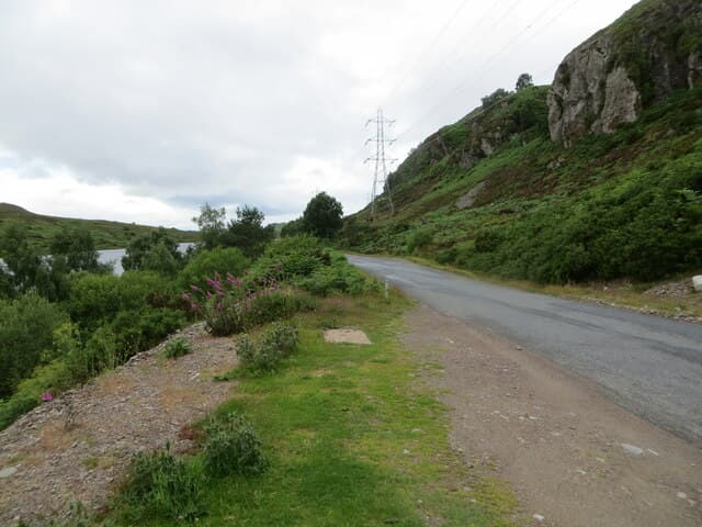
The standard route uses the unclassified road from Farr to Loch Ruthven, then forestry tracks climbing south. The summit knoll sits clear of the trees and gives an open view across Loch Ruthven RSPB reserve. About 2 to 3 hours.
Terrain
Forestry tracks for most of the ascent, with a short break onto heather and bilberry for the summit knoll. The plantation can be muddy in wet weather and feels enclosed compared with the bare tops around Loch Mhor.
In winter
A low hill on the eastern side of the Monadhliath that rarely holds snow for long. The forestry tracks freeze hard in cold spells; spikes are a reasonable precaution but full winter kit is overkill at 464m.
This hill is in the Creag Meagaidh SAIS forecast area. Check SAIS forecasts in winter (December–April).
Best time of year
Getting there
- Glasgow4h 49m
- Edinburgh5h 40m
OS maps: OS Landranger 26, OS Landranger 35, OS Explorer 417
Mobile signal: Patchy. Coverage on summit thanks to Inverness transmitters; the lower forest blocks the signal.
Current conditions
Daylight Today
- Sunrise
- 05:10
- Sunset
- 21:38
- Civil dawn
- 04:17
- Civil dusk
- 22:31
NOAA Solar Calculator · 30 July 2026
Around Tom Bailgeann on the SCOT network
Getting there, basing yourself, and what to do off the hill.
Getting there: Inverness station
Highland capital — Cairngorms east side, Affric, Far North via bus/car
18km from the hill
tripscot.co.uk
On TripSCOTBase yourself in Inverness
Highland capital — gateway to Cairngorms, Affric, Far North
17km from the hill
tripscot.co.uk
On TasteSCOTAfter the hill: Tomatin
Tomatin — large Highland distillery just off the A9, south of Inverness
20km from the hill
tastescot.co.uk
Tom Bailgeann — common questions
- What difficulty is Tom Bailgeann?
- On the OutdoorSCOT scale, Tom Bailgeann comes in at 1/5 — easy. Underfoot: Forestry tracks for most of the ascent, with a short break onto heather and bilberry for the summit knoll.
- What is Tom Bailgeann's prominence?
- 242m of prominence. That's the vertical drop from the summit to the col that links Tom Bailgeann to the next higher ground. That drop is what qualifies it as a Marilyn — a hill with at least 150m of descent on every side.
- When is the best time to climb Tom Bailgeann?
- March, April, May, June, July, August, September, October give the most reliable conditions on Tom Bailgeann. Beyond that window the high ground turns wintry: carry full mountain kit, be confident navigating, and check the SAIS avalanche forecast for the area.
- Is Tom Bailgeann dog-friendly?
- Yes, but dogs must be kept on a lead — there is livestock or ground-nesting bird interest on the route.
- Is there mobile signal on Tom Bailgeann?
- Patchy. Coverage on summit thanks to Inverness transmitters; the lower forest blocks the signal.
- Is Tom Bailgeann safe in winter?
- A low hill on the eastern side of the Monadhliath that rarely holds snow for long. The forestry tracks freeze hard in cold spells; spikes are a reasonable precaution but full winter kit is overkill at 464m.
Get the OutdoorSCOT weekly
One email a week — new route, hill and bothy guides, seasonal conditions and the odd hard-won lesson. No spam, unsubscribe in one click.