Marilyn · Kintail
Meall na h-Eilrig
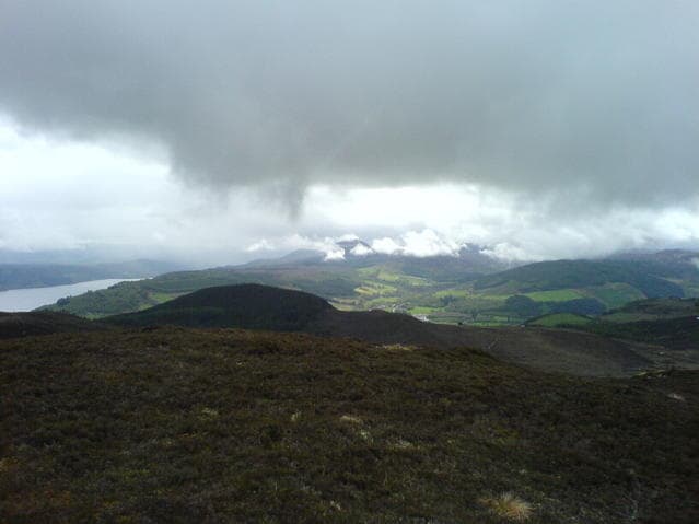
Meall na h-Eilrig stands at 465m at NH 537 326 above Glen Convinth, west of Loch Ness. The Gaelic eilrig means a deer trap — a natural funnel of ground once used by hunters — and traces of such traps survive on hills with the name across the eastern Highlands.
Quick facts
- Height
- 465m/ 1526ft
- Prominence
- 187 m
- Grid ref
- NH 53710 32606
- Nearest city
- Inverness· 18km
- Dogs
- Dogs on lead required near livestockDog-friendly guide ↗
Height and prominence cross-checked against the Database of British and Irish Hills (CC BY).
No GPX track yet
Walked this route? Share your track to help other walkers.
Standard route
heather moorland 65% · grass slopes 25% · rocky summit 10%
Park near Eskadale chapel and follow estate tracks south-west through plantation before breaking out onto open hillside. The summit is reached on grass and heather; descents can be varied to make a circuit. Around 3 hours.
Terrain
Plantation tracks for the first kilometre, then drier heather slopes than many inland hills offer. The summit is firm short turf with a small stone shelter.
In winter
Below typical Highland snowlines through most of the season. Track ice is the chief issue in cold weather; the open ground is rarely problematic. A pleasant short-day winter outing from Beauly.
Best time of year
Getting there
- Glasgow4h 54m
- Edinburgh5h 52m
OS maps: OS Landranger 26, OS Explorer 431
Mobile signal: Poor. A dead zone on all networks. A paper OS map is essential here.
Current conditions
Daylight Today
- Sunrise
- 05:10
- Sunset
- 21:38
- Civil dawn
- 04:17
- Civil dusk
- 22:31
NOAA Solar Calculator · 30 July 2026
Around Meall na h-Eilrig on the SCOT network
Getting there, basing yourself, and what to do off the hill.
Getting there: Inverness station
Highland capital — Cairngorms east side, Affric, Far North via bus/car
18km from the hill
tripscot.co.uk
On TripSCOTBase yourself in Inverness
Highland capital — gateway to Cairngorms, Affric, Far North
18km from the hill
tripscot.co.uk
On TasteSCOTAfter the hill: Glen Ord
Muir of Ord — Black Isle distillery; the Singleton range's Highland anchor
18km from the hill
tastescot.co.uk
Meall na h-Eilrig — common questions
- How hard is Meall na h-Eilrig?
- We grade Meall na h-Eilrig at 1/5, which puts it in easy territory. Underfoot: Plantation tracks for the first kilometre, then drier heather slopes than many inland hills offer.
- What is Meall na h-Eilrig's prominence?
- 187m of prominence. That's the vertical drop from the summit to the col that links Meall na h-Eilrig to the next higher ground. That drop is what qualifies it as a Marilyn — a hill with at least 150m of descent on every side.
- When is the best time to climb Meall na h-Eilrig?
- March, April, May, June, July, August, September, October give the most reliable conditions on Meall na h-Eilrig. Beyond that window the high ground turns wintry: carry full mountain kit, be confident navigating, and check the SAIS avalanche forecast for the area.
- Is Meall na h-Eilrig dog-friendly?
- Yes, but dogs must be kept on a lead — there is livestock or ground-nesting bird interest on the route.
- Is there mobile signal on Meall na h-Eilrig?
- Poor. A dead zone on all networks. A paper OS map is essential here.
- Is Meall na h-Eilrig safe in winter?
- Below typical Highland snowlines through most of the season. Track ice is the chief issue in cold weather; the open ground is rarely problematic. A pleasant short-day winter outing from Beauly.
Get the OutdoorSCOT weekly
One email a week — new route, hill and bothy guides, seasonal conditions and the odd hard-won lesson. No spam, unsubscribe in one click.