Sub-Marilyn · Cairngorms
Hill of Goauch
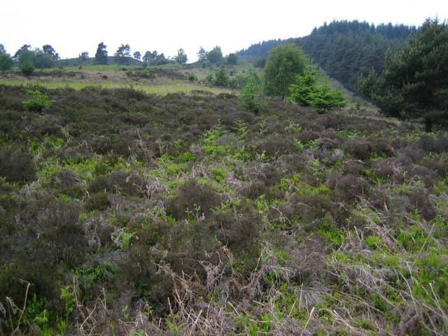
A largely forgotten 337m moorland top above Strachan in central Aberdeenshire, with the Forest of Birse stretching westward and a panorama spanning the Hill of Fare to the Mounth. The cairn marks an old county march, with two adjoining parishes meeting at the point.
Quick facts
- Height
- 337.2m/ 1106ft
- Prominence
- 149 m
- Grid ref
- NO 66307 94171
- Nearest city
- Aberdeen· 31km
- Dogs
- Dogs on lead required near livestockDog-friendly guide ↗
Sub-Marilyn: 149m of drop — misses the 150m Marilyn cut by 1m. We keep it on the list as a near-miss.
Height and prominence cross-checked against the Database of British and Irish Hills (CC BY).
No GPX track yet
Walked this route? Share your track to help other walkers.
Standard route
heather moorland 70% · grass slopes 20% · rocky summit 10%
A right-of-way climbs from the road near Bridge of Dye, crossing felled forestry before opening onto moor. Direct ascent of the eastern shoulder reaches the cairn in about an hour; allow 2 hours return for 5km.
Terrain
Mostly firm heather with stretches of brash and stumps where the conifers have been clearfelled. Boots help against the sharp brashings.
In winter
The proximity to the sea keeps temperatures higher than equivalent inland hills, so winter ascents are usually free of axe-and-crampon conditions. Hill of Goauch makes a sound choice on a stormy day when bigger plans are off.
Best time of year
Getting there
- Glasgow5h 20m
- Edinburgh3h 15m
OS maps: OS Landranger 38, OS Landranger 45, OS Explorer 406W
Mobile signal: Mixed. EE only occasional here; better toward Aberdeenshire valleys.
Current conditions
Daylight Today
- Sunrise
- 06:38
- Sunset
- 19:34
- Civil dawn
- 05:59
- Civil dusk
- 20:13
NOAA Solar Calculator · 14 September 2026
Around Hill of Goauch on the SCOT network
Getting there, basing yourself, and what to do off the hill.
Hill of Goauch — common questions
- How hard is Hill of Goauch?
- We grade Hill of Goauch at 1/5, which puts it in easy territory. Underfoot: Mostly firm heather with stretches of brash and stumps where the conifers have been clearfelled.
- What is Hill of Goauch's prominence?
- 149m of prominence. That's the vertical drop from the summit to the col that links Hill of Goauch to the next higher ground. That leaves it 1m short of the 150m drop a Marilyn needs — DoBIH classes it a sub-Marilyn, a near-miss rather than a full Marilyn.
- When is the best time to climb Hill of Goauch?
- March, April, May, June, July, August, September, October give the most reliable conditions on Hill of Goauch. Beyond that window the high ground turns wintry: carry full mountain kit, be confident navigating, and check the SAIS avalanche forecast for the area.
- Is Hill of Goauch dog-friendly?
- Yes, but dogs must be kept on a lead — there is livestock or ground-nesting bird interest on the route.
- Is there mobile signal on Hill of Goauch?
- Mixed. EE only occasional here; better toward Aberdeenshire valleys.
- Is Hill of Goauch safe in winter?
- The proximity to the sea keeps temperatures higher than equivalent inland hills, so winter ascents are usually free of axe-and-crampon conditions. Hill of Goauch makes a sound choice on a stormy day when bigger plans are off.
Get the OutdoorSCOT weekly
One email a week — new route, hill and bothy guides, seasonal conditions and the odd hard-won lesson. No spam, unsubscribe in one click.