Sub-Marilyn · Borders
Fanna Hill
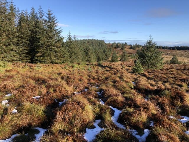
A 514m hill on the Scotland-England border above the upper Liddel Water and Wauchope Forest. Remote moorland country with the Anglo-Scottish boundary running close to the summit. Reaches 514.6 m in the Borders.
Quick facts
- Height
- 514.6m/ 1688ft
- Prominence
- 148 m
- Grid ref
- NT 56977 03195
- Parking
- NY 56100 96500
- Nearest city
- Carlisle· 50km
- Dogs
- Dogs on lead required near livestockDog-friendly guide ↗
Sub-Marilyn: 148m of drop — misses the 150m Marilyn cut by 2m. We keep it on the list as a near-miss.
Height and prominence cross-checked against the Database of British and Irish Hills (CC BY).
No GPX track yet
Walked this route? Share your track to help other walkers.
Standard route
grass moorland 60% · heather 30% · boggy ground 10%
A long forestry approach from Saughtree or Note o' the Gate makes this a 5-6 hour day. Open moorland on the upper sections leads to the boundary-line summit.
Terrain
Forestry tracks for the long approach, then peat hags and boggy heather on the open watershed. Wet underfoot in most conditions.
In winter
Forestry shelters the approach but the open border watershed catches the worst of easterly weather. Long round-trip — plan for short winter daylight.
Best time of year
Getting there
- Glasgow4h 18m
- Edinburgh2h 5m
OS maps: OS Landranger 80, OS Explorer 331
Mobile signal: Good. Scottish Borders; solid EE signal throughout. Vodafone also reliable.
Current conditions
Daylight Today
- Sunrise
- 05:14
- Sunset
- 21:20
- Civil dawn
- 04:26
- Civil dusk
- 22:08
NOAA Solar Calculator · 30 July 2026
Around Fanna Hill on the SCOT network
Getting there, basing yourself, and what to do off the hill.
Fanna Hill — common questions
- How difficult is Fanna Hill?
- Fanna Hill carries a 2/5 (moderate) grade on the OutdoorSCOT scale. Terrain: Forestry tracks for the long approach, then peat hags and boggy heather on the open watershed.
- How prominent is Fanna Hill?
- Fanna Hill has 148m of topographic prominence — the height of its summit above the highest col connecting it to higher ground. That leaves it 2m short of the 150m drop a Marilyn needs — DoBIH classes it a sub-Marilyn, a near-miss rather than a full Marilyn.
- Where should I park to climb Fanna Hill?
- Standard parking is at NY 56100 96500. Check the parking grid reference on an OS map before travel; informal laybys can fill on summer weekends.
- When should I climb Fanna Hill?
- The standard good-weather months for Fanna Hill are April, May, June, July, August, September, October. Outside those months, expect winter conditions on the high ground — full mountain kit, navigation skills, and a check of the SAIS avalanche forecast for the relevant region.
- Can I bring my dog up Fanna Hill?
- On a lead only — the route crosses ground with livestock or nesting-bird interest.
- What's mobile reception like on Fanna Hill?
- Good. Scottish Borders; solid EE signal throughout. Vodafone also reliable.
- Is Fanna Hill safe in winter?
- Forestry shelters the approach but the open border watershed catches the worst of easterly weather. Long round-trip — plan for short winter daylight.
Get the OutdoorSCOT weekly
One email a week — new route, hill and bothy guides, seasonal conditions and the odd hard-won lesson. No spam, unsubscribe in one click.