Marilyn · Borders
Blackwood Hill
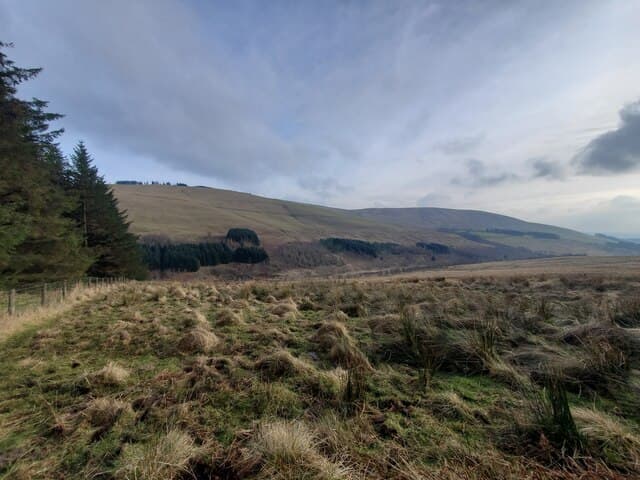
Blackwood Hill stands at 447m above the Borthwick Water in southern Roxburghshire (NY 53172 96191), a broad heather-clad top with extensive forestry on its lower slopes. The summit gives views toward Teviotdale and the Cheviot Hills along the English border.
Quick facts
- Height
- 447m/ 1467ft
- Prominence
- 189 m
- Grid ref
- NY 53172 96191
- Nearest city
- Carlisle· 42km
- Dogs
- Dogs on lead required near livestockDog-friendly guide ↗
Height and prominence cross-checked against the Database of British and Irish Hills (CC BY).
No GPX track yet
Walked this route? Share your track to help other walkers.
Standard route
grass moorland 65% · heather 25% · boggy ground 10%
Approach via forestry tracks from Roberton in the Borthwick valley, breaking out of plantation onto open heather for the final pull to the 447m summit. About 6km return — allow 2-3 hours. No marked trail; navigate by map.
Terrain
Mix of conifer forestry tracks and open heather moorland. Tussocky going above the tree line with some peaty hollows on the summit plateau.
In winter
Modest Borders winter walking. Tracks usable year round; the open ridge may collect a dusting of snow but rarely more.
Best time of year
Getting there
- Glasgow4h 12m
- Edinburgh2h 8m
OS maps: OS Landranger 79, OS Explorer 042W, OS Explorer 324
Mobile signal: Good. Borders; EE signal solid on summit and approach. Vodafone also reliable.
Current conditions
Daylight Today
- Sunrise
- 05:15
- Sunset
- 21:20
- Civil dawn
- 04:27
- Civil dusk
- 22:08
NOAA Solar Calculator · 30 July 2026
Around Blackwood Hill on the SCOT network
Getting there, basing yourself, and what to do off the hill.
Blackwood Hill — common questions
- What difficulty is Blackwood Hill?
- On the OutdoorSCOT scale, Blackwood Hill comes in at 1/5 — easy. Ground conditions: Mix of conifer forestry tracks and open heather moorland.
- How much drop does Blackwood Hill have?
- The drop is 189m: measured from the summit of Blackwood Hill down to the saddle joining it to higher terrain. Passing the 150m-drop threshold on all sides is exactly what makes it a Marilyn.
- What's the best month to climb Blackwood Hill?
- Aim for March, April, May, June, July, August, September, October on Blackwood Hill. In the remaining months treat it as a winter hill — full kit, solid navigation, and a look at the relevant SAIS avalanche forecast before you go.
- Can dogs go up Blackwood Hill?
- Dogs are fine on a lead. The route passes livestock or ground-nesting bird habitat, so keep them close throughout.
- Will I get phone signal on Blackwood Hill?
- Good. Borders; EE signal solid on summit and approach. Vodafone also reliable.
- Is Blackwood Hill safe in winter?
- Modest Borders winter walking. Tracks usable year round; the open ridge may collect a dusting of snow but rarely more.
Get the OutdoorSCOT weekly
One email a week — new route, hill and bothy guides, seasonal conditions and the odd hard-won lesson. No spam, unsubscribe in one click.