Marilyn · Borders
Greatmoor Hill
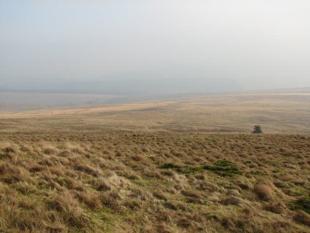
A 599m summit on the watershed above the Borthwick Water, the highest ground between Teviotdale and Liddesdale. Quiet hill country with sweeping views toward the Cheviots, Eildon Hills and the upper Teviot valley.
Quick facts
- Height
- 599m/ 1965ft
- Prominence
- 163 m
- Grid ref
- NT 48982 00687
- Parking
- NT 47000 06000
- Nearest city
- Carlisle· 46km
- Dogs
- Dogs on lead required near livestockDog-friendly guide ↗
Height and prominence cross-checked against the Database of British and Irish Hills (CC BY).
No GPX track yet
Walked this route? Share your track to help other walkers.
Standard route
grass moorland 65% · heather 25% · boggy ground 10%
A pathless route from the minor road in the Borthwick valley climbs grassy fellsides directly to the summit, around 3-4 hours round-trip. Some walkers extend the day by traversing south along the watershed toward Pikethaw and Wisp.
Terrain
Open Borders grassland with patches of heather and tussocky going on the broad summit dome. Fence lines aid navigation on the higher ground.
In winter
Modest elevation keeps conditions manageable, though snow drifts can collect on the broad plateau in easterly weather. Good visibility makes navigation simple in clear conditions.
Best time of year
Getting there
- Glasgow4h 0m
- Edinburgh2h 57m
OS maps: OS Landranger 79, OS Explorer 331
Mobile signal: Good. Scottish Borders; EE signal solid. Download maps for backup anyway.
Current conditions
Daylight Today
- Sunrise
- 05:15
- Sunset
- 21:21
- Civil dawn
- 04:27
- Civil dusk
- 22:09
NOAA Solar Calculator · 30 July 2026
Around Greatmoor Hill on the SCOT network
Getting there, basing yourself, and what to do off the hill.
Greatmoor Hill — common questions
- How difficult is Greatmoor Hill?
- Greatmoor Hill carries a 2/5 (moderate) grade on the OutdoorSCOT scale. Underfoot: Open Borders grassland with patches of heather and tussocky going on the broad summit dome.
- What is Greatmoor Hill's prominence?
- 163m of prominence. That's the vertical drop from the summit to the col that links Greatmoor Hill to the next higher ground. That drop is what qualifies it as a Marilyn — a hill with at least 150m of descent on every side.
- Where do I park for Greatmoor Hill?
- Most walkers start from NT 47000 06000. Verify the grid reference on an OS map before you set off — space is tight on busy summer weekends.
- When is the best time to climb Greatmoor Hill?
- March, April, May, June, July, August, September, October give the most reliable conditions on Greatmoor Hill. Beyond that window the high ground turns wintry: carry full mountain kit, be confident navigating, and check the SAIS avalanche forecast for the area.
- Is Greatmoor Hill dog-friendly?
- Yes, but dogs must be kept on a lead — there is livestock or ground-nesting bird interest on the route.
- Is there mobile signal on Greatmoor Hill?
- Good. Scottish Borders; EE signal solid. Download maps for backup anyway.
- Is Greatmoor Hill safe in winter?
- Modest elevation keeps conditions manageable, though snow drifts can collect on the broad plateau in easterly weather. Good visibility makes navigation simple in clear conditions.
Get the OutdoorSCOT weekly
One email a week — new route, hill and bothy guides, seasonal conditions and the odd hard-won lesson. No spam, unsubscribe in one click.