Marilyn · Borders
Ellson Fell
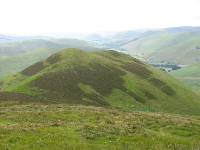
A 537m hill above Teviothead, close to the head of the Teviot Water. Surrounded by extensive forestry plantations but with open moorland on the summit dome. Reaches 537 m in the Borders.
Quick facts
- Height
- 537m/ 1762ft
- Prominence
- 163 m
- Grid ref
- NY 41037 98497
- Parking
- NT 40400 05500
- Nearest city
- Carlisle· 43km
- Dogs
- Dogs on lead required near livestockDog-friendly guide ↗
Height and prominence cross-checked against the Database of British and Irish Hills (CC BY).
No GPX track yet
Walked this route? Share your track to help other walkers.
Standard route
grass moorland 60% · heather 30% · boggy ground 10%
Forestry tracks from near Teviothead church give the best approach, then open hill to the cairn — around 3-4 hours return. Watch for active timber operations.
Terrain
Forestry tracks, clearfell debris and rough heather on the open summit. The going can be tussocky once off the tracks.
In winter
Shelter from the surrounding plantations softens the winter conditions, though clearfell areas are exposed and snow-bound after storms.
Best time of year
Getting there
- Glasgow4h 44m
- Edinburgh2h 52m
OS maps: OS Landranger 79, OS Explorer 324
Mobile signal: Good. Borders and Dumfriesshire area; EE gives reliable coverage.
Current conditions
Daylight Today
- Sunrise
- 05:15
- Sunset
- 21:21
- Civil dawn
- 04:28
- Civil dusk
- 22:09
NOAA Solar Calculator · 30 July 2026
Around Ellson Fell on the SCOT network
Getting there, basing yourself, and what to do off the hill.
Ellson Fell — common questions
- Is Ellson Fell a hard climb?
- Ellson Fell is rated 2/5 (moderate) on the OutdoorSCOT scale. Underfoot: Forestry tracks, clearfell debris and rough heather on the open summit.
- What is Ellson Fell's prominence?
- 163m of prominence. That's the vertical drop from the summit to the col that links Ellson Fell to the next higher ground. That drop is what qualifies it as a Marilyn — a hill with at least 150m of descent on every side.
- Where do I park for Ellson Fell?
- Most walkers start from NT 40400 05500. Verify the grid reference on an OS map before you set off — space is tight on busy summer weekends.
- When is the best time to climb Ellson Fell?
- March, April, May, June, July, August, September, October, November give the most reliable conditions on Ellson Fell. Beyond that window the high ground turns wintry: carry full mountain kit, be confident navigating, and check the SAIS avalanche forecast for the area.
- Is Ellson Fell dog-friendly?
- Yes, but dogs must be kept on a lead — there is livestock or ground-nesting bird interest on the route.
- Is there mobile signal on Ellson Fell?
- Good. Borders and Dumfriesshire area; EE gives reliable coverage.
- Is Ellson Fell safe in winter?
- Shelter from the surrounding plantations softens the winter conditions, though clearfell areas are exposed and snow-bound after storms.
Get the OutdoorSCOT weekly
One email a week — new route, hill and bothy guides, seasonal conditions and the odd hard-won lesson. No spam, unsubscribe in one click.