Marilyn · Borders
Wisp Hill
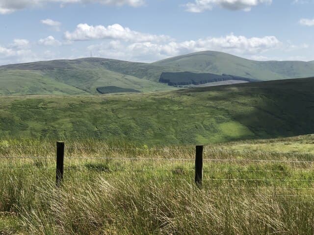
A 595m hill sitting close to the A7 above Mosspaul on the Borders-Dumfriesshire divide. The summit gives broad views across Eskdale, the Lowther Hills and on a clear day southwards into the Lake District.
Quick facts
- Height
- 595m/ 1952ft
- Prominence
- 261 m
- Grid ref
- NY 38645 99346
- Parking
- NY 39800 99700
- Nearest city
- Carlisle· 44km
- Dogs
- Dogs on lead required near livestockDog-friendly guide ↗
Height and prominence cross-checked against the Database of British and Irish Hills (CC BY).
No GPX track yet
Walked this route? Share your track to help other walkers.
Standard route
grass moorland 65% · heather 25% · boggy ground 10%
A short steep climb of around 2-3 hours from a roadside pull-in near Mosspaul Hotel on the A7. The route follows a fence-line up firm grass to a small summit cairn.
Terrain
Steep grassy slopes from the roadside, then drier rolling moorland on the crest. Fences provide handrails throughout.
In winter
The proximity to the A7 makes this a useful winter outing — short, accessible and rarely seriously snow-bound. Wind chill on the exposed crest can still be sharp.
Best time of year
Getting there
- Glasgow4h 38m
- Edinburgh2h 49m
OS maps: OS Landranger 79, OS Explorer 323N, OS Explorer 324
Mobile signal: Good. Borders; reliable signal on summit. Vodafone and EE both work here.
Current conditions
Daylight Today
- Sunrise
- 06:42
- Sunset
- 19:34
- Civil dawn
- 06:05
- Civil dusk
- 20:11
NOAA Solar Calculator · 14 September 2026
Around Wisp Hill on the SCOT network
Getting there, basing yourself, and what to do off the hill.
Wisp Hill — common questions
- How hard is Wisp Hill?
- We grade Wisp Hill at 2/5, which puts it in moderate territory. Underfoot: Steep grassy slopes from the roadside, then drier rolling moorland on the crest.
- What is Wisp Hill's prominence?
- 261m of prominence. That's the vertical drop from the summit to the col that links Wisp Hill to the next higher ground. That drop is what qualifies it as a Marilyn — a hill with at least 150m of descent on every side.
- Where do I park for Wisp Hill?
- Most walkers start from NY 39800 99700. Verify the grid reference on an OS map before you set off — space is tight on busy summer weekends.
- When is the best time to climb Wisp Hill?
- March, April, May, June, July, August, September, October, November give the most reliable conditions on Wisp Hill. Beyond that window the high ground turns wintry: carry full mountain kit, be confident navigating, and check the SAIS avalanche forecast for the area.
- Is Wisp Hill dog-friendly?
- Yes, but dogs must be kept on a lead — there is livestock or ground-nesting bird interest on the route.
- Is there mobile signal on Wisp Hill?
- Good. Borders; reliable signal on summit. Vodafone and EE both work here.
- Is Wisp Hill safe in winter?
- The proximity to the A7 makes this a useful winter outing — short, accessible and rarely seriously snow-bound. Wind chill on the exposed crest can still be sharp.
Get the OutdoorSCOT weekly
One email a week — new route, hill and bothy guides, seasonal conditions and the odd hard-won lesson. No spam, unsubscribe in one click.