Sub-Marilyn · Borders
Arkleton Hill
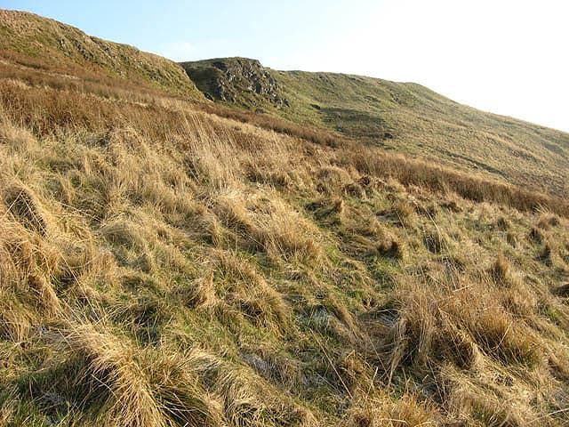
A 521m heather hill rising above Ewes Water near Langholm, on the Dumfriesshire-Roxburghshire boundary. The summit dome gives broad views across Eskdale and toward the Solway Firth. A 521 m top in the Borders.
Quick facts
- Height
- 521m/ 1709ft
- Prominence
- 146 m
- Grid ref
- NY 40515 92188
- Parking
- NY 39800 92500
- Nearest city
- Carlisle· 37km
- Dogs
- Dogs on lead required near livestockDog-friendly guide ↗
Sub-Marilyn: 146m of drop — misses the 150m Marilyn cut by 4m. We keep it on the list as a near-miss.
Height and prominence cross-checked against the Database of British and Irish Hills (CC BY).
No GPX track yet
Walked this route? Share your track to help other walkers.
Standard route
heather moorland 55% · grass slopes 35% · boggy ground 10%
A direct ascent from the A7 near Ewes climbs heather and forest edge for around 3 hours return. The summit can also be approached from Westerkirk in Eskdalemuir.
Terrain
Deep heather on the upper slopes — slow going off the fence-lines that thread across the hill. Forestry edges aid the lower approach.
In winter
Snow lingers in heather hollows but the south-facing aspect clears quickly after thaws. A reasonable winter outing with care on the heathery descent.
Best time of year
Getting there
- Glasgow4h 47m
- Edinburgh2h 0m
OS maps: OS Landranger 79, OS Explorer 323N, OS Explorer 324
Mobile signal: Good. Dumfriesshire; solid EE coverage. Download offline maps as backup.
Current conditions
Daylight Today
- Sunrise
- 05:16
- Sunset
- 21:21
- Civil dawn
- 04:28
- Civil dusk
- 22:09
NOAA Solar Calculator · 30 July 2026
Around Arkleton Hill on the SCOT network
Getting there, basing yourself, and what to do off the hill.
Arkleton Hill — common questions
- What difficulty is Arkleton Hill?
- On the OutdoorSCOT scale, Arkleton Hill comes in at 2/5 — moderate. Terrain: Deep heather on the upper slopes — slow going off the fence-lines that thread across the hill.
- How prominent is Arkleton Hill?
- Arkleton Hill has 146m of topographic prominence — the height of its summit above the highest col connecting it to higher ground. That leaves it 4m short of the 150m drop a Marilyn needs — DoBIH classes it a sub-Marilyn, a near-miss rather than a full Marilyn.
- Where should I park to climb Arkleton Hill?
- Standard parking is at NY 39800 92500. Check the parking grid reference on an OS map before travel; informal laybys can fill on summer weekends.
- When should I climb Arkleton Hill?
- The standard good-weather months for Arkleton Hill are March, April, May, June, July, August, September, October, November. Outside those months, expect winter conditions on the high ground — full mountain kit, navigation skills, and a check of the SAIS avalanche forecast for the relevant region.
- Can I bring my dog up Arkleton Hill?
- On a lead only — the route crosses ground with livestock or nesting-bird interest.
- What's mobile reception like on Arkleton Hill?
- Good. Dumfriesshire; solid EE coverage. Download offline maps as backup.
- Is Arkleton Hill safe in winter?
- Snow lingers in heather hollows but the south-facing aspect clears quickly after thaws. A reasonable winter outing with care on the heathery descent.
Get the OutdoorSCOT weekly
One email a week — new route, hill and bothy guides, seasonal conditions and the odd hard-won lesson. No spam, unsubscribe in one click.